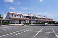
Hijiri-zuka, Kono Michinobu tomb, Kitakami City
Article

03206 / きたかみし

Iwate Prefecture

Kitakami City

A mound in a scroll's grave-visit scene.

Hijiri-zuka, Kono Michinobu tomb

Photo by COUNTR (CC BY-SA 3.0)

01 / Domain border

Mounds on the Nanbu–Date domain borderstand both west and east of the Kitakami River.

Domain border in Kitakami City
Photo by 663highland (CC BY-SA 4.0)

The Nanbu-ryo Date-ryo Sakaizuka mounds were built in 1642 (Kanei 19) to mark the boundary between the Nanbu and Date domains. They consist of large mounds and small mounds, the small ones built to fill the gaps between the large ones. West and east of the Kitakami River, they remain on the line between the former Nanbu and Date domains.

  • Built 1642 (Kanei 19)
  • Large and small mounds
  • National Historic Site (designated 2000)

02 / Stone settings

Stone settings with a standing stoneare spread from the hill slope to the flat ground.

Stone settings in Kitakami City
Photo by MChew (CC BY-SA 4.0)

Kabayama Site is a Jomon-period site at the foot of the Kitakami Mountains, which jut out onto the left bank of the Kitakami River. Stone settings with a standing stone are scattered irregularly from the gentle western slope of the hill to the flat ground. The tourist association says some see them as graves and others as ritual grounds.

  • Stone settings with a standing stone
  • Jomon-period site
  • National Historic Site (designated 1977)

03 / Farmhouse

Building records show the main house dates to 1728and the gate to 1720.

Farmhouse in Kitakami City
Photo by 663highland (CC BY 2.5)

The Former Kanno Family Residence is a typical farmhouse of the Date domain. It was built in Kuchinai, on the border with the Nanbu domain, and is said to have been the home of a village headman. It now stands rebuilt at Michinoku Folk Village and is an Important Cultural Property.

  • Main house, Kyoho 13 (1728)
  • Gate, Kyoho 5 (1720)
  • Important Cultural Property (main house and front gate)

Kitakami City from the sky

Now and 1974–78. Tap a photo to zoom in.

Wide (about 6 km across)

Close (about 1.5 km across)

Now (shot June 2024)Shot 1974–78

Source: Geospatial Information Authority of Japan (GSI) GSI Tiles(全国最新写真(シームレス)/国土画像情報(第一期:1974〜1978年撮影))

Open in GSI Maps (now)Open in GSI Maps (1974–78)

Living here

Tokyo in 2 h 22 min on the Tohoku Shinkansen.

  • about 90,000 people
  • Shinkansen stops here

The Tohoku Shinkansen stops at Kitakami Station, reached from Tokyo Station without changing trains. The fastest train that runs every day takes 2 hours 22 minutes. Kitakami Station is also on the Tohoku Main Line and the Kitakami Line.

People living here
93,045people
19952020

−0.5% since 2015

87,969 → 93,045

Area
437.55km²

204.23km² of it habitable

2024

Households
38,915households

2.4 people per household

2020

Rent (average for rentals)
48,760yen

National average 60,630 yen

2023

Healthcare
3 hospitals / 62 clinics

7.0 per 10,000 people

2023

Area437.55km²Habitable land204.23km² / 47%
Area and habitable land at the same scalee-Stat B1101 / B1103
Children waiting for childcare
—19 nurseries and similar
Home purchase subsidy
—
Average annual temperature
—

These 3 items are waiting on a nationwide data source. We do not fill them with estimates.

ACCESS

Where you can go from here.

Kitakami City in Japan39.287°N 141.113°E
TokyoOsakaKitakami City
Kitakami Station
北上駅2023
  • to TokyoTohoku Shinkansen142min

Travel times follow JR東日本の駅の時刻表(北上駅の下り。timetables.jreast.co.jp/2610/timetable/tt0564/056401[0|1].html)の列車ページ30枚ほどを jr_count.py で数えた。東京の発→北上の着。平日と土休日の両方に同じ分数で載り、運転日の欄が空の定期列車の最速:東北新幹線 4109B(東京18:56発→北上21:18着)の142分 (checked 2026-10-23). They vary by time of day.

Shape

Borders 4 municipalities.

Territory of Kitakami City
Boundaries: National Land Numerical Information (Administrative Area Data), MLIT. Processed by Machigatari.

Kitakami City isthis kind of town.

  1. 01Hijiri-zuka in Kitakami is a prefecturally designated historic site thought to be the tomb of Kono Michinobu; a National Treasure picture scroll shows his grandson Ippen visiting the grave
  2. 02The Nanbu-ryo Date-ryo Sakaizuka mounds and the Kabayama Site are National Historic Sites, and the Former Kanno Family Residence, once in Kuchinai on the Nanbu domain border, has been rebuilt at Michinoku Folk Village
  3. 03The city also has the Ezuriko tumulus group and the ruins of a mountain temple, both National Historic Sites, the travertine deposits at Geto Onsen, a Special Natural Monument, and the Oni Kenbai sword dance, a nationally designated Important Intangible Folk Cultural Property

See the town as it is now.

Source: Wikidata (P2002, P2003, P2013, P2397)

If something caught your eye, ask the town itself.