Heart-shaped dogū, Gobara site, Higashiagatsuma Town
Article

10429 / ひがしあがつままち

Gunma Prefecture 吾妻郡

Higashiagatsuma Town

A heart-shaped dogū dug up in town.

Heart-shaped dogū, Gobara site

Photo by Saigen Jiro (Public domain)

01 / Mountain castle

A layout joining stronghold and castle town,unusual even by national standards.

Mountain castle in Higashiagatsuma Town
Photo by 前田左衛門佐 (Public domain)

Iwabitsu Castle Ruins, on the slope of Mt. Iwabitsu, became a national historic site in 2019. It combines a stronghold zone with a castle-town zone thought to have housed craftsmen and merchants. In fiscal 2021, gold particles were found on a crucible from the main enclosure, taken as a sign that metalworkers worked there.

  • National Historic Site (notified 16 Oct 2019)
  • Castle area 136 ha
  • Gold particles on a crucible

02 / Great tree

When the town moved,this tree set the town plan.

Great tree in Higashiagatsuma Town
Photo by 㭍月例祭 (CC0)

The great zelkova at the east end of Haramachi is a National Natural Monument. The town says it is said to be 1,000 years old, and when the town was moved here in the early Edo period it became the reference for laying out the streets. Its trunk is 11 m around at eye level. The town writes that it was pruned in recent years for safety, and its old appearance has faded.

  • National Natural Monument (13 Apr 1933)
  • Said to be 1,000 years old
  • 11 m around at eye level

03 / Gorge

A gorge that split Agatsuma's economy east from west:in 1894, Dorokujin Pass was cut.

Gorge in Higashiagatsuma Town
Photo by Kuru man from Japan (CC BY 2.0)

Agatsuma Gorge became a nationally designated Place of Scenic Beauty in 1935 and is also called the "Yabakei of Kanto". The town's guide map says the gorge long obstructed travel and split Agatsuma's economy in two. In 1894, through the efforts of Noguchi, Dorokujin Pass was cut, fulfilling a hope held for centuries.

  • National Place of Scenic Beauty (24 Dec 1935)
  • Dorokujin Pass cut in 1894
  • Hatcho-kuragari narrows to 3 m

Higashiagatsuma Town from the sky

Now and 1974–78. Tap a photo to zoom in.

Wide (about 6 km across)

Close (about 1.5 km across)

Now (shot June–October 2016)Shot 1974–78

Source: Geospatial Information Authority of Japan (GSI) GSI Tiles(全国最新写真(シームレス)/国土画像情報(第一期:1974〜1978年撮影))

Open in GSI Maps (now)Open in GSI Maps (1974–78)

Living here

178 minutes from Shinjuku by highway bus.

  • about 10,000 people
  • Rural district town

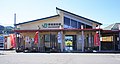
The town's gateway is Gumma-Haramachi Station on the JR Agatsuma Line. From Tokyo and Shinjuku, JR Bus Kanto's Joshu Yumeguri-go and other services reach the Gumma-Haramachi-eki-iriguchi stop. It takes 178 minutes from Busta Shinjuku and 186 minutes from Tokyo Station Yaesu South Exit (timetable revised December 2025; reserved seats).

People living here
12,728people
2010

−9.3% since 2015

15,622 → 12,728

Area
253.91km²

56.57km² of it habitable

2024

Households
5,144households

2.5 people per household

2020

Rent (average for rentals)
—
Healthcare
1 hospital / 8 clinics

7.1 per 10,000 people

2023

Area253.91km²Habitable land56.57km² / 22%
Area and habitable land at the same scalee-Stat B1101 / B1103
Children waiting for childcare
—3 nurseries and similar
Home purchase subsidy
—
Average annual temperature
—

These 3 items are waiting on a nationwide data source. We do not fill them with estimates.

ACCESS

Where you can go from here.

Higashiagatsuma Town in Japan36.571°N 138.820°E
OsakaHigashiagatsuma Town
Gunma-Haramachi Station
群馬原町駅2021
  • to TokyoHighway bus186min
  • to ShinjukuHighway bus178min

Travel times follow ジェイアールバス関東 デジタル時刻表『東京・新宿~伊香保・草津温泉 上州ゆめぐり号/東京ゆめぐり号』(http://time.jrbuskanto.co.jp/bk03010.html。2025年12月15日改正の表。2026-10-21 に読んだ)の下り。停留所は『群馬原町駅入口』(東吾妻町の交通案内が『群馬原町駅入り口下車』と挙げる停留所)。表の『運転日注記』の欄に注記は無く、運転日の注記のある便は見当たらない (checked 2026-10-21). They vary by time of day.

Shape

Borders 4 municipalities.

Territory of Higashiagatsuma Town
Boundaries: National Land Numerical Information (Administrative Area Data), MLIT. Processed by Machigatari.Lakes: National Land Numerical Information (Lake Data), MLIT. Processed by Machigatari. Prepared with the approval of the Director-General of the Geospatial Information Authority of Japan, using its Digital Map 25000 (Spatial Data Framework) and Digital Map 25000 (Place Names and Public Facilities). (承認番号 平27情使、第585号)

Higashiagatsuma Town isthis kind of town.

  1. 01The Jōmon heart-shaped dogū (30.5 cm tall) from the Gobara site is a nationally designated Important Cultural Property, now kept by the Tokyo National Museum
  2. 02Iwabitsu Castle Ruins, a national historic site, joins a stronghold zone and a castle-town zone, and gold particles were found on a crucible from its main enclosure
  3. 03The town tells of the great zelkova at Haramachi that set the town plan, and of Agatsuma Gorge, where Noguchi cut Dorokujin Pass

If something caught your eye, ask the town itself.