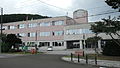
Yoshioka Teiten, Seikan Tunnel, Fukushima Town
Article

01332 / ふくしまちょう

Hokkaido 松前郡

Fukushima Town

A station once lay beneath the sea.

Yoshioka Teiten, Seikan Tunnel

Photo by Encino at the Chinese Wikipedia (CC BY-SA 3.0)

01 / Bank of the Yoshioka River

In a letter to his son, Ino Tadatakacalled his landing "a riverbank called Yoshioka."

On July 10, 1800, the boat carrying the six-member survey party, bound for Hakodate, was carried by the wind to near the Yoshioka River. The town says the diary entry "a little over one ri of land, Fukushima" can be called the first survey record in Hokkaido. A mountain in the town recorded in the bearings of mountains and islands was sighted from nine places in Aomori Prefecture.

  • Reached the Yoshioka River on July 10, 1800
  • Diary entry "a little over one ri of land, Fukushima" is the first survey record (town)
  • The town's mountain was sighted from 9 places in Aomori

02 / Yoshioka Teiten

From Yoshioka Teiten to the surface,1,189 steps run beside the cable car.

Yoshioka Teiten in Fukushima Town
Photo by SElefant (CC BY-SA 3.0)

Yoshioka Teiten, the former seabed station, is one of the places inside the Seikan Tunnel where a train is stopped for evacuation guidance and firefighting. JR Hokkaido says a staircase of 1,189 steps beside the cable car leads to the surface, about 20 to 25 minutes for a fit person.

  • 1,189 steps (JR Hokkaido)
  • Two teiten: Tappi and Yoshioka
  • Station service to end in March 2014, announced in 2013

03 / Mount Daisengen

In the early Edo period, the whole foot ofMount Daisengen was a place for gathering gold dust.

Mount Daisengen in Fukushima Town
Photo by DrTerraKhan (CC BY-SA 3.0)

The town introduces Mount Daisengen (1,072 m) as its "hometown mountain." In the early Edo period the whole foot of the mountain was a place for gathering gold dust, and the town's site writes that the gold remains in the weave of the "neko," a thick straw mat, one of the panning tools.

  • 1,072 m
  • Gold-dust site in the early Edo period
  • Town emblem shows Mount Daisengen and the Seikan Tunnel work base (adopted 1975)

Fukushima Town from the sky

Now and 1974–78. Tap a photo to zoom in.

Wide (about 6 km across)

Close (about 1.5 km across)

Now (shot April 2018)Shot 1974–78

Source: Geospatial Information Authority of Japan (GSI) GSI Tiles(全国最新写真(シームレス)/国土画像情報(第一期:1974〜1978年撮影))

Open in GSI Maps (now)Open in GSI Maps (1974–78)

Living here

Fifty-three minutes by route bus from Kikonai Station.

  • about 4,000 people
  • Rural district town

There is no railway station in Fukushima Town, Hokkaido. You take a Hakodate Bus route bus from Kikonai Station on the Hokkaido Shinkansen and the Donan Isaribi Railway. In the timetable revised on October 20, 2026, the fastest daily service runs from Kikonai Station to the Seikan Tunnel Museum stop in 53 minutes, with no transfer.

People living here
3,794people
19952020

−14.2% since 2015

7,430 → 3,794

Area
187.25km²

16.55km² of it habitable

2024

Households
1,861households

2.0 people per household

2020

Rent (average for rentals)
—
Healthcare
0 hospitals / 3 clinics

7.9 per 10,000 people

2023

Area187.25km²Habitable land16.55km² / 9%
Area and habitable land at the same scalee-Stat B1101 / B1103
Children waiting for childcare
—1 nurseries and similar
Home purchase subsidy
—
Average annual temperature
—

These 3 items are waiting on a nationwide data source. We do not fill them with estimates.

ACCESS

Where you can go from here.

Fukushima Town in Japan41.484°N 140.251°E
TokyoOsakaFukushima Town
Fukushima Town Office
福島町役場2013
  • to KikonaiLocal bus53min

Travel times follow 案A(東京から乗り換えなしの便だけ)。福島町に鉄道の駅は無い(JR松前線は1988-02-01に廃止。北海道新幹線の青函トンネルは町内を通るが駅は無い)。町にいちばん近い現役のJRの駅は木古内駅(木古内町。道南いさりび鉄道・北海道新幹線)で、福島町役場(福島820番地。国土地理院の住所検索の座標 41.4836N 140.2475E)から直線26.6km(次点は札苅駅30.2km)。函館バス公式の時刻表(令和8年10月20日改正。次の改正は令和8年11月9日で、木古内駅前・福島の該当便は同じ時刻)で、木古内駅前(1番のりば)発の521・522・523系統(行先 松前出張所・知内出張所と福島経由)。平日と土日祝の両方に載る便は 9:00・11:10・12:30・15:50・18:32発の5本。青函トンネル記念館前(役場に最も近い停留所=役場まで約590m)着は 9:53・12:03・13:23・16:43・19:28=53分・53分・53分・53分・56分。毎日運転の最速は53分。福島(停留所。役場まで約840m)着はこの1分後で54分 (checked 2026-10-29). They vary by time of day.

Shape

Borders 3 municipalities.

Territory of Fukushima Town
Boundaries: National Land Numerical Information (Administrative Area Data), MLIT. Processed by Machigatari.Lakes: National Land Numerical Information (Lake Data), MLIT. Processed by Machigatari. Prepared with the approval of the Director-General of the Geospatial Information Authority of Japan, using its Digital Map 25000 (Spatial Data Framework) and Digital Map 25000 (Place Names and Public Facilities). (承認番号 平27情使、第585号)

Fukushima Town isthis kind of town.

  1. 01Yoshioka Teiten, the former Yoshioka-kaitei Station on the Hokkaido side of the Seikan Tunnel, is described by JR Hokkaido as a place to stop a train for evacuation guidance and firefighting, and in 2013 JR Hokkaido announced that station service would end in March 2014
  2. 02The survey party of Ino Tadataka was carried by the wind to near the Yoshioka River on July 10, 1800, and the town says his diary entry "a little over one ri of land, Fukushima" can be called the first survey record in Hokkaido
  3. 03A Jomon village site in the town yielded a stone figure about 37.1 cm long, which the town says is called the largest found in Japan, and the foot of Mount Daisengen was a gold-dust site in the early Edo period

If something caught your eye, ask the town itself.

From this town's themes