Kaiyodai, grid windbreak forest, Nakashibetsu Town
Article

01692 / なかしべつちょう

Hokkaido 標津郡

Nakashibetsu Town

From 270 m, a windbreak grid is visible.

Kaiyodai, grid windbreak forest

Photo by Tzu-hsun, Hsu (CC BY-SA 4.0)

01 / Moan-yama

On a mountain slope, a huge character for "cow"is reported to have been written by mowing dwarf bamboo.

Moan-yama in Nakashibetsu Town
Photo by 100yen (CC BY-SA 3.0)

The Hokkaido Tourism Organization's tourism site introduces a huge "cow" character that stands out in white against the green mountainside. In 2009 the Hokkaido Shimbun reported that a character 100 m long and 60 m wide, made by local dairy farmers who mowed the dwarf bamboo with brush cutters, had appeared on Moan-yama, about 357 m high.

  • 100 m by 60 m (Hokkaido Shimbun, 2009)
  • About 357 m high
  • Dwarf bamboo mowed with brush cutters
02 / Mount Musa

At 1,005.2 m, Mount Musa isthe symbol of the town, the town says.

Mount Musa in Nakashibetsu Town
Photo by Koda6029 (CC BY-SA 4.0)

The town describes Mount Musa as its symbol and as one of Hokkaido's hundred famous mountains. From the summit one can see the latticed windbreak forests of the Konsen Plateau, a Hokkaido Heritage. It is about 5.6 km from the trailhead to the top, a standard 2 hours 30 minutes one way. The town charter also begins with "gazing up each morning and evening at noble Mount Musa."

  • 1,005.2 m high
  • About 5.6 km from trailhead to summit
  • Town charter: "noble Mount Musa"

03 / Old Agricultural Experiment Station

Four buildings of the former experiment station,including offices and storehouses, are registered properties.

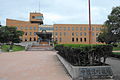
Denseikan, the office building of the former Nemuro branch of the Hokkaido Agricultural Experiment Station, is a two-story reinforced concrete building from 1927. The Agency for Cultural Affairs describes it as one of the buildings symbolizing the development of the Konsen wilderness. Together with the exhibition hall, the seed storehouse and the tool storehouse, four buildings were registered on 7 August 2009.

  • Denseikan: 1927, two-story reinforced concrete
  • Four registered tangible cultural properties (buildings)
  • Registered 7 August 2009

Nakashibetsu Town from the sky

Now and 1974–78. Tap a photo to zoom in.

Wide (about 6 km across)

Close (about 1.5 km across)

Now (shot July–November 2023)Shot 1974–78

Source: Geospatial Information Authority of Japan (GSI) GSI Tiles(全国最新写真(シームレス)/国土画像情報(第一期:1974〜1978年撮影))

Open in GSI Maps (now)Open in GSI Maps (1974–78)

Living here

No station in town; 73 minutes by bus from Attoko.

  • about 20,000 people
  • Rural district town

There is no railway station in town. Nemuro Kotsu's airport bus runs from the stop "Attoko Station" near JR Attoko Station to "Nakashibetsu Town Office", and every daily trip takes 73 minutes (timetable revised 29 March 2026). The town's transport guide says to get off the JR at Kushiro or Shibecha Station and change to a bus.

People living here
23,010people
19952020

−3.2% since 2015

22,326 → 23,010

Area
684.87km²

358.34km² of it habitable

2024

Households
10,577households

2.2 people per household

2020

Rent (average for rentals)
44,986yen

National average 60,630 yen

2023

Healthcare
2 hospitals / 5 clinics

3.0 per 10,000 people

2023

Area684.87km²Habitable land358.34km² / 52%
Area and habitable land at the same scalee-Stat B1101 / B1103
Children waiting for childcare
—2 nurseries and similar
Home purchase subsidy
—
Average annual temperature
—

These 3 items are waiting on a nationwide data source. We do not fill them with estimates.

ACCESS

Where you can go from here.

Nakashibetsu Town in Japan43.555°N 144.971°E
TokyoOsakaNakashibetsu Town
Nakashibetsu Town Office
中標津町役場2013
  • to AttokoLocal bus73min

Travel times follow 根室交通『中標津空港線』(根室⇔中標津ターミナル・中標津空港)の時刻表(2026年3月29日改正・根室交通公式 PDF)。町公式『バスの運行情報』『鉄道・バス』(中標津町公式)の路線一覧 (checked 2026-10-29). They vary by time of day.

Shape

Borders 5 municipalities.

Territory of Nakashibetsu Town
Boundaries: National Land Numerical Information (Administrative Area Data), MLIT. Processed by Machigatari.Lakes: National Land Numerical Information (Lake Data), MLIT. Processed by Machigatari. Prepared with the approval of the Director-General of the Geospatial Information Authority of Japan, using its Digital Map 25000 (Spatial Data Framework) and Digital Map 25000 (Place Names and Public Facilities). (承認番号 平27情使、第585号)

Nakashibetsu Town isthis kind of town.

  1. 01Kaiyodai is a plateau 270 m above sea level, and the town says that among the views from it are the Hokkaido Heritage latticed windbreak forests of the Konsen Plateau, which span four towns: Nakashibetsu, Betsukai, Shibetsu and Shibecha
  2. 02The Hokkaido Tourism Organization introduces the huge "cow" character on the slope of Moan-yama, and the Hokkaido Shimbun reported in 2009 that it measures 100 m by 60 m; the town says Mount Musa, 1,005.2 m high, is its symbol
  3. 03Denseikan, the office of the former Nemuro branch of the Hokkaido Agricultural Experiment Station, is a 1927 two-story reinforced concrete building, and four buildings including the exhibition hall, seed storehouse and tool storehouse are registered tangible cultural properties

See the town as it is now.

Source: Wikidata (P2002, P2003, P2013, P2397)

If something caught your eye, ask the town itself.