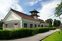
Kaito-cho slump structure, Miura City
Article

14210 / みうらし

Kanagawa Prefecture

Miura City

“Overseas” reads Kaito: a seabed slide.

Kaito-cho slump structure

Photo by At by At (CC BY-SA 3.0)

01 / Forest

From source to tidal flat to sea,one valley stays connected.

Forest in Miura City
Photo by Quercus acuta (CC BY-SA 4.0)

Koajiro Forest, near the tip of the Miura Peninsula, was selected by the Ministry of the Environment as an important satoyama. From the source of a river about 1 km long, water runs through valley wetland and an estuary tidal flat to the sea. Kanagawa Prefecture describes forest, wetland, tidal flat and sea as continuous in the river’s catchment.

  • River source about 1 km long
  • Ministry of the Environment’s important satoyama
  • One river catchment

02 / Archaeological site

A dwelling site 15 metreson its long axis has been found.

Archaeological site in Miura City
Photo by Prel1h (CC BY-SA 4.0)

A large settlement of the middle to late Yayoi period, designated a National Historic Site in 2011. Besides a huge dwelling site 15.0 m by 12.2 m, more than 130 pit dwelling sites have been counted. The Agency for Cultural Affairs writes that it is considered a core settlement of the Miura Peninsula.

  • 15.0 m by 12.2 m
  • 130+ pit dwelling sites
  • National Historic Site (2011)

03 / Dance

The Little New Year dancehas been performed by women only.

Every 15 January, at Koshogatsu, the Little New Year, it is danced in the Nakasaki and Hanagure districts of Misaki and at Kainan Shrine. Adult women sing, and girls from about 5 to 12 dance. A local record published in 1756 suggests it has been handed down for about 250 years. It is one of UNESCO’s Furyu-odori.

  • Every 15 January
  • Handed down for about 250 years
  • National Important Intangible Folk Cultural Property (1976)

Miura City from the sky

Now and 1974–78. Tap a photo to zoom in.

Wide (about 6 km across)

Close (about 1.5 km across)

Now (shot November 2021)Shot 1974–78

Source: Geospatial Information Authority of Japan (GSI) GSI Tiles(全国最新写真(シームレス)/国土画像情報(第一期:1974〜1978年撮影))

Open in GSI Maps (now)Open in GSI Maps (1974–78)

Living here

69 minutes from Shinagawa on the Keikyu.

  • about 40,000 people
  • 90 min to a city centre

From Shinagawa, a Keikyu Rapid Limited Express reaches Misakiguchi Station, the end of the Kurihama Line, with no change, in 69 minutes at the fastest. Keikyu buses run from the station into town.

People living here
42,069people
19952020

−7.1% since 2015

54,152 → 42,069

Area
32.05km²

26.17km² of it habitable

2024

Households
17,210households

2.4 people per household

2020

Rent (average for rentals)
65,325yen

National average 60,630 yen

2023

Healthcare
2 hospitals / 26 clinics

6.7 per 10,000 people

2023

Area32.05km²Habitable land26.17km² / 82%
Area and habitable land at the same scalee-Stat B1101 / B1103
Children waiting for childcare
—4 nurseries and similar
Home purchase subsidy
—
Average annual temperature
—

These 3 items are waiting on a nationwide data source. We do not fill them with estimates.

ACCESS

Where you can go from here.

Miura City in Japan35.144°N 139.621°E
OsakaMiura City
Misakiguchi Station
三崎口駅2011
  • to ShinagawaKeikyu Main Line69min

Travel times follow 京急電鉄(京浜急行電鉄)公式の駅時刻表(norikae.keikyu.co.jp の「各駅時刻表」。品川駅・浦賀方面。平日〔dw=0〕・土曜〔dw=1〕・日曜祝日〔dw=2〕の3つのダイヤ。ページに『平日 2025年12月13日改』とある)の、行き先が三崎口の列車すべて(平日71本・土曜71本・日曜祝日71本)の列車ごとの停車駅ページ(T7)で、品川の発車と三崎口の着を引いて分数を出した (checked 2026-10-21). They vary by time of day.

Shape

Borders 1 municipalities.

Territory of Miura City
Boundaries: National Land Numerical Information (Administrative Area Data), MLIT. Processed by Machigatari.Lakes: National Land Numerical Information (Lake Data), MLIT. Processed by Machigatari. Prepared with the approval of the Director-General of the Geospatial Information Authority of Japan, using its Digital Map 25000 (Spatial Data Framework) and Digital Map 25000 (Place Names and Public Facilities). (承認番号 平27情使、第585号)

North to south

9.0km

Miura City isthis kind of town.

  1. 01Kaito-cho’s cliff shows strata formed by a seabed landslide
  2. 02Koajiro Forest connects one valley from source to sea
  3. 03A National Historic Site, Akasaka, and the women-only Chakkirako dance

See the town as it is now.

Source: Wikidata (P2002, P2003, P2013, P2397)

If something caught your eye, ask the town itself.

From this town's themes