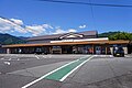
Sugarioike.jpg
Article

24209 / おわせし

Mie Prefecture

Owase City

Seawater normally stays out of the pond.

Sugari Oike, a coastal lagoon

Photo by Alpsdake (CC BY-SA 4.0)

01 / Nirakura

The sacred ground Nirakura is saidto have been a store for sea urchins.

Kuki Nirakura 2021-07 ac (1).jpg
Photo by Asturio Cantabrio (CC BY-SA 4.0)

The New Year rites of Kuki-cho are run by members of the Kukiura Cooperative, which holds a share in the yellowtail set net. Nirakura, the sacred ground at the centre of the settlement, is walled in stone about 1 m high. It is said to have been a store for the sea urchins (gangaze) that fishermen cleared, and a great bonfire is lit there on New Year's Eve.

  • Stone wall about 1 m high
  • Hosts from the Kukiura Cooperative
  • Nationally selected in 1997

02 / Kojin-do site

The tea house beside the Kojin hallis recorded as selling rice cakes.

The Yakiyama road is about 6,100 m long, the longest section on the Ise route, and is regarded as the hardest stretch on the pilgrimage west. At the Kojin-do site, recommended for addition to the national historic site, a mountain-ascetic family is said to have run the tea house next door. The building is gone, but a stone-built platform remains. A guidebook to the Saigoku pilgrimage records the tea house selling rice cakes.

  • Yakiyama road, about 6,100 m
  • Tea house with rice cakes and sake in a 1812 travel record
  • Recommended addition to the Kumano pilgrimage route (Ise route)

03 / Sabaru Island

From its shape, locals came at some pointto call it "Moomin Island" fondly.

Sabaru Island.JPG
Photo by Alpsdake (CC BY-SA 4.0)

The island lies at the head of Owase Bay, 200 m east to west, 400 m north to south and 80 m high, and was designated a Prefectural Natural Monument in 1969. The bay side is sand and mudstone and the Pacific side is granite porphyry, with joints more than 20 m high and sea caves.

  • 200 m by 400 m, 80 m high
  • Prefectural designation, 1969
  • Area 4.65 ha

Living here

158 minutes from Nagoya on the Ltd. exp. Nanki.

  • about 20,000 people

Owase Station on the JR Kisei Line is 158 minutes at the fastest from Nagoya on the Limited Express Nanki, with no change of train (departures from Nagoya at 12:58 and 19:45; a limited express ticket is required). The city covers 192.71 km2, and about 90 percent or more of it is forest.

People living here
16,252people
19952020

−9.8% since 2015

25,258 → 16,252

Area
192.71km²

17.13km² of it habitable

2024

Households
8,153households

2.0 people per household

2020

Rent (average for rentals)
31,260yen

National average 60,630 yen

2023

Healthcare
1 hospital / 21 clinics

13.5 per 10,000 people

2023

Area192.71km²Habitable land17.13km² / 9%
Area and habitable land at the same scalee-Stat B1101 / B1103
Children waiting for childcare
—7 nurseries and similar
Home purchase subsidy
—
Average annual temperature
—

These 3 items are waiting on a nationwide data source. We do not fill them with estimates.

ACCESS

Where you can go from here.

Owase City in Japan34.071°N 136.191°E
TokyoOwase City
Owase Station
尾鷲駅2023
  • to NagoyaLtd. exp. Nanki158min

Travel times follow 【名古屋・特急南紀】JRおでかけネットの区間時刻表(紀勢本線 多気〜新宮 下り。https://timetable.jr-odekake.net/line-timetable/2320?date=20261013・20261017・20261018 の3日とも同じ。運転日注意の欄は空)で、特急南紀の下り4本(3001D=1号・3003D=3号・3005D=5号・3007D=7号)の名古屋発と尾鷲着を読んだ:1号 名古屋8:02発→尾鷲10:44着(162分)/3号 10:01発→12:42着(161分)/5号 12:58発→15:36着(158分)/7号 19:45発→22:23着(158分)。上り(同 紀勢本線 新宮〜多気 上り=2323と、関西本線・伊勢鉄道 津・亀山〜名古屋 上り=2319)は 2号 尾鷲7:07発→名古屋9:42着(155分)/4号 10:01→12:41(160分)/6号 13:32→16:12(160分)/8号 18:18→20:49(151分)。JR東海の尾鷲駅の駅時刻表(2026年3月ダイヤ。https://railway.jr-central.co.jp/time-schedule/srch/_pdf/data/202603/kisei_Owase_E_e_ud.pdf。『毎日 Daily』・『特急南紀』の1・3・5・7号が新宮・紀伊勝浦方面、2・4・6・8号が松阪・名古屋方面)とも一致。【名古屋・高速バス】三重交通『南紀〜VISON〜名古屋』の時刻表(2026年4月1日改正。https://www.sanco.co.jp/highway/nankinagoya/time/)の名古屋(名鉄バスセンター)→尾鷲市病院前:7:50→11:14(204分)・11:00→14:39(219分)・13:30→17:09(219分)・17:30→20:39(189分)・20:10→23:19(189分)。上りは尾鷲市病院前5:37→名古屋8:51(194分)ほか。【東京・夜行バス】三重交通『南紀・VISON〜横浜・東京・埼玉』(高速南紀東京大宮線。時刻表は2024年11月1日改正のまま。https://www.sanco.co.jp/highway/nankitokyo/time/):バスタ新宿22:05発→尾鷲市6:41着(516分)、上りは尾鷲市21:14発→バスタ新宿5:55着(521分)。 (checked 2026-10-13). They vary by time of day.

Shape

Borders 3 municipalities across 1 prefectures.

Territory of Owase City
Boundaries: National Land Numerical Information (N03)

North to south

37.3km

Mie Prefecture
熊野市, 紀北町
Nara Prefecture
上北山村

Owase City isthis kind of town.

  1. 01Sugari Oike in Sugari-cho is a coastal lagoon facing the Kumanonada sea; this long pond of about 5.8 ha normally takes in no seawater, and it was designated a National Natural Monument in 2012
  2. 02The New Year rites of Kuki-cho, hosted by members of the Kukiura Cooperative and including a great bonfire at the sacred ground Nirakura, were selected by the national government in 1997
  3. 03The Kojin-do and tea house site on the Yakiyama road was recommended for addition to the national historic site of the Kumano pilgrimage route (Ise route), and Sabaru Island in Owase Bay is a Prefectural Natural Monument also called Moomin Island

See the town as it is now.

Source: Wikidata (P2002, P2003, P2013, P2397)

If something caught your eye, ask the town itself.