Sasebo Fukui Cave.jpg
Article

42202 / させぼし

Nagasaki Prefecture

Sasebo City

Paleolithic to Jomon, shown by layers.

Fukui Cave

Photo by Dyamasan (CC BY-SA 4.0)

01 / Emukae Honjin Site

The Hirado lord's lodging on his sankin-kotai tripsis preserved with its period furnishings.

Emukae-Honjin 201003.jpg
Photo by user:Atsasebo (CC BY-SA 3.0)

The site of the honjin (本陣, official inn) where the Hirado domain lord stayed on his sankin-kotai (参勤交代, alternate-attendance) trips. It is thought to have been established by the Genroku era; the present honjin was begun with renovation and garden-making in 1830 (Bunsei 13) and completed in 1832 (Tenpo 3). Its form has been kept as it was, and many furnishings of the time remain.

  • Prefectural historic site
  • Present honjin completed in 1832 (Tenpo 3) (city)
  • Thought to have been established by the Genroku era (city)
02 / Sasebo Yamodo Festival

On January 26, a great straw shimenawa is remade.Two young men called "Yamodo" lead the festival.

The first festival of the year at Yodohime Shrine (淀姫神社). Parishioners of Matsubara (松原) and the adjoining town bring rice straw from the previous harvest, make a great shimenawa (注連縄, sacred rope), hang it on the torii in the precinct, and pray for a good harvest. The two young men who lead the festival are called "Yamodo", thought to be a corruption of "yamaudo" (山人, mountain people).

  • Prefectural Intangible Folk Cultural Property (designated February 25, 2004)
  • Held every January 26 (prefecture)
  • Yamodo are two young men whose parents are both living (prefecture)

03 / Kuroshima Cultural Landscape

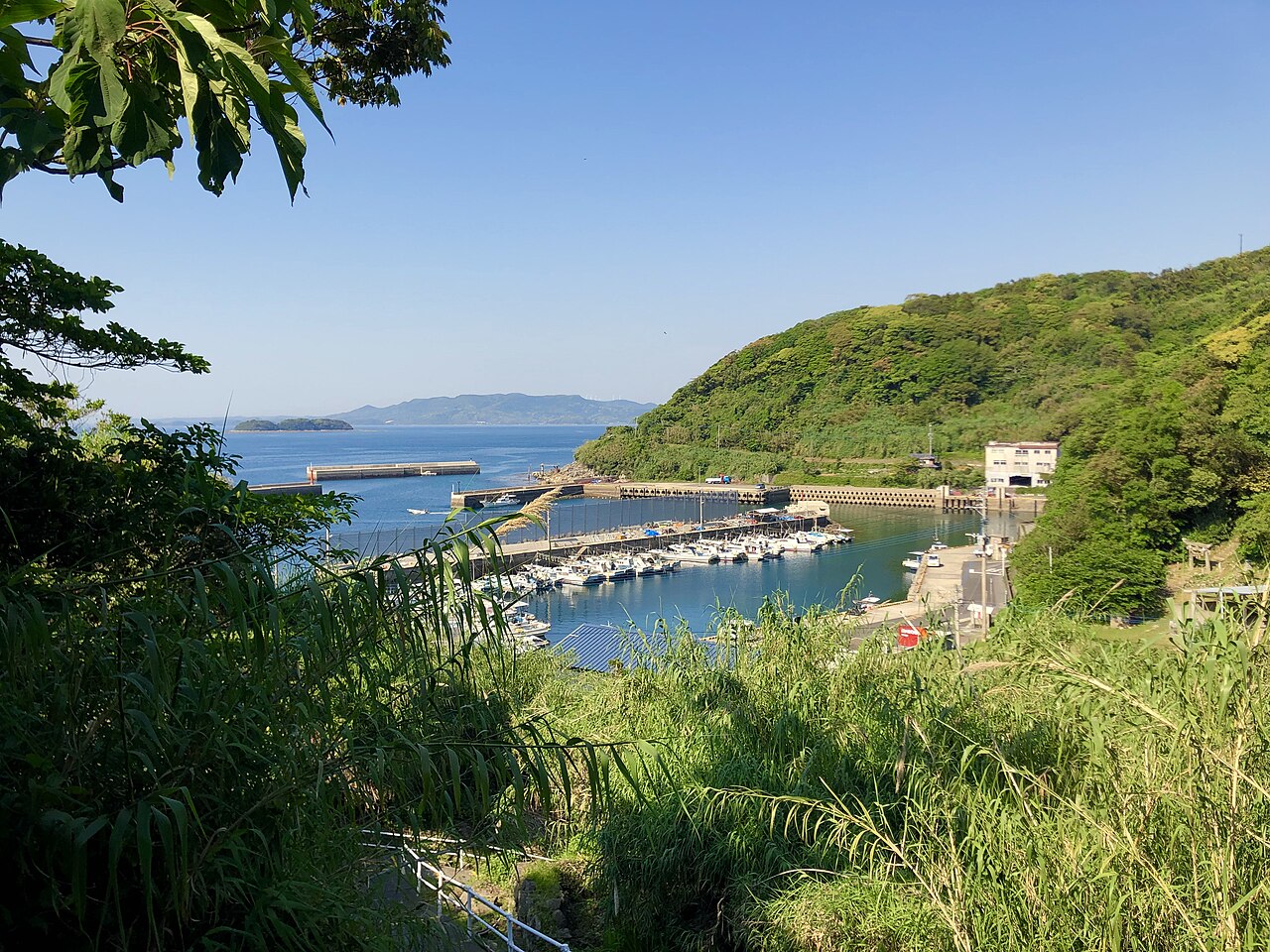
A settlement opened by migrants on a former ranch.In Warabe, akou trees twine over stone walls.

本村集落より望む黒島港.jpg
Photo by そのだ かずき (CC BY-SA 4.0)

The largest island of the Kujukushima (九十九島) group. After the Hirado domain's ranch on the island was closed in the late Edo period, migrants kept arriving from the Sotome area of the Nishisonogi Peninsula and elsewhere to develop the former pasture. They built homes along the coast, ringed by windbreak woods, and opened the slopes behind them. In the southern Warabe district, akou (アコウ, a fig tree) planted as windbreaks twine over the houses' stone walls.

  • National Important Cultural Landscape (selected September 21, 2011)
  • Largest of the Kujukushima islands (Agency for Cultural Affairs)
  • Akou roots twine over stone walls in the southern Warabe district (Agency for Cultural Affairs, city)

Living here

From 2005 to 2010, the cityabsorbed six towns.

  • about 240,000 people

A city in northern Nagasaki Prefecture. It absorbed Yoshii and Sechibaru in April 2005, Uku and Kosaza in March 2006, and Emukae and Shikamachi in March 2010. The city's history page says it has become the commercial and service center of the prefecture's northern area (updated September 2022).

People living here
243,223people
2010

−4.8% since 2015

261,101 → 243,223

Area
426.01km²

208.28km² of it habitable

2024

Households
104,053households

2.3 people per household

2020

Rent (average for rentals)
47,218yen

National average 60,630 yen

2023

Healthcare
24 hospitals / 215 clinics

9.8 per 10,000 people

2023

Area426.01km²Habitable land208.28km² / 49%
Area and habitable land at the same scalee-Stat B1101 / B1103

Population from 2010 onward (municipal boundary changed).2005-04-01 に編入合併(吉井町・世知原町)。2005年調査から市域が変わっている。2006-03-31 に編入合併(宇久町・小佐々町)。2010年調査から市域が変わっている。2010-03-31 に編入合併(江迎町・鹿町町)。2010年調査から市域が変わっている。

Children waiting for childcare
—73 nurseries and similar
Home purchase subsidy
—
Average annual temperature
—

These 3 items are waiting on a nationwide data source. We do not fill them with estimates.

Shape

Borders 7 municipalities across 1 prefectures.

Sasebo City in Japan33.180°N 129.715°E
TokyoOsakaSasebo City
Territory of Sasebo City
Boundaries: National Land Numerical Information (N03)

North to south

32.5km

Nagasaki Prefecture
佐々町, 松浦市, 波佐見町, 川棚町, 平戸市
Saga Prefecture
有田町, 伊万里市

Travel times per leg are not published by the municipality, so they are not shown.

Sasebo City isthis kind of town.

  1. 01Fukui Cave (福井洞窟) is a sandstone cave formed by erosion from the Fukui River. It is 16.4 m wide at the mouth and 5.5 m deep, and remains from the Paleolithic period through the Incipient Jomon period have been excavated in layers. The city explains that pottery and microliths were found in strata of the same period, which made clear the shift from Paleolithic to Jomon culture. It was designated a Special Historic Site in October 2024 (Reiwa 6).
  2. 02Kuroshima is the largest of the Kujukushima islands, and its settlement is a component of the World Heritage site "Hidden Christian Sites in the Nagasaki Region". Kuroshima Church (黒島天主堂) and Saikai Bridge (西海橋) are national Important Cultural Properties, Senpukuji Cave (泉福寺洞窟) and the Onodai dolmen group (大野台支石墓群) in Shikamachi are national historic sites, and the Yoshinomoto kiln site (葭之本窯跡) in Mikawachi is a prefectural historic site.
  3. 03A city in northern Nagasaki Prefecture. It absorbed six towns between 2005 and 2010, and its territory includes Kujukushima, Kuroshima, and Uku Island, the northernmost of the Goto Islands.

See the town as it is now.

Source: Wikidata (P2002, P2003, P2013, P2397)

If something caught your eye, ask the town itself.