Dokurasyouzaburou magaihi.JPG
Article

29452 / かわかみむら

Nara Prefecture 吉野郡

Kawakami Village

His home cliff bears a forester's name.

Dokura tribute, rock inscription

Photo by Enon1979 (Public domain)

01 / Primeval forest

The Togasawara forest of the Sannokogawa valleywas deemed representative for its grandeur.

Sannokogawa Togasawara primeval forest. D.jpg
Photo by さかおり (CC BY-SA 4.0)

A primeval forest of togasawara, a conifer, grows in the Sannokogawa gorge. The tree grows only in parts of Yamato, Kii and Shikoku, and the Cultural Heritage Online explanation calls the forest representative for the grandeur of its stand. It is a national Natural Monument; the tourism association describes a pure stand of 21.67 ha at 450 to 730 m, on slopes too steep to approach easily.

  • National Natural Monument, 1929
  • 450 to 730 m, 21.67 ha
  • Trunks can reach about 30 m long, about 1 m thick

02 / Former shrine site

Stone rods dug up at the old shrine siteare thought to mark a Jomon ritual place.

Niukawakami-jinja Kamisha Haiden(Worship Hall) 001.jpg
Photo by Naokijp (CC BY-SA 4.0)

Niukawakami Shrine Kamisha moved to its present site in March 1998. The shrine says excavation of the former precinct found several phases of shrine-related remains beneath the main hall's platform, and more than ten stone rods about 30 cm long. They are thought to be traces of a ritual place from about 4,000 years ago, the end of the Middle Jomon to the start of the Late Jomon.

  • 10+ stone rods, about 30 cm long
  • Late Middle to early Late Jomon, c. 4,000 years ago
  • Moved in March 1998

03 / Yumi-iwai-shiki

From a temple courtyard in Unokawa,arrows are loosed at a demon target.

Yumi-iwai-shiki is a ceremony held every January at Unokawa Shrine and Unsenji Temple in the Unokawa district, joining Shinto and Buddhist rites. The village records that it rests on the tale of the master archer Higashi Yaso, who struck down a demon; arrows are shot at a demon target from the temple courtyard. The village designated it an Intangible Folk Cultural Property on 25 April 2000.

  • Village designation, 25 April 2000
  • Held every January
  • Arrows shot from the temple courtyard

Living here

From Yamato-Kamiichi, 30 minutes by bus.

  • about 1,000 people
  • Rural district town

There is no railway station in the village. The Yuyu Bus runs from Yamato-Kamiichi Station on the Kintetsu Yoshino Line, in Yoshino, to the village office in 30 minutes (timetable revised 1 October 2026, a daily service). The village gives its area as about 269.26 km², its elevation as 240 to 1,378 m, and its registered population as 1,140 (end of August 2026).

People living here
1,156people
19952020

−12% since 2015

2,821 → 1,156

Area
269.26km²

13.52km² of it habitable

2024

Households
625households

1.8 people per household

2020

Rent (average for rentals)
—
Healthcare
0 hospitals / 1 clinic

8.7 per 10,000 people

2023

Area269.26km²Habitable land13.52km² / 5%
Area and habitable land at the same scalee-Stat B1101 / B1103
Children waiting for childcare
—0 nurseries and similar
Home purchase subsidy
—
Average annual temperature
—

These 3 items are waiting on a nationwide data source. We do not fill them with estimates.

ACCESS

Where you can go from here.

Kawakami Village in Japan34.338°N 135.954°E
TokyoKawakami Village
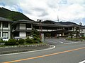
Kawakami Village Office
川上村役場2007
  • to Yamato-KamiichiLocal bus30min

Travel times follow 川上村公式『公共交通情報』(https://www.vill.kawakami.nara.jp/life/docs/2017012700017/ 。公開日 2022-07-29)が載せる『やまぶきバス・ゆうゆうバス時刻表』PDF(https://www.vill.kawakami.nara.jp/life/docs/2017012700017/file_contents/yamabukibus_jikoku.pdf 。令和8年10月1日改正・A2・2ページ。保存 $SP/kawakami/yamabukibus_jikoku.pdf)。『吉野発』の表(平日・土曜)のゆうゆうバスの列で、上市駅→川上村役場(庁舎前)を読んだ (checked 2026-10-14). They vary by time of day.

Shape

Borders 7 municipalities across 1 prefectures.

Territory of Kawakami Village
Boundaries: National Land Numerical Information (N03)

North to south

20.6km

Nara Prefecture
東吉野村, 上北山村, 天川村, 吉野町, 黒滝村
Mie Prefecture
大台町, 松阪市

Kawakami Village isthis kind of town.

  1. 01The rock inscription "Dokura-o Zorin Shotoku Kinen" honors Dokura Shozaburo (1840 to 1917). The Japan Heritage site says that in 1921, soon after his death, it was carved at the urging of the forestry scholar Honda Seiroku into the rock face of Otaki, where he grew up. Shozaburo contributed to the growth of Yoshino forestry, including the development of the Dokura planting method
  2. 02The village describes the Shimotako village forest as a stand of cedar and cypress planted in the early Edo period. The site of the Shiraya settlement stands empty after a group relocation, and a planting project to restore its landscape continues
  3. 03On the stone steps up to Unokawa Shrine are the words "Ikada Renchu" (raftsmen's group); the tourism association says the upper steps were donated by the raftsmen in 1851 and the lower ones built by the raftsmen's union in 1937

If something caught your eye, ask the town itself.