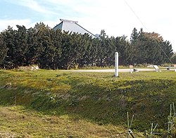
Shikakudake, 3-prefecture border, Takko Town
Article

02443 / たっこまち

Aomori Prefecture 三戸郡

Takko Town

One mountain spans three prefectures.

Shikakudake, 3-prefecture border

Photo by らんで (CC BY-SA 3.0)

01 / Takko Kagura

In the early Edo period, a Takko mountain asceticperformed kagura for the Nanbu domain.

The prefecture's description records that a mountain ascetic (shugen) of Takko served as the Nanbu domain's official kagura performer in the early Edo period. After a decline, today's Takko Kagura is said to come from a lion dance that a man brought from Iwate and his pupil passed on. At the old New Year it visits homes for spring prayers.

  • Prefectural Intangible Folk Cultural Property, 1961
  • National selection, 1971
  • 16 Yamabushi kagura pieces

02 / Former Hashimoto Residence

Adze marks can be confirmedon the pillars of the earth-floored room and stable.

The Former Hashimoto Residence is a Nanbu magariya, with the stable laid out in an L shape from the main house. The prefecture records that no documents show its history, but its construction methods suggest the late 19th century. It was moved to a facility in the town in fiscal 1992 and repaired.

  • Prefectural Treasure (building), 2005
  • Presumed late 19th century
  • Relocated in FY1992

03 / Pest-driving ritual

In one hamlet, a male-and-female pair of barley-straw effigiesis carried around, then dropped into a ravine at the village border.

According to the prefecture, in one hamlet villagers carry the effigy to flute, drum and hand-gong music and make it dance at crossroads. In another, a paper flag is waved and the effigy is set up at the village border. The prefecture records it as a survival of the pest-driving charm.

  • Prefectural Intangible Folk Cultural Property, 1983
  • A pair of barley-straw effigies
  • Held in two hamlets

Takko Town from the sky

Now and 1974–78. Tap a photo to zoom in.

Wide (about 6 km across)

Close (about 1.5 km across)

Now (shot May–October 2021)Shot 1974–78

Source: Geospatial Information Authority of Japan (GSI) GSI Tiles(全国最新写真(シームレス)/国土画像情報(第一期:1974〜1978年撮影))

Open in GSI Maps (now)Open in GSI Maps (1974–78)

Living here

28 minutes by bus from Sannohe Station. No station in town.

  • about 5,000 people
  • Rural district town

There is no railway station in the town; the town says it is about 30 minutes by local bus from Sannohe Station on the Aoimori Railway. On the Nanbu Bus timetable revised on April 1, 2026, the fastest daily bus takes 28 minutes from Sannohe Station to Sanmoru Takko, with no change of bus.

People living here
4,968people
19952020

−10.6% since 2015

7,681 → 4,968

Area
241.98km²

46.97km² of it habitable

2024

Households
1,918households

2.6 people per household

2020

Rent (average for rentals)
—
Healthcare
0 hospitals / 3 clinics

6.0 per 10,000 people

2023

Area241.98km²Habitable land46.97km² / 19%
Area and habitable land at the same scalee-Stat B1101 / B1103
Children waiting for childcare
—2 nurseries and similar
Home purchase subsidy
—
Average annual temperature
—

These 3 items are waiting on a nationwide data source. We do not fill them with estimates.

ACCESS

Where you can go from here.

Takko Town in Japan40.340°N 141.152°E
TokyoOsakaTakko Town
  • to SannoheLocal bus28min

Travel times follow 南部バス『2026年4月1日改正 路線別時刻表』(ポケット時刻表・令和8年3月3日現在。PDF の Last-Modified は 2026-07-15。平日と『土曜・日祝日』の2種)の『田子線』(下り)。平日は『三戸駅前』19:20発→『サンモール田子』19:48着=28分(八戸ラピア始発 18:07 の便。通常の便は三戸駅前 6:52→サンモール田子 7:19 など31分)、『土曜・日祝日』は三戸駅前 19:19発→サンモール田子 19:47着=28分(通常の便は29分)。平日と土日祝のどちらも最速は28分で同じ。町公式『田子町の概要』の『青い森鉄道三戸駅から路線バスで約30分』・町観光協会『アクセス』の『青い森鉄道「三戸駅」からバスで30分』と合う (checked 2026-10-28). They vary by time of day.

Shape

Borders 4 municipalities across 2 prefectures.

Territory of Takko Town
Boundaries: National Land Numerical Information (Administrative Area Data), MLIT. Processed by Machigatari.Lakes: National Land Numerical Information (Lake Data), MLIT. Processed by Machigatari. Prepared with the approval of the Director-General of the Geospatial Information Authority of Japan, using its Digital Map 25000 (Spatial Data Framework) and Digital Map 25000 (Place Names and Public Facilities). (承認番号 平27情使、第585号)

North to south

19.8km

Aomori Prefecture
Sannohe Town
Iwate Prefecture
Ninohe City, Hachimantai City
Akita Prefecture
Kazuno City

Takko Town isthis kind of town.

  1. 01Mount Shikakudake lies at the southern end of the town, and the town describes it as spanning Aomori, Akita and Iwate. Its summit has a nearly flat raised bog
  2. 02Takko Kagura is a nationally selected and prefecturally designated folk performing art, the Takko pest-driving ritual is also a Prefectural Intangible Folk Cultural Property, and the Former Hashimoto Residence is a Nanbu magariya and Prefectural Treasure
  3. 03Lacquer-tapping tool making is a nationally selected conservation technique, and the town says the most likely origin of the name Takko is an Ainu word meaning a small hill

If something caught your eye, ask the town itself.