Kasaishi Enakyo.jpg
Article

21210 / えなし

Gifu Prefecture

Ena City

Granite worn into a matsutake shape.

Kasaishi, Enakyo granite

Photo by Alpsdake (CC BY-SA 4.0)

01 / Gomoza

A community hall that doubled as a playhousewas named Gomoza after the place name.

Gomouza.jpg
Photo by Opqr (CC BY-SA 4.0)

The former Iiji Community Hall was built in 1951 as a community hall and local kabuki playhouse. In 1983, after a new community hall was built, it became a playhouse only and was named Gomoza, after the place name. Inside are a stage with a hanamichi runway and balcony seating, and it is a nationally Registered Tangible Cultural Property.

  • Built in 1951 as a community hall and local kabuki playhouse
  • Named Gomoza in 1983
  • Registered Tangible Cultural Property (national)

02 / Kano House

A gunsmith's house, supported by the Iwamura domain,had its forge behind the earthen-floored entry.

Kano House Iwamura ac.jpg
Photo by Asturio Cantabrio (CC BY-SA 4.0)

Its first master, Kanefusa, was taken into the service of the Iwamura domain in 1814 and moved to the present site around 1831. The main house and the storehouse behind it are city-designated cultural properties (buildings), and a komainu guardian dog sits on the ridge in place of an onigawara ridge-end tile.

  • City-designated cultural property (building)
  • Two-story, 8 ken by 7.5 ken
  • Moved to the present site around 1831

03 / Shoge Haiji site

The posts of the main hall's surrounding aisleare arranged radially around its core.

Shoge haidera05.jpg
Photo by takami torao (Public domain)

A temple site of the Nara and Heian periods, designated a National Historic Site in 2001. A pagoda to the west and the main hall to the east are laid out with the lecture hall to their north, in the Horyu-ji style. The Agency for Cultural Affairs explains that the main hall's post arrangement has no parallel in surviving buildings or excavated remains, only in the Tamamushi Shrine of the Asuka period.

  • National Historic Site, August 13, 2001
  • Horyu-ji-style temple layout
  • Radial posts around the main hall's aisle

Living here

A city of six merged municipalities, about 80% forest.

  • about 50,000 people

The city was formed on October 25, 2004 by the merger of the former Ena city with the towns of Iwamura, Yamaoka, Akechi and Kamiyahagi and the village of Kushihara. Its area is 504.24 km², with the Kiso Mountains running along the east, and its urban areas lie in the Ena Basin and the Iwamura Basin to its south. City Hall is about 900 m south of Ena Station.

People living here
47,774people
20052020

−6.5% since 2015

55,761 → 47,774

Area
504.24km²

114.68km² of it habitable

2024

Households
18,158households

2.6 people per household

2020

Rent (average for rentals)
37,958yen

National average 60,630 yen

2023

Healthcare
2 hospitals / 40 clinics

8.8 per 10,000 people

2023

Area504.24km²Habitable land114.68km² / 23%
Area and habitable land at the same scalee-Stat B1101 / B1103

Population from 2005 onward (municipal boundary changed).2004-10-25 に合併。2005年調査から市域が変わっている。

Children waiting for childcare
—17 nurseries and similar
Home purchase subsidy
—
Average annual temperature
—

These 3 items are waiting on a nationwide data source. We do not fill them with estimates.

ACCESS

Where you can go from here.

Ena City in Japan35.449°N 137.413°E
TokyoOsakaEna City
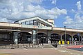
Ena Station
恵那駅2018
  • to NagoyaLtd. exp. Shinano42min

Travel times follow JR東海『アクセス検索』(https://railway.jr-central.co.jp/timetable/nr_doc/search.html。『(2026/9/18発売)時刻表10月号のデータ』)で、名古屋駅→恵那駅・恵那駅→名古屋駅を2026年10月16日(金)・17日(土)・18日(日)・19日(月)の複数の時刻で引いた。毎日運転の最速は名古屋→恵那が特急しなの3号(名古屋08:00発→恵那08:42着・乗換0・42分。16〜19日の4日とも同じ)。【第2段で追加】JR東日本『駅の時刻表』(2026年10月分)の特急しなの3号(1003M)の停車駅一覧(https://timetables.jreast.co.jp/2610/train/000/000081.html)で、名古屋08:00発→千種→多治見→恵那08:42着(08:42発)→中津川08:50着と確かめた。運行日カレンダーは2026-09-18〜12-31のうち 10月17日・10月31日の2日だけ別ページ(000082・000083。どちらも名古屋08:00発・恵那08:42着で同じ時刻。木曽福島・塩尻の手前の停車駅が違うだけ)で、ほかの全日(平日・土休日を含む)は同じ時刻。恵那に毎日停まる定期の特急で、臨時停車ではない (checked 2026-10-15). They vary by time of day.

Shape

Borders 7 municipalities across 2 prefectures.

Territory of Ena City
Boundaries: National Land Numerical Information (N03)

North to south

36.1km

Gifu Prefecture
中津川市, 瑞浪市, 八百津町, 白川町
Aichi Prefecture
豊田市
Nagano Prefecture
平谷村, 根羽村

Ena City isthis kind of town.

  1. 01Kasaishi is a weathered remnant of biotite granite on the left bank of Enakyo, and a National Natural Monument; the explanation at designation says a columnar remnant was worn away by wind near its base into a matsutake-like shape, with a circumference of 10.2 m at the head and 2.3 m at the narrowest point
  2. 02Iwamura was the castle town of the Iwamura domain, and its Honmachi-dori was selected in 1998 (Heisei 10) as a nationally designated Important Preservation District for Groups of Traditional Buildings; the city describes the district of about 14.6 ha as a merchant town where Edo-period and modern townhouses harmonize
  3. 03The city's historic-scenery plan records that jikyogen, local amateur theater, is handed down today in seven districts (Higashino, Misato-cho, Iiji-cho, Yamaoka-cho, Akechi-cho, Kushihara and Kamiyahagi-cho), and that Iiji kabuki has continued since the Tenpo era (1831-1845)

See the town as it is now.

Source: Wikidata (P2002, P2003, P2013, P2397)

If something caught your eye, ask the town itself.