Wheel Stone, Hanasaki Port, Nemuro City
Article

01223 / ねむろし

Hokkaido

Nemuro City

Cut across, the rock looks like a wheel.

Wheel Stone, Hanasaki Port

Photo by Captain76 (CC BY-SA 3.0)

01 / Shunkunitai

The sandbar, 8 km long and 1.3 km wide,is made up of three dunes.

Shunkunitai in Nemuro City
Photo by NEXT-EXIT (CC BY-SA 3.0)

Shunkunitai is a sandbar between Nemuro Bay and Lake Furen. The Nemuro Tourism Association says the first dune formed 1,000 to 1,500 years ago and the third row of dunes 3,000 years ago. A primeval forest of Sakhalin spruce grows on the dunes.

  • 8 km long, 1.3 km wide
  • Three dunes, first to third
  • Third row of dunes said to be 3,000 years old

02 / Meiji Park silos

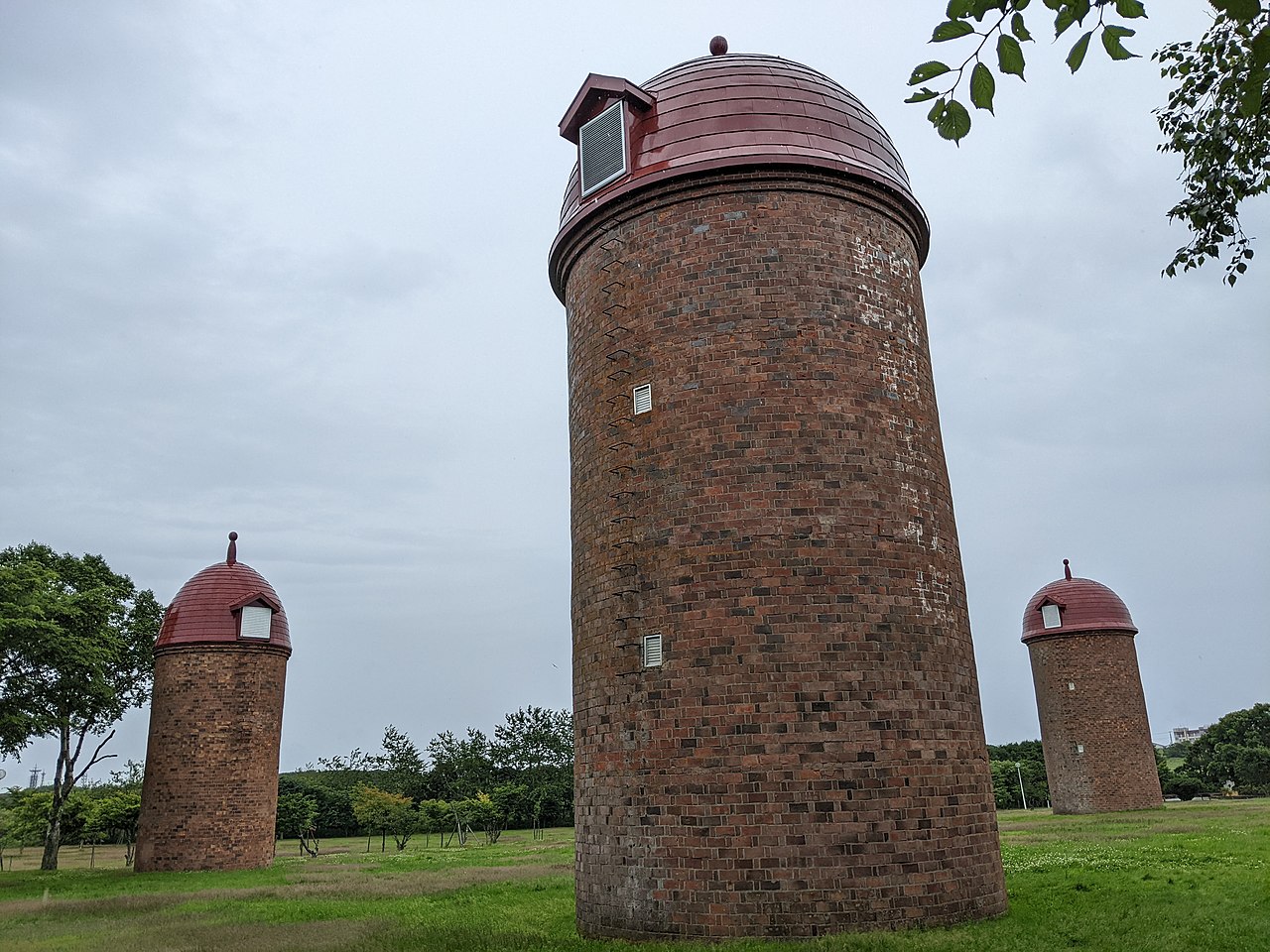
Three brick silos, 12 to 15 m tall,stand on the lawn of Meiji Park.

Meiji Park silos in Nemuro City
Photo by Animataru (CC BY-SA 4.0)

The three silos in Meiji Park were built in 1932 (the second) and 1936 (the first and third), and all are National Registered Tangible Cultural Properties (registered in 2001). They stand on land opened in 1875 as the Nemuro livestock farm of the Hokkaido Development Commission, and are 12 to 15 m tall.

  • National Registered Tangible Cultural Properties
  • Built in 1932 and 1936
  • 12 to 15 m tall

03 / Nemuro Peninsula Chashi Sites

Most chashi sites lie on plateausabove coastal cliffs.

Nemuro Peninsula Chashi Sites in Nemuro City
Photo by 1467jp (CC BY-SA 3.0)

The Nemuro Peninsula Chashi Sites were designated a national historic site in 1983. According to the city, most lie on flat plateaus on coastal cliffs 5 to 50 m above sea level, ringed by semicircular or square ditches. Twenty-four sites are designated.

  • National historic site (1983)
  • On cliff-top plateaus, about 5 to 50 m above sea level
  • Semicircular and square ditches

Nemuro City from the sky

Now and 1974–78. Tap a photo to zoom in.

Wide (about 6 km across)

Close (about 1.5 km across)

Now (shot May 2024)Shot 1974–78

Source: Geospatial Information Authority of Japan (GSI) GSI Tiles(全国最新写真(シームレス)/国土画像情報(第一期:1974〜1978年撮影))

Open in GSI Maps (now)Open in GSI Maps (1974–78)

Living here

From spring to late summer, fog comes almost daily.

  • about 20,000 people

The city says that in Nemuro, fog forms almost every day from spring to the end of summer, and the temperature is slow to rise (updated 1 March 2018). Its weather page (updated 26 March 2026) lists 2025 as a year with an average temperature of 8.6°C, a high of 33.9°C and a low of minus 10.0°C.

People living here
24,636people
19952020

−8.5% since 2015

34,934 → 24,636

Area
407.81km²

205.71km² of it habitable

2024

Households
11,153households

2.2 people per household

2020

Rent (average for rentals)
33,017yen

National average 60,630 yen

2023

Healthcare
3 hospitals / 7 clinics

4.1 per 10,000 people

2023

Area407.81km²Habitable land205.71km² / 50%
Area and habitable land at the same scalee-Stat B1101 / B1103
Children waiting for childcare
—7 nurseries and similar
Home purchase subsidy
—
Average annual temperature
—

These 3 items are waiting on a nationwide data source. We do not fill them with estimates.

Shape

Borders 2 municipalities.

Nemuro City in Japan43.330°N 145.583°E
TokyoOsakaNemuro City
Territory of Nemuro City
Boundaries: National Land Numerical Information (Administrative Area Data), MLIT. Processed by Machigatari.Lakes: National Land Numerical Information (Lake Data), MLIT. Processed by Machigatari. Prepared with the approval of the Director-General of the Geospatial Information Authority of Japan, using its Digital Map 25000 (Spatial Data Framework) and Digital Map 25000 (Place Names and Public Facilities). (承認番号 平27情使、第585号)

North to south

26.8km

Travel times per leg are not published by the municipality, so they are not shown.

Nemuro City isthis kind of town.

  1. 01The Nemuro Wheel Stone is pillow lava of basalt on the coast at Hanasaki Port, named because its cross-section looks like a wheel with radiating lines; it is a national natural monument
  2. 02Shunkunitai is a sandbar between Nemuro Bay and Lake Furen, 8 km long and 1.3 km wide, and the three silos in Meiji Park are National Registered Tangible Cultural Properties
  3. 03The Nemuro Peninsula Chashi Sites are a national historic site, and most chashi sites lie on plateaus above coastal cliffs; in Nemuro, fog forms almost every day from spring to the end of summer

If something caught your eye, ask the town itself.