Higashimokoto Shibazakura Park, Ozora Town
Article

01564 / おおぞらちょう

Hokkaido 網走郡

Ozora Town

A village mark planted in moss phlox.

Higashimokoto Shibazakura Park

Photo by 221.20 (Public domain)

01 / Memambetsu Wetland Plant Community

Yachidamo ash and yachihannoki alder woodsrun about 2 km along the Lake Abashiri shore.

Memambetsu Wetland Plant Community in Ozora Town
Photo by しいな (CC BY-SA 3.0)

The Agency for Cultural Affairs says that in the lowland marsh on the east shore of the southern part of Lake Abashiri, a natural broadleaf forest whose main canopy trees are yachidamo ash and yachihannoki alder continues in a belt for about 2 km. Skunk cabbage spreads over the forest floor, and the site was designated a national Natural Monument in 1972.

  • National Natural Monument (designated June 14, 1972)
  • Natural forest runs in a belt for about 2 km
  • Canopy trees are yachidamo ash and yachihannoki alder
02 / Yamatsumi Shrine

Settlers from around Soma District, Fukushima,enshrined an object from the head shrine in Iitate.

Yamatsumi Shrine in Ozora Town
Photo by Kaz Ish (CC BY-SA 3.0)

The park's own site says that in 1913 (Taisho 2), settlers who came from around Soma District, Fukushima, received a sacred object of worship, chose this spot as a place of protection and enshrined it. The head shrine is in Iitate Village, Soma District, Fukushima, and the present sanctuary was rebuilt by local volunteers in the spring of 1985.

  • Enshrined in 1913 (Taisho 2)
  • Head shrine in Iitate Village, Fukushima
  • Present sanctuary rebuilt in spring 1985

03 / Marchen Hill

Fields line the gently rolling hills,a hill that was also a filming location for Dreams.

Marchen Hill in Ozora Town
Photo by 221.20 (Public domain)

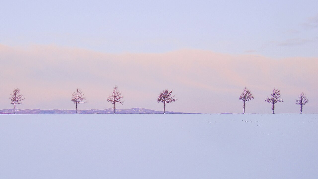
The town says Marchen Hill is a viewpoint where fields stretching across gently rolling hills paint pastoral scenery that changes with the seasons. It was also a location for Dreams, the film by the late director Akira Kurosawa, and the town's quiz book gives it as a filming spot for the fifth episode, Crows.

  • Fields stretch across gently rolling hills
  • Location for Akira Kurosawa's film Dreams
  • Town quiz book cites episode 5, Crows

Ozora Town from the sky

Now and 1974–78. Tap a photo to zoom in.

Wide (about 6 km across)

Close (about 1.5 km across)

Now (shot July–August 2024)Shot 1974–78

Source: Geospatial Information Authority of Japan (GSI) GSI Tiles(全国最新写真(シームレス)/国土画像情報(第一期:1974〜1978年撮影))

Open in GSI Maps (now)Open in GSI Maps (1974–78)

Living here

A farming town born from the merger of Memambetsu Town and Higashimokoto Village.

  • about 7,000 people
  • Rural district town

The town says Ozora Town was born on March 31, 2006, when Memambetsu Town and Higashimokoto Village merged. Its main industry is agriculture, with wheat and barley, potatoes, sugar beets, beans and vegetables among the crops grown. Its area is 343.66 km².

People living here
6,775people
2010

−7.9% since 2015

7,933 → 6,775

Area
343.66km²

194.62km² of it habitable

2024

Households
2,750households

2.5 people per household

2020

Rent (average for rentals)
—
Healthcare
1 hospital / 4 clinics

7.4 per 10,000 people

2023

Area343.66km²Habitable land194.62km² / 57%
Area and habitable land at the same scalee-Stat B1101 / B1103
Children waiting for childcare
—0 nurseries and similar
Home purchase subsidy
—
Average annual temperature
—

These 3 items are waiting on a nationwide data source. We do not fill them with estimates.

Shape

Borders 4 municipalities.

Ozora Town in Japan43.912°N 144.173°E
TokyoOsakaOzora Town
Territory of Ozora Town
Boundaries: National Land Numerical Information (Administrative Area Data), MLIT. Processed by Machigatari.Lakes: National Land Numerical Information (Lake Data), MLIT. Processed by Machigatari. Prepared with the approval of the Director-General of the Geospatial Information Authority of Japan, using its Digital Map 25000 (Spatial Data Framework) and Digital Map 25000 (Place Names and Public Facilities). (承認番号 平27情使、第585号)

North to south

28.3km

Travel times per leg are not published by the municipality, so they are not shown.

Ozora Town isthis kind of town.

  1. 01Higashimokoto Shibazakura Park, the park's own site says, planted a village mark on its south slope in 1983 and a mark of the cow Nonki on its west slope in 1989. Its timeline starts in 1977 with moss phlox divided from a patch of about one tan, and a 2008-09 redevelopment made it a park of about 10 hectares
  2. 02The Memambetsu Wetland Plant Community is a lowland forest on the east shore of the southern part of Lake Abashiri, designated a national Natural Monument in 1972. Yamatsumi Shrine was enshrined in 1913 by settlers from around Soma District, Fukushima, and its head shrine is in Iitate Village
  3. 03Marchen Hill is a viewpoint where fields across rolling hills paint scenery that changes with the seasons, and it was a filming location for the film Dreams. Ozora Town was born in 2006 from the merger of Memambetsu Town and Higashimokoto Village, and its gateway is Memambetsu Station

If something caught your eye, ask the town itself.