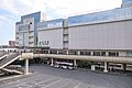
Mito City Teiku Water Tower, Mito City
Article

08201 / みとし

Ibaraki Prefecture

Mito City

Windows above a gallery carry reliefs.

Mito City Teiku Water Tower

Photo by Asturio Cantabrio (CC BY-SA 4.0)

01 / Burial mound

On the rear wall of the chamber,a mural of arms is incised.

Burial mound in Mito City
Photo by Saigen Jiro (Public domain)

Yoshida Kofun has a horizontal stone chamber built of slabs. Its rear wall bears an incised mural centered on weapons: yuki, tosu knives and spears. The city says its date is thought to be the mid-7th century. Recent surveys confirmed an octagonal mound. The photo shows a replica of the mural.

  • National Historic Site (1922)
  • Yuki, tosu and spears incised on rear wall
  • Thought mid-7th century (city)

02 / Waterworks

Stone-conduit tunnel from Kasahara,a copper pipe over the Bizen-bori.

Waterworks in Mito City
Photo by papakuro (CC BY 3.0)

The Kasahara Waterworks was ordered in 1662 to bring water to a lower town short of drinking water, and was completed the next year. A stone-conduit tunnel carried it from Kasahara, and a copper pipe crossed the Bizen-bori. It runs about 10 km. The photo shows a restored conduit.

  • Prefectural Historic Site (1938)
  • About 10 km long
  • Stele at the water source

03 / Folk craft

One daikon, one knife,and peony or chrysanthemum blooms.

Daikon mukibana is a folk craft long handed down in Moto-Ishikawa-cho. From one daikon and a single knife, makers carve peonies, chrysanthemums, irises and camellias. It is said that water-peeling takes 3 years and flowers 8. A votive plaque offered to Tegosaki Shrine in 1888 is the clue to its start.

  • Municipal Intangible Folk Cultural Property (1975)
  • Water-peeling 3 years, flowers 8
  • Preserved by a preservation society

Mito City from the sky

Now and 1974–78. Tap a photo to zoom in.

Wide (about 6 km across)

Close (about 1.5 km across)

Now (shot April 2022)Shot 1974–78

Source: Geospatial Information Authority of Japan (GSI) GSI Tiles(全国最新写真(シームレス)/国土画像情報(第一期:1974〜1978年撮影))

Open in GSI Maps (now)Open in GSI Maps (1974–78)

Living here

65 minutes to Ueno, 72 to Tokyo.

  • about 270,000 people
  • 90 min to a city centre

Mito Station is 65 minutes from Ueno Station and 72 minutes from Tokyo Station by the fastest Limited Express Hitachi, with no change. The times are the fastest of the daily trains, counted from the October 2026 JR East timetable.

People living here
270,685people
20052020

0% since 2015

262,603 → 270,685

Area
217.32km²

184.96km² of it habitable

2024

Households
122,598households

2.2 people per household

2020

Rent (average for rentals)
49,284yen

National average 60,630 yen

2023

Healthcare
25 hospitals / 242 clinics

9.9 per 10,000 people

2023

Area217.32km²Habitable land184.96km² / 85%
Area and habitable land at the same scalee-Stat B1101 / B1103

Population from 2005 onward (municipal boundary changed).2005-02-01 に合併。2005年調査から市域が変わっている。

Children waiting for childcare
—51 nurseries and similar
Home purchase subsidy
—
Average annual temperature
—

These 3 items are waiting on a nationwide data source. We do not fill them with estimates.

ACCESS

Where you can go from here.

Mito City in Japan36.366°N 140.471°E
OsakaMito City
Mito Station
水戸駅2023
  • to UenoLtd. exp. Hitachi65min
  • to TokyoLtd. exp. Hitachi72min

Travel times follow JR東日本の時刻表(2610版)『常磐線 下り』の平日(timetable-v/240d1)と土曜・休日(240d2)の列車ごとの停車時刻で、上野・東京の発から水戸の着までを数えた(下り=都市→町)。 (checked 2026-10-22). They vary by time of day.

Shape

Borders 6 municipalities.

Territory of Mito City
Boundaries: National Land Numerical Information (Administrative Area Data), MLIT. Processed by Machigatari.Lakes: National Land Numerical Information (Lake Data), MLIT. Processed by Machigatari. Prepared with the approval of the Director-General of the Geospatial Information Authority of Japan, using its Digital Map 25000 (Spatial Data Framework) and Digital Map 25000 (Place Names and Public Facilities). (承認番号 平27情使、第585号)

Mito City isthis kind of town.

  1. 01Mito City Teiku Water Tower, built in 1932, is a 21.6 m cylinder with reliefs in its upper windows above the gallery
  2. 02Yoshida Kofun is a national historic site with incised weapons on the rear wall of its chamber
  3. 03The Kodokan is a national special historic site, Kairakuen a national historic site and place of scenic beauty, Kasahara Waterworks a prefectural site, and daikon mukibana a municipal folk property

See the town as it is now.

Source: Wikidata (P2002, P2003, P2013, P2397)

If something caught your eye, ask the town itself.