Bronze seal, Shizu Shrine, Naka City
Article

08226 / なかし

Ibaraki Prefecture

Naka City

Works found a bronze seal at tree roots.

Bronze seal, Shizu Shrine

Photo by Saigen Jiro (CC0)

01 / Earthenware

A four-character ink inscription on potterycame from a district once home to weavers.

A fragment of a haji ware cup unearthed at the Shimo-Oga site bears a four-character ink inscription. Shimo-Oga was once known as a weaving village, home to people who wove a cloth named by two of those characters. The city records that an excavated record bearing the characters for that cloth is unprecedented, and that the piece is thought to date from the first half of the 9th century.

  • City-designated (2020)
  • 12 cm long, 3.5 cm wide
  • Thought to date from the first half of the 9th century

02 / Manuscript

The list of emperors that comes with a commentaryis a key source confirming Emperor Chokei's accession.

Manuscript in Naka City
Photo by 小石川人晃 (CC BY-SA 4.0)

Jofuku-ji Temple holds the Nihon Shoki Shisho, a commentary on the age-of-the-gods volumes of the Nihon Shoki compiled by Ryoyo Shogei around 1398. At the end of its third volume comes the Jinno Hyakudai Gumyoki, a list of successive emperors that closes with the Southern Court emperors. The prefecture records it as a key source confirming Emperor Chokei's accession.

  • Prefecturally designated (1972)
  • Compiled around 1398 (Oei 5)
  • 3 volumes

03 / Old tree

An old tree with a hollow trunk is said tohave taken root from Yoshiie's riding whip.

The muku tree in the grounds of a local Inari shrine in Shizu is about 30 m tall, with a trunk girth of 7.25 m and an estimated age of 880 years. Its trunk has rotted from the base into a hollow, and the city records it as a rare giant tree at the northern limit of its range. It is said to have taken root from the whip Minamoto no Yoshiie stuck in the ground in 1086 when he prayed for victory.

  • Prefectural natural monument (1939)
  • About 30 m tall, trunk girth 7.25 m
  • Estimated age 880 years

Naka City from the sky

Now and 1974–78. Tap a photo to zoom in.

Wide (about 6 km across)

Close (about 1.5 km across)

2012 (shot FY2012)Shot 1974–78

Source: Geospatial Information Authority of Japan (GSI) GSI Tiles(年度別空中写真(2012年度)/国土画像情報(第一期:1974〜1978年撮影))

Open in GSI Maps (now)Open in GSI Maps (1974–78)

Living here

99 minutes to Tokyo, 139 to Shinjuku.

  • about 50,000 people
  • 2 hours to a city centre

The city covers 97.82 km² and describes itself as lying at the center of the Naka Plateau, a little north of the middle of Ibaraki Prefecture. Nine stations of the JR Suigun Line lie within it. Ibaraki Kotsu's expressway buses take 99 minutes from the south exit of Tokyo Station's Yaesu side to the Naka City Hall Entrance stop and 139 minutes from Busta Shinjuku; the stop is not on the City Hall grounds.

People living here
53,502people
20052020

−1.4% since 2015

54,705 → 53,502

Area
97.82km²

81.39km² of it habitable

2024

Households
20,931households

2.6 people per household

2020

Rent (average for rentals)
52,781yen

National average 60,630 yen

2023

Healthcare
4 hospitals / 30 clinics

6.4 per 10,000 people

2023

Area97.82km²Habitable land81.39km² / 83%
Area and habitable land at the same scalee-Stat B1101 / B1103
Children waiting for childcare
—7 nurseries and similar
Home purchase subsidy
—
Average annual temperature
—

These 3 items are waiting on a nationwide data source. We do not fill them with estimates.

ACCESS

Where you can go from here.

Naka City in Japan36.457°N 140.487°E
OsakaNaka City
Kami-Sugaya Station
上菅谷駅2022
  • to TokyoHighway bus99min
  • to ShinjukuHighway bus139min

Travel times follow 市公式『高速バス』(2026-06-26 更新)が掲げる茨城交通『高速バス 常陸太田・大宮・大子線』の時刻表(2026年7月6日から。市サイトのPDF)。下り(東京駅・バスタ新宿 → 那珂IC → 大子・大宮・常陸太田)の毎日運転の便で数えた (checked 2026-10-22). They vary by time of day.

Shape

Borders 7 municipalities.

Territory of Naka City
Boundaries: National Land Numerical Information (Administrative Area Data), MLIT. Processed by Machigatari.Lakes: National Land Numerical Information (Lake Data), MLIT. Processed by Machigatari. Prepared with the approval of the Director-General of the Geospatial Information Authority of Japan, using its Digital Map 25000 (Spatial Data Framework) and Digital Map 25000 (Place Names and Public Facilities). (承認番号 平27情使、第585号)

Naka City isthis kind of town.

  1. 01The bronze seal of Shizu Shrine, bearing the inscription for “Shizu Shrine seal,” was found at the roots of a great cypress in the shrine grounds during construction work in 1667, when Tokugawa Mitsukuni had the Buddhist temple attached to the shrine separated from it; it is a nationally designated Important Cultural Property
  2. 02The ink-inscribed earthenware from the Shimo-Oga site comes from a district once known as a weaving village and is a city-designated archaeological material thought to date from the first half of the 9th century
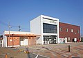
  3. 03Jofuku-ji holds a prefecturally designated Nihon Shoki Shisho, regarded as a key source confirming Emperor Chokei's accession, and the Shizu muku tree is a prefectural natural monument said to have taken root from Minamoto no Yoshiie's whip

See the town as it is now.

Source: Wikidata (P2002, P2003, P2013, P2397)

If something caught your eye, ask the town itself.

From this town's themes