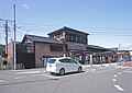
Former Uwaoka School, Building 1, Daigo Town
Article

08364 / だいごまち

Ibaraki Prefecture 久慈郡

Daigo Town

Desks stand in rows, as the school looked at closing.

Former Uwaoka School, Building 1

Photo by 雨宮千夏 (CC BY-SA 4.0)

01 / Paper raw material

Black and inner bark are scraped offby hand, using a straw stand.

The town says kozo grown in Daigo has fine, dense fibres, and that both Hon-Mino paper and Echizen hosho are made solely from Daigo Nasu kozo. In bark stripping, the black bark and inner bark are scraped off by hand; the town describes the straw 'bark-stripping stand' used for it as a unique, handmade traditional tool found in no other producing area.

  • Town-designated intangible cultural property
  • 16 members, about 4 tons a year (2019)
  • Raw material for Hon-Mino paper and Echizen hosho

02 / Natural monument

A cedar said to have heldMinamoto no Yoshiie's halberd.

Natural monument in Daigo Town
Photo by Zeter114514 (CC BY-SA 4.0)

This is the sacred tree of Chikatsu Shrine in Shimonomiya, said to have been planted when the shrine was founded. Its name is said to come from Minamoto no Yoshiie, who on his way to Oshu stopped here, leaned his own halberd against the tree and prayed. The town gives its estimated age as over 1,300 years and its height as about 43 m.

  • Prefectural natural monument
  • Designated 13 October 1931
  • Estimated age over 1,300 years

03 / Place of scenic beauty

The national scenic site includesthe falls upstream of Fukuroda.

Place of scenic beauty in Daigo Town
Photo by Σ64 (CC BY 4.0)

Namase Falls lies upstream of Fukuroda Falls and drops about 15 m. According to the town, you reach it by crossing the suspension bridge from which Fukuroda Falls is seen, then climbing the hiking course beyond. Together with Fukuroda Falls it was designated a national place of scenic beauty on 10 March 2015.

  • Drop of about 15 m
  • National place of scenic beauty
  • 10 March 2015

Daigo Town from the sky

Now and 1974–78. Tap a photo to zoom in.

Wide (about 6 km across)

Close (about 1.5 km across)

2013 (shot FY2013)Shot 1974–78

Source: Geospatial Information Authority of Japan (GSI) GSI Tiles(年度別空中写真(2013年度)/国土画像情報(第一期:1974〜1978年撮影))

Open in GSI Maps (now)Open in GSI Maps (1974–78)

Living here

177 minutes from Tokyo Station by highway bus.

  • about 20,000 people
  • Rural district town

The town has JR Suigun Line stations, but no railway reaches it from Tokyo without a change. On Ibaraki Kotsu's Daigo-Ota highway bus, leaving Tokyo Station Yaesu South Exit at 15:10 gets you to Daigo Town Office at 18:07, 177 minutes. All seats must be reserved. The present town was formed in 1955 by the merger of one town and eight villages.

People living here
15,736people
19952020

−12.8% since 2015

25,604 → 15,736

Area
325.76km²

70.08km² of it habitable

2024

Households
6,356households

2.5 people per household

2020

Rent (average for rentals)
30,088yen

National average 60,630 yen

2023

Healthcare
3 hospitals / 5 clinics

5.1 per 10,000 people

2023

Area325.76km²Habitable land70.08km² / 22%
Area and habitable land at the same scalee-Stat B1101 / B1103
Children waiting for childcare
—5 nurseries and similar
Home purchase subsidy
—
Average annual temperature
—

These 3 items are waiting on a nationwide data source. We do not fill them with estimates.

ACCESS

Where you can go from here.

Daigo Town in Japan36.764°N 140.364°E
OsakaDaigo Town
Hitachi-Daigo Station
常陸大子駅2022
  • to TokyoHighway bus177min

Travel times follow 茨城交通(事業者公式)の高速バス『大子・大宮・常陸太田 ─ 那珂IC ─ 東京駅・バスタ新宿(大子・太田線)』の下り時刻表(2026.7.6 改正)。東京駅八重洲南口発の毎日運転の便(大子1号・大子3号)で、大子町役場着までを数えた (checked 2026-10-22). They vary by time of day.

Shape

Borders 6 municipalities across 2 prefectures.

Territory of Daigo Town
Boundaries: National Land Numerical Information (Administrative Area Data), MLIT. Processed by Machigatari.Lakes: National Land Numerical Information (Lake Data), MLIT. Processed by Machigatari. Prepared with the approval of the Director-General of the Geospatial Information Authority of Japan, using its Digital Map 25000 (Spatial Data Framework) and Digital Map 25000 (Place Names and Public Facilities). (承認番号 平27情使、第585号)

North to south

28.5km

Fukushima Prefecture
Yamatsuri Town, Tanagura Town
Tochigi Prefecture
Otawara City, Nakagawa Town

Daigo Town isthis kind of town.

  1. 01The wooden school buildings of a school that closed in 2001 include three registered tangible cultural properties, and the town says the interior can be seen as it was at closing
  2. 02The town says Daigo Nasu kozo, a town-designated intangible cultural property, is the raw material of Hon-Mino paper and Echizen hosho, and a straw stand is used to strip its bark
  3. 03Chikatsu Shrine has Hokosugi, a prefectural natural monument said to have held Minamoto no Yoshiie's halberd, and Namase Falls upstream of Fukuroda Falls is part of a national scenic site

If something caught your eye, ask the town itself.

From this town's themes