Raigo-in Tahoto Pagoda, Ryugasaki City
Article

08208 / りゅうがさきし

Ibaraki Prefecture

Ryugasaki City

Year and craftsmen, carved on a finial.

Raigo-in Tahoto Pagoda

Photo by 小石川人晃 (CC BY-SA 4.0)

01 / Locomotive

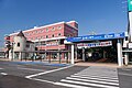
The city bought back a steam locomotivesold to Kumejima, before it shipped.

Locomotive in Ryugasaki City
Photo by Suikotei (CC BY 4.0)

This C-type tank steam locomotive ran on the line that is now the Kanto Railway Ryugasaki Line and was built in 1925. After it was scrapped in 1971 it was sold to Kumejima for a tourism development, but the city, valuing its historical worth, bought it back before it was sent. It now stands on the grounds of the Museum of History and Folklore.

  • C-type tank locomotive built in 1925
  • Scrapped in 1971; sold to Kumejima
  • City-designated historical material (2016)
02 / Stone post

After Date Masamune's grant, a jin'ya was set up;two “Sendai-ryo” stone posts remain.

In 1606 Date Masamune, lord of Sendai, received a grant of 10,000 koku in total in Kawachi and Shida districts of Hitachi Province, and a jin'ya (administrative office) was set up in Ryugasaki. The city regards the stone posts carved “Sendai-ryo” as boundary markers for the four corners of the fief; only two remain, at the Museum of History and Folklore.

  • Grant of 10,000 koku in total, 1606
  • Jin'ya kept in Ryugasaki to the end of the Edo period
  • City-designated historical material (1978)

03 / Signpost

On the back of a crossroads signpost, elders recordsaving one mon per sutra reading.

The signpost stands at a three-way junction at the northeast corner of a municipal elementary school, its three faces carved “Mito 16 ri,” “Edo 13 ri” and “Fukawa 3 ri.” The back says that, because travelers lost their way, the elders of Wakashiba post town saved one mon for each reading of a sutra chapter and set it up in 1826, with the names of 15 villagers.

  • Mito 16 ri, Edo 13 ri, Fukawa 3 ri
  • Erected in December 1826
  • City-designated historic site (1978)

Ryugasaki City from the sky

Now and 1974–78. Tap a photo to zoom in.

Wide (about 6 km across)

Close (about 1.5 km across)

Now (shot May–September 2008)Shot 1974–78

Source: Geospatial Information Authority of Japan (GSI) GSI Tiles(全国最新写真(シームレス)/国土画像情報(第一期:1974〜1978年撮影))

Open in GSI Maps (now)Open in GSI Maps (1974–78)

Living here

32 minutes to Ueno, 39 to Tokyo.

  • about 80,000 people

The city covers 78.59 km². Its north is the Inashiki upland and its south an alluvial plain between the Tone and Kokai rivers. From Ryugasakishi Station on the JR Joban Line, an evening Limited Express Tokiwa reaches Ueno in 32 minutes and Tokyo in 39. Addresses in the old Ryugasaki town area have no district name, as in the city hall's “Ryugasaki City 3710.”

People living here
76,420people
19952020

−2.5% since 2015

69,163 → 76,420

Area
78.59km²

68.56km² of it habitable

2024

Households
32,158households

2.4 people per household

2020

Rent (average for rentals)
44,716yen

National average 60,630 yen

2023

Healthcare
3 hospitals / 44 clinics

6.2 per 10,000 people

2023

Area78.59km²Habitable land68.56km² / 87%
Area and habitable land at the same scalee-Stat B1101 / B1103
Children waiting for childcare
—13 nurseries and similar
Home purchase subsidy
—
Average annual temperature
—

These 3 items are waiting on a nationwide data source. We do not fill them with estimates.

ACCESS

Where you can go from here.

Ryugasaki City in Japan35.912°N 140.182°E
OsakaRyugasaki City
Ryugasakishi Station
龍ケ崎市駅2023
  • to TokyoLtd. exp. Tokiwa39min
  • to UenoLtd. exp. Tokiwa32min

Travel times follow JR東日本「駅の時刻表」(timetables.jreast.co.jp)の龍ケ崎市駅・常磐線の下り(土浦・水戸方面)の平日と土曜・休日の時刻表(2026年10月ダイヤ・URL の版は 2610)。各列車の「停車駅一覧」ページで品川・東京・上野・北千住の「発」時刻と龍ケ崎市の「着」時刻を引いて分数を出した(第2段で数え直し。第1段は途中駅の着時刻を使っていて東京・上野が2分長かった)。運転日のカレンダー(2026-09-18〜12-31)が全日「運転」で、運転日注意の印(◆)も『平日運転』などの注記も無い列車だけ数えた(平日と土曜・休日の両方の時刻表に載り、分数が同じ) (checked 2026-10-22). They vary by time of day.

Shape

Borders 7 municipalities.

Territory of Ryugasaki City
Boundaries: National Land Numerical Information (Administrative Area Data), MLIT. Processed by Machigatari.Lakes: National Land Numerical Information (Lake Data), MLIT. Processed by Machigatari. Prepared with the approval of the Director-General of the Geospatial Information Authority of Japan, using its Digital Map 25000 (Spatial Data Framework) and Digital Map 25000 (Place Names and Public Facilities). (承認番号 平27情使、第585号)

Ryugasaki City isthis kind of town.

  1. 01According to the inscription on its finial, the Raigo-in tahoto pagoda was repaired in 1556 by Toki, lord of Edosaki Castle, with many craftsmen taking part; the city's list records it as an Important Cultural Property
  2. 02The No. 4 locomotive that ran on the line now called the Kanto Railway Ryugasaki Line was bought back by the city before it was shipped to Kumejima and stands at the Museum of History and Folklore; the brick gate of Moroka Ryosuke, a president of the railway company, was also moved within the city by citizens
  3. 03In Ryugasaki, where a jin'ya was set up after Date Masamune's grant, the Sendai-ryo stone posts remain, and a signpost saved up by sutra readings stands at a junction in Wakashiba; the Tsukumai is a traditional performance selected by the nation and designated by the prefecture

See the town as it is now.

Source: Wikidata (P2002, P2003, P2013, P2397)

If something caught your eye, ask the town itself.

From this town's themes