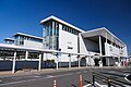
Inada stone, Ishi no Hyakunenkan, Kasama City
Article

08216 / かさまし

Ibaraki Prefecture

Kasama City

A stone wall with a woven pattern.

Inada stone, Ishi no Hyakunenkan

Photo by AT@wiki (CC BY-SA 2.0)

01 / Natural monument

Its song can be heard,but the cicada is hardly seen.

Natural monument in Kasama City
Photo by 小石川人晃 (CC BY-SA 4.0)

The grounds of Ryogonji Temple and Hachiman Shrine in Kataniwa are a National Natural Monument, a habitat of the Himeharu cicada. The city records that it is the northern limit of the species on the Pacific side, that it emerges from late June to late July, and that its song is heard but the insect is hardly seen. The temple gate, a thatched four-pillared gate built in 1374, is nationally designated.

  • Emerges late June to late July
  • Northern limit, Pacific side
  • Gate built 1374

02 / Building

A Meiji three-storey wooden buildingwas moved back by hikiya.

Building in Kasama City
Photo by tak1701d (Public domain)

The city describes the former Izutsuya main building as a three-storey wooden building of the mid-Meiji era, and carried out the hikiya (building-moving) work on 25 July 2017. It is now the Kasama History Exchange Hall. The facility's own site says it was moved about 15 m back from the road, with polished Inada stone as its base.

  • Moved 25 July 2017
  • About 15 m back
  • Opened 1 April 2018

03 / Kiln

A climbing kiln said to be builton advice from a Shigaraki potter.

The climbing kiln of the Kuno family in Kasama is said to have been built in the Anei era (1772-80), when the head of the family took the advice and guidance of a potter who had come from Shigaraki in Omi Province. Of its two rows, the 14-chamber kiln is said to have been used for bisque firing and the 10-chamber kiln for main firing. It is a city historic site.

  • Anei era (1772-80)
  • Two rows, 14 and 10 chambers
  • City Historic Site, 2002

Kasama City from the sky

Now and 1974–78. Tap a photo to zoom in.

Wide (about 6 km across)

Close (about 1.5 km across)

Now (shot May–November 2019)Shot 1974–78

Source: Geospatial Information Authority of Japan (GSI) GSI Tiles(全国最新写真(シームレス)/国土画像情報(第一期:1974〜1978年撮影))

Open in GSI Maps (now)Open in GSI Maps (1974–78)

Living here

70 minutes from Tokyo, 63 from Ueno.

  • about 70,000 people
  • 90 min to a city centre

Tomobe Station, on the Joban and Mito lines, is the first access the city's official guide gives for City Hall (a 15-minute walk). On the limited express Tokiwa it takes at least 63 minutes from Ueno Station and 70 from Tokyo Station (JR East timetable, checked October 2026). The Ishi no Hyakunenkan stands beside Inada Station on the Mito Line.

People living here
73,173people
2010

−4.6% since 2015

79,409 → 73,173

Area
240.4km²

134.75km² of it habitable

2024

Households
28,918households

2.5 people per household

2020

Rent (average for rentals)
42,836yen

National average 60,630 yen

2023

Healthcare
5 hospitals / 39 clinics

6.0 per 10,000 people

2023

Area240.4km²Habitable land134.75km² / 56%
Area and habitable land at the same scalee-Stat B1101 / B1103

Population from 2010 onward (municipal boundary changed).2006-03-19 に新設合併(友部町・岩間町)。2010年調査から市域が変わっている。

Children waiting for childcare
—10 nurseries and similar
Home purchase subsidy
—
Average annual temperature
—

These 3 items are waiting on a nationwide data source. We do not fill them with estimates.

ACCESS

Where you can go from here.

Kasama City in Japan36.345°N 140.304°E
OsakaKasama City
Tomobe Station
友部駅2023
  • to TokyoLtd. exp. Tokiwa70min
  • to UenoLtd. exp. Tokiwa63min

Travel times follow JR東日本の駅時刻表(timetables.jreast.co.jp・2610版)の常磐線 下り(平日・土曜休日)を列車ごとに数えた値。毎日運転(全日)の特急ときわの最速 (checked 2026-10-22). They vary by time of day.

Shape

Borders 7 municipalities across 1 prefectures.

Territory of Kasama City
Boundaries: National Land Numerical Information (Administrative Area Data), MLIT. Processed by Machigatari.Lakes: National Land Numerical Information (Lake Data), MLIT. Processed by Machigatari. Prepared with the approval of the Director-General of the Geospatial Information Authority of Japan, using its Digital Map 25000 (Spatial Data Framework) and Digital Map 25000 (Place Names and Public Facilities). (承認番号 平27情使、第585号)

North to south

20.4km

Tochigi Prefecture
Motegi Town

Kasama City isthis kind of town.

  1. 01Ishi no Hyakunenkan in Inada, a hall named for more than 100 years of quarrying, has an outer wall designed in a sugiaya pattern, also seen in Yuki tsumugi, which the city says shows the high skill of Inada stone work. The Tsukuba Massif granite, which includes Inada stone, was made an IUGS Heritage Stone in 2024
  2. 02The grounds of Ryogonji Temple and Hachiman Shrine in Kataniwa are a National Natural Monument habitat of the Himeharu cicada, and the temple's thatched gate was built in 1374, the city records
  3. 03The former Izutsuya building was moved back by hikiya work on 25 July 2017, and the Kuno family's climbing kiln is a city historic site tied to the origin of Kasama ware

See the town as it is now.

Source: Wikidata (P2002, P2003, P2013, P2397)

If something caught your eye, ask the town itself.