Yamanishi-Kawahara monument.JPG
Article

43432 / にしはらむら

Kumamoto Prefecture 阿蘇郡

Nishihara Village

The governor's ruling set the district.

The Birth of Nishihara Village

Photo by hyolee2 (CC BY-SA 3.0)

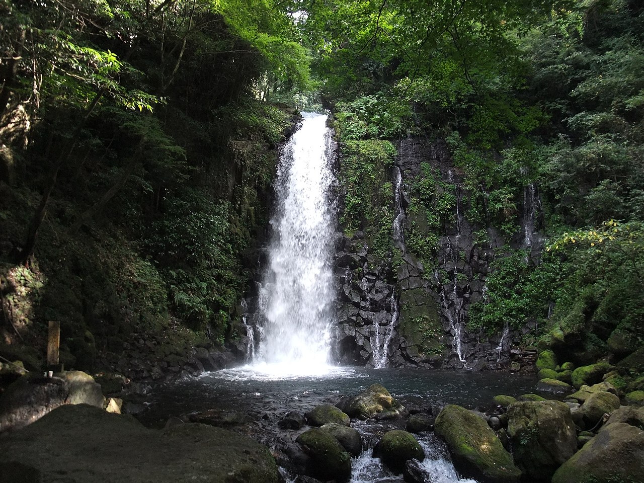
01 / Shiraito Falls

A beautiful woman met in a thunderstormis said to lie behind its other name.
西原白糸の滝 - panoramio.jpg
Photo by sk01 (CC BY-SA 3.0)

Upstream on the Taki River (滝川) near Kawahara Elementary School, the water drops about 20m and looks like a white thread, the prefecture writes. The falls' other name (寄姫の滝) is said to come from the legend of a beautiful woman (寄姫) who appeared before a man sheltering from the rain. It is on Kumamoto's Heisei 100 Famous Waters list.

  • About 20m high (Kumamoto Prefecture)
  • Other name (寄姫の滝)
  • Kumamoto Heisei 100 Famous Waters

02 / Kumamoto Nishihara-go Dictionary

People who left the villagecompiled its words into a dictionary.

The Kanto Nishihara Association (関東にしはら会), made up of people living in Tokyo, compiled a dictionary under the name 'Nishihara-go' (西原語), holding that local languages deserve the leading role too. The village says the second edition was released in March 2025 (Reiwa 7). It draws about 1,300 words from a Higo-dialect dictionary and adds roughly 100 that appear to be unique to Nishihara.

  • Compiled by the Kanto Nishihara Association
  • Second edition released March 2025
  • About 1,300 words drawn, about 100 added (2nd ed.)

03 / Western Outer Rim Grasslands

Outside the outer rim's ridgeline,forestry and farming used the grassland.

View from Mount Tawarayama.jpg
Photo by そらみみ (CC BY-SA 4.0)

The Agency for Cultural Affairs designates the area outside the outer rim's ridgeline (west side), including the Tawarayama (俵山) district, as the Important Cultural Landscape 'Grassland Landscape of the Western Aso Outer Rim.' It notes that being next to Kumamoto's urban area has left traces of land clearing and commercial crop production.

  • Important Cultural Landscape (Agency for Cultural Affairs)
  • Mt. Tawarayama: 1,095m (village)
  • Adjacent to Kumamoto's urban area

Living here

20km east of Kumamoto City, 80% grassland and forest.

  • about 6,000 people
  • Rural district town

The village describes itself as 20km east of Kumamoto City, with a total area of 77.22 km². Its east is mostly vast fields and forest around 1,095m Mt. Tawarayama, making up 80% of the area. There is no railway in the village; the nearest station is Higo-Ozu Station on the Hohi Line.

People living here
6,426people
19952020

−5.5% since 2015

5,144 → 6,426

Area
77.22km²

31.31km² of it habitable

2024

Households
2,362households

2.7 people per household

2020

Rent (average for rentals)
—
Healthcare
0 hospitals / 4 clinics

6.2 per 10,000 people

2023

Area77.22km²Habitable land31.31km² / 41%
Area and habitable land at the same scalee-Stat B1101 / B1103
Children waiting for childcare
—2 nurseries and similar
Home purchase subsidy
—
Average annual temperature
—

These 3 items are waiting on a nationwide data source. We do not fill them with estimates.

Shape

Borders 5 municipalities.

Nishihara Village in Japan32.835°N 130.903°E
TokyoOsakaNishihara Village
Territory of Nishihara Village
Boundaries: National Land Numerical Information (N03)

North to south

9.8km

大津町, 南阿蘇村, 御船町, 益城町, 山都町

Travel times per leg are not published by the municipality, so they are not shown.

Nishihara Village isthis kind of town.

  1. 01Nishihara Village was founded on September 1, 1960 (Showa 35) when Yamanishi and Kawahara villages merged, in Aso District (阿蘇郡). The village says the new name took one character from each old name, and that the district became Aso by the governor's ruling.
  2. 02Shiraito Falls (白糸の滝) in Kawahara drops about 20m and looks like a white thread, the prefecture writes; it also has another name (寄姫の滝). The Kanto Nishihara Association, made up of people who left the village, compiles the 'Kumamoto Nishihara-go Dictionary,' whose second edition was released in March 2025.
  3. 03Mt. Tawarayama, 1,095m, is the village's symbol per the village, and the outer rim's west side is an Important Cultural Landscape area. The springs at Hakamano Shrine in Komori and Shioisha across the road are also on Kumamoto's Heisei 100 Famous Waters list.

If something caught your eye, ask the town itself.