Misaka Pass Site, ritual ground, Achi Village
Article

20407 / あちむら

Nagano Prefecture 下伊那郡

Achi Village

Stone sword, mirror copies from a pass.

Misaka Pass Site, ritual ground

Photo by takami torao (Public domain)

01 / Hahakigi of Sonohara

A poem on Sonohara's hahakigistands carved in stone.

Hahakigi of Sonohara in Achi Village
Photo by 濃間 (CC BY-SA 4.0)

The hahakigi is a giant cypress that has stood in Sonohara since long ago. Hahakigi-kan records that its base still remains and a new trunk grown from it has risen tall. A monument is inscribed with a poem under the name of Sakanoue no Korenori: "Sonohara ya fuseya ni ouru hahakigi no ari to wa miete awanu kimi kana."

  • The hahakigi is a giant cypress long standing in Sonohara (Hahakigi-kan)
  • A new trunk has grown from the base (Hahakigi-kan)
  • The poem is inscribed under the name of Sakanoue no Korenori (photo caption of the monument)
02 / Oguro River Mizunara Oak

Said to be over 300 years old,the "Great Maki of Oguro River."

This mizunara oak stands in the mountains at 1,035 m, 20 m tall with a trunk girth of about 7.25 m. A dozen or more thick branches spread in all directions, reaching a diameter of 36 m. Cultural Heritage Online records that a 1988 nationwide survey showed it to be the foremost giant mizunara in Japan, and that it was designated a national Natural Monument.

  • National Natural Monument, designated September 4, 1996
  • 20 m tall, trunk girth about 7.25 m, branch spread 36 m
  • Already a Nagano Prefecture Natural Monument since May 16, 1968

03 / Kumagai Motoichi's Record

Village children and daily life,photographed for about 70 years from 1934.

Kumagai Motoichi, an amateur photographer from a village that is now part of Achi, photographed children and daily life for about 70 years from 1934. The village holds about 50,000 frames of this film. In 1996 (Heisei 8), the village assembly declared a "Village of Rural Record Photography" to carry the record on.

  • Photographed for about 70 years from 1934 (village website)
  • The village holds about 50,000 frames of film (village website)
  • On June 21, 1996, the village assembly adopted the "Village of Rural Record Photography" declaration

Achi Village from the sky

Now and 1974–78. Tap a photo to zoom in.

Wide (about 6 km across)

Close (about 1.5 km across)

Now (shot May 2022)Shot 1974–78

Source: Geospatial Information Authority of Japan (GSI) GSI Tiles(全国最新写真(シームレス)/国土画像情報(第一期:1974〜1978年撮影))

Open in GSI Maps (now)Open in GSI Maps (1974–78)

Living here

From 410 m up to the summit of Mt. Ena, 56 settlements dot the village.

  • about 6,000 people
  • 2 hours to a city centre
  • Rural district town

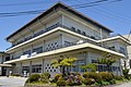
According to the village profile, the area is 214.43 km², with elevations from 410 m to 2,191 m at the summit of Mt. Ena, and 56 settlements dotted through the mountains. The Achi and Wachino rivers flow into the Tenryu River. The village merged with Namiai Village in 2006 and Seinaiji Village in 2009 to become today's Achi. The village office is in Komaba, and the gateway is Achi Village Office.

People living here
6,068people
2010

−7.2% since 2015

7,036 → 6,068

Area
214.43km²

21.49km² of it habitable

2024

Households
2,152households

2.8 people per household

2020

Rent (average for rentals)
—
Healthcare
0 hospitals / 7 clinics

11.5 per 10,000 people

2023

Area214.43km²Habitable land21.49km² / 10%
Area and habitable land at the same scalee-Stat B1101 / B1103

Population from 2010 onward (municipal boundary changed).2006-01-01 に編入合併(浪合村)。2010年調査から市域が変わっている。2009-03-31 に編入合併(清内路村)。2010年調査から市域が変わっている。

Children waiting for childcare
—3 nurseries and similar
Home purchase subsidy
—
Average annual temperature
—

These 3 items are waiting on a nationwide data source. We do not fill them with estimates.

ACCESS

Where you can go from here.

Achi Village in Japan35.444°N 137.748°E
OsakaAchi Village
Achi Village Office
阿智村役場2018
  • to IidaLocal bus26min
  • to NagoyaHighway bus104min

Travel times follow ①信南交通 広域バス駒場線(切石経由)の時刻表(【2025年4月1日改定】)。平日・土曜・日曜祝日の3つの表すべてで、飯田駅前発→こまんば着は26分の便がある(平日 9:40→10:06・11:25→11:51・13:00→13:26 ほか、土曜 9:00→9:26・11:00→11:26 ほか、日曜祝日 9:00→9:26・11:00→11:26 ほか。朝の7:15〜8:15発と7:45発は32分)。②名鉄バス『名古屋⇔飯田』の時刻表:名鉄バスセンター 9:00 発(信南交通〈SN〉の便)→阿智 10:44 着=104分(ほかに 13:00 発→14:53 着=113分、14:00 発→15:51 着=111分) (checked 2026-10-21). They vary by time of day.

Shape

Borders 6 municipalities across 1 prefectures.

Territory of Achi Village
Boundaries: National Land Numerical Information (Administrative Area Data), MLIT. Processed by Machigatari.Lakes: National Land Numerical Information (Lake Data), MLIT. Processed by Machigatari. Prepared with the approval of the Director-General of the Geospatial Information Authority of Japan, using its Digital Map 25000 (Spatial Data Framework) and Digital Map 25000 (Place Names and Public Facilities). (承認番号 平27情使、第585号)

North to south

23.7km

Gifu Prefecture
Nakatsugawa City

Achi Village isthis kind of town.

  1. 01Misaka Pass Site, in Achi Village, is a national historic site designated on September 4, 1981. Located on Misaka Pass (1,595 m), it yielded more than 1,300 ritual relics, mainly stone imitation objects, and Cultural Heritage Online records it as a place of pass-deity rites from the mid-Kofun period onward
  2. 02The hahakigi of Sonohara is a giant cypress long standing there, with a new trunk grown from its base. A monument inscribed under the name of Sakanoue no Korenori stands in Sonohara
  3. 03The Oguro River Mizunara Oak was designated a national Natural Monument on September 4, 1996. The village holds about 50,000 frames of film of village life that Kumagai Motoichi photographed for about 70 years from 1934

If something caught your eye, ask the town itself.

From this town's themes