Nagano Prefecture has 77 municipalities (19 cities, 23 towns, 35 villages). All of them have town stories to read.
Boundaries: National Land Numerical Information (Administrative Area Data), MLIT. Processed by Machigatari.Lakes: National Land Numerical Information (Lake Data), MLIT. Processed by Machigatari. Prepared with the approval of the Director-General of the Geospatial Information Authority of Japan, using its Digital Map 25000 (Spatial Data Framework) and Digital Map 25000 (Place Names and Public Facilities). (承認番号 平27情使、第585号)
Point at an interest to light up its towns on the map.
Point at a town to see it here. Click to open its page.
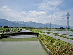
National TreasureA castleMountainsA river runs throughりんどう橋
Click to open Ueda City.
20204 / Nanshin
Okaya City
おかやし
Western-style house joins a storehouse.
Former Hayashi Family Residence
Population
47,790
5-year change
−4.7%
to Shinjuku
138 min
A lakeA river runs throughTown of makers旧林家住宅林国蔵
Click to open Okaya City.
20205 / Nanshin
Iida City
いいだし
A school's ground floor, a kabuki stage.
Former Zakoji Omi School
Population
98,164
5-year change
−3.4%
to Shinjuku
244 min
Nagoya 121 min
MountainsA river runs throughFruit growingTraditional crafts旧座光寺麻績学校校舎
Click to open Iida City.
20206 / Nanshin
Suwa City
すわし
Seven boat-shaped stones line a hill.
Takashima Domain lords' graves
Population
48,729
5-year change
−2.8%
to Shinjuku
127 min
MountainsA lakeHighlandsCastle town高島藩
Click to open Suwa City.
20207 / Hokushin
Suzaka City
すざかし
A caldera stream falls down a cliff.
Yonako Falls: Gongen and Fudo
Population
49,559
5-year change
−2.3%
MountainsA river runs throughOld streetscapeMountain climbing須坂
Click to open Suzaka City.
20208 / Toshin
Komoro City
こもろし
They say rare tiles named it Tile Gate.
Komoro Castle Otemon, Tile Gate
Population
40,991
5-year change
−3.6%
to Shinjuku
190 min
Castle townPost townA castleAn odd landmark小諸城
Click to open Komoro City.
20209 / Nanshin
Ina City
いなし
Pupils found a keyhole-shaped tomb.
Roshoba Kofun, found by pupils
Population
66,125
5-year change
−3.1%
to Shinjuku
190 min
Nagoya 180 min
MountainsCastle townA castle老松場古墳群前方後円墳
Click to open Ina City.
20210 / Nanshin
Komagane City
こまがねし
A tag dating the house is in the roof.
Former Takemura Residence, moved
Population
32,202
5-year change
−1.7%
to Shinjuku
210 min
Nagoya 155 min
MountainsA river runs throughMany shrines and temples旧竹村家住宅旧駒ヶ根市役所庁舎
Click to open Komagane City.
20211 / Hokushin
Nakano City
なかのし
No clear trace of garden water channels.
Takanashi Manor Site, moated
Population
42,338
5-year change
−3.6%
A river runs throughMountainsTraditional craftsFarming townFruit growing
Click to open Nakano City.
20212 / Chushin
Omachi City
おおまちし
Hot-spring deposits grow into a hill.
Funtokyu sinter cone, Yumata
Population
26,029
5-year change
−7.2%
to Shinjuku
194 min
MountainsA river runs throughHot springsNational Treasure噴湯丘
Click to open Omachi City.
20213 / Hokushin
Iiyama City
いいやまし
Mountain water is led past stone walls.
Kawa and Tane, Kosuge's water
Population
19,539
5-year change
−8.9%
to Tokyo
98 min
MountainsA river runs throughIt snowsNatural springsMany shrines and temples
Click to open Iiyama City.
20214 / Nanshin
Chino City
ちのし
A fishless acidic pond becomes a mirror.
Mishakaike, an irrigation pond
Population
56,400
5-year change
+0.9%
to Shinjuku
121 min
National TreasureMountainsHighlands御射鹿池ため池百選
Click to open Chino City.
20215 / Chushin
Shiojiri City
しおじりし
Near ruins, a spring unfrozen in winter.
Hiraide Spring, near the ruins
Population
67,241
5-year change
+0.2%
to Shinjuku
145 min
Nagoya 113 min
Natural springsPost townOld streetscapeTraditional craftsA river runs through
Click to open Shiojiri City.
20217 / Toshin
Saku City
さくし
Western-style castle with star bastions.
Tatsuoka Castle, moat and walls
Population
98,199
5-year change
−1.2%
to Tokyo
69 min
A castleAn odd landmarkPost townMountains龍岡城跡
Click to open Saku City.
20218 / Hokushin
Chikuma City
ちくまし
Round part: oval or rounded-rectangular.
Mori Shogunzuka, restored mound
Population
58,852
5-year change
−2.4%
Old streetscapeFamous festivalMountainsA river runs through森将軍塚古墳
Click to open Chikuma City.
20219 / Toshin
Tomi City
とうみし
Long and short lattice bars alternate.
Unno goshi, Unno-juku
Population
30,122
5-year change
0%
Post townOld streetscapeMountainsA river runs through海野宿
Click to open Tomi City.
20220 / Chushin
Azumino City
あづみのし
A channel that drops over 30 cm per km.
Jikkasegi irrigation channel
Population
94,222
5-year change
−1.1%
to Shinjuku
174 min
MountainsA river runs throughFarming townRice country拾ケ堰
Click to open Azumino City.
20303 / Toshin
Koumi Town
こうみまち
Three lakes form Lake Matsubara.
Lake Matsubara, three lakes
Population
4,353
5-year change
−7.6%
A lakeHighlandsMountainsA river runs through松原湖
Click to open Koumi Town.
20304 / Toshin
Kawakami Village
かわかみむら
Jomon ring village on a 1,300 m plateau.
Omiyama Site, National Site
Population
4,344
5-year change
−5.7%
MountainsHighlandsFarming town大深山遺跡仮面装飾香炉形土器
Click to open Kawakami Village.
20305 / Toshin
Minamimaki Village
みなみまきむら
The track climbs to a 1,375 m crossing.
JR Highest Point Monument
Population
3,242
5-year change
−4.9%
MountainsA river runs throughHighlandsCool summersFarming town
Click to open Minamimaki Village.
20306 / Toshin
Minamiaiki Village
みなみあいきむら
A lord opened a temple for his father.
Jogen-ji, the Aiki clan's temple
Population
962
5-year change
−4.3%
to Koumi
20 min
MountainsA river runs throughMountain climbingFishing常源寺
Click to open Minamiaiki Village.
20307 / Toshin
Kitaaiki Village
きたあいきむら
Landlocked valley, 130+ seashell items.
Tochibara Rock Shelter Site
Population
752
5-year change
−2.8%
to Koumi
15 min
MountainsA river runs throughFishingMountain climbing栃原岩陰遺跡
Click to open Kitaaiki Village.
20309 / Toshin
Sakuho Town
さくほまち
A knobby giant stands on charcoal hills.
Kobutaro, horse chestnut
Population
10,218
5-year change
−8.7%
MountainsA river runs throughHighlandsCool summersMountain climbing
Click to open Sakuho Town.
20321 / Toshin
Karuizawa Town
かるいざわまち
Right to Sarashina, left to Miyoshino.
Wakasare of Oiwake-juku
Population
19,188
5-year change
+1%
to Tokyo
61 min
Post townHighlandsMountains追分宿分去れ
Click to open Karuizawa Town.
20323 / Toshin
Miyota Town
みよたまち
Princesses stayed at a small post town.
Odai-juku, Princess Post Town
Population
15,555
5-year change
+2.4%
to Shinjuku
207 min
Post townOld streetscapeMountainsHighlands小田井宿
Click to open Miyota Town.
20324 / Toshin
Tateshina Town
たてしなまち
Seedlings said to come from the shogun.
Kasatori Pass pine avenue
Population
6,612
5-year change
−9%
to Oya
27 min
MountainsHighlandsPost town笠取峠マツ並木
Click to open Tateshina Town.
20349 / Toshin
Aoki Village
あおきむら
Only the 1st tier has simpler brackets.
Daihoji Pagoda, bracket sets
Population
4,121
5-year change
−5.1%
to Ueda
31 min
MountainsA river runs throughNational TreasureFarming town大法寺三重塔
Click to open Aoki Village.
20350 / Toshin
Nagawa Town
ながわまち
Winter travelers got gruel and a fire.
Wada Pass relief station
Population
5,600
5-year change
−9.2%
to Ueda
39 min
MountainsA river runs throughPost townTraditional crafts永代人馬施行所
Click to open Nagawa Town.
20361 / Nanshin
Shimosuwa Town
しもすわまち
Struck by a chisel, it bled, they say.
Manji Stone Buddha
Population
19,155
5-year change
−5.3%
to Shinjuku
139 min
Post townA lakeMountains万治の石仏青塚古墳
Click to open Shimosuwa Town.
20362 / Nanshin
Fujimi Town
ふじみまち
Two sites across a stream share a name.
Idojiri Site Group, Middle Jomon
Population
14,084
5-year change
−2.8%
to Shinjuku
121 min
MountainsHighlandsPost town井戸尻遺跡群井戸尻遺跡
Click to open Fujimi Town.
20363 / Nanshin
Hara Village
はらむら
An Early Jomon plaza lies in the woods.
Aku Site, stone belt and pillar
Population
7,680
5-year change
+1.5%
MountainsHighlandsFarming townCool summers阿久遺跡
Click to open Hara Village.
20382 / Nanshin
Tatsuno Town
たつのまち
A serpent-like rock lies in the stream.
Yokokawa no Jaishi (Snake Rock)
Population
18,555
5-year change
−6.1%
MountainsA river runs throughPost townOld streetscapeCamping
Click to open Tatsuno Town.
20383 / Nanshin
Minowa Town
みのわまち
Iida Line electric loco sits out front.
ED19-1, local history museum
Population
24,989
5-year change
−1%
to Nagoya
203 min
MountainsA river runs throughA castleED19-1電気機関車
Click to open Minowa Town.
20384 / Nanshin
Iijima Town
いいじままち
Magistrate's office became prefectural.
Ina Prefectural Office Site
Population
9,004
5-year change
−5.5%
MountainsA river runs throughMountain climbingTraditional crafts伊那県庁
Click to open Iijima Town.
20385 / Nanshin
Minamiminowa Village
みなみみのわむら
Field area sets the number of outlets.
Cylindrical dividers, Nishitenryu
Population
15,797
5-year change
+4.9%
to Shinjuku
182 min
Nagoya 188 min
MountainsA river runs throughMountain climbing円筒分水工西天竜幹線水路
Click to open Minamiminowa Village.
20386 / Nanshin
Nakagawa Village
なかがわむら
A parabolic arch spans the Tenryu River.
Sakado Bridge, 70 m span
Population
4,651
5-year change
−4.1%
MountainsA river runs throughFruit growing坂戸橋天竜川
Click to open Nakagawa Village.
20388 / Nanshin
Miyada Village
みやだむら
Once buried for the domain it named.
Takato domain border stele
Population
8,569
5-year change
−2.9%
to Shinjuku
204 min
Nagoya 164 min
Post townMountainsA river runs through従是北高遠領分杭
Click to open Miyada Village.
20402 / Nanshin
Matsukawa Town
まつかわまち
A town named for a river from the Alps.
Katagiri-Matsukawa River
Population
12,530
5-year change
−4.8%
MountainsA river runs throughFarming townFruit growingA castle
Click to open Matsukawa Town.
20403 / Nanshin
Takamori Town
たかもりまち
Moats protected an earthen castle.
Matsuoka Castle Site, Ninohori
Population
12,811
5-year change
−2.1%
MountainsA river runs throughFruit growing松岡城跡下市田学校校舎
Click to open Takamori Town.
20404 / Nanshin
Anan Town
あなんちょう
A town-designated cedar flanks the hall.
Waseda Shrine's great cedar
Population
4,299
5-year change
−13.4%
MountainsA river runs throughFamous festival新野の雪祭り伊豆神社
Click to open Anan Town.
20407 / Nanshin
Achi Village
あちむら
Stone sword, mirror copies from a pass.
Misaka Pass Site, ritual ground
Population
6,068
5-year change
−7.2%
to Iida
26 min
Nagoya 104 min
MountainsA river runs throughMountain climbing神坂峠遺跡神坂峠
Click to open Achi Village.
20409 / Nanshin
Hiraya Village
ひらやむら
Stabled horse inns flourished here.
Hiraya-juku, a Chuma post town
Population
387
5-year change
−20%
Post townOld streetscapeMountainsHighlands平谷宿
Click to open Hiraya Village.
20410 / Nanshin
Neba Village
ねばむら
Two cedars appear as one at the base.
Tsukize no Osugi
Population
852
5-year change
−12.2%
MountainsA river runs throughLocal cuisine月瀬の大スギ天然記念物
Click to open Neba Village.
20411 / Nanshin
Shimojo Village
しもじょうむら
A cedar 11.5 m round stands by shrines.
Oyamada Shrine, cedar, 2 halls
Population
3,545
5-year change
−7.9%
MountainsA river runs throughMany shrines and temples大山田神社相殿
Click to open Shimojo Village.
20412 / Nanshin
Urugi Village
うるぎむら
About 4 km of path in woods at 1,200 m.
Kotori no Mori, Atebidaira
Population
548
5-year change
−4.7%
MountainsHot springsCampingあてび平小鳥の森
Click to open Urugi Village.
20413 / Nanshin
Tenryu Village
てんりゅうむら
A set-square slope averaging about 27°.
Nakaisamurai tea fields
Population
1,178
5-year change
−13.7%
MountainsA river runs throughFamous festival天竜村の霜月神楽霜月神楽
Click to open Tenryu Village.
20414 / Nanshin
Yasuoka Village
やすおかむら
Wall behind the platform, river below.
Tamoto Station, Cliff Station
Population
1,542
5-year change
−9.4%
MountainsA river runs throughLocal cuisineAn odd landmark田本駅
Click to open Yasuoka Village.
20415 / Nanshin
Takagi Village
たかぎむら
A hatamoto built a two-storey teahouse.
Shogetsuan, Chikyu teahouse
Population
5,973
5-year change
−5.3%
MountainsFruit growingTraditional crafts曙月庵茶室
Click to open Takagi Village.
20416 / Nanshin
Toyooka Village
とよおかむら
Up the steps, a 12.8 m two-story gate.
Senryuin Sanmon, two-story gate
Population
6,426
5-year change
−2.5%
MountainsA river runs throughFruit growingFarming town泉龍院山門
Click to open Toyooka Village.
20417 / Nanshin
Oshika Village
おおしかむら
Tan and green rock meet directly.
Anko outcrop, Tectonic Line
Population
1,023
5-year change
0%
to Ina-Oshima
29 min
MountainsA river runs throughFamous festivalMountain climbingAn odd landmark
Click to open Oshika Village.
20422 / Chushin
Agematsu Town
あげまつまち
Granite splits like boxes set in a row.
Nezame no Toko
Population
4,131
5-year change
−11.5%
to Nagoya
82 min
MountainsA river runs throughPost townFamous festival寝覚の床
Click to open Agematsu Town.
20423 / Chushin
Nagiso Town
なぎそまち
A wooden suspension bridge, 247.8 m.
Momosuke Bridge, wooden span
Population
3,915
5-year change
−9.2%
to Nagoya
59 min
MountainsA river runs throughPost townOld streetscape桃介橋
Click to open Nagiso Town.
20425 / Chushin
Kiso Village
きそむら
Where the Hida road left the Nakasendo.
Yabuhara-juku, Hida road fork
Population
2,692
5-year change
−8%
MountainsA river runs throughPost townTraditional crafts薮原宿
Click to open Kiso Village.
20429 / Chushin
Otaki Village
おうたきむら
Timber locomotives line up by a shed.
Otaki Forest Railway cars
Population
715
5-year change
−14.8%
to Kiso-Fukushima
38 min
MountainsA river runs throughCool summersLocal cuisine王滝森林鉄道
Click to open Otaki Village.
20430 / Chushin
Okuwa Village
おおくわむら
Three kinds of rock under green water.
Atera Gorge, three rock types
Population
3,439
5-year change
−10.1%
MountainsA river runs throughPost townOld streetscape阿寺渓谷
Click to open Okuwa Village.
20432 / Chushin
Kiso Town
きそまち
Garden clouds are drawn in white cement.
Kan-un-tei, Kozenji garden
Population
10,584
5-year change
−10.5%
to Nagoya
84 min
MountainsA river runs throughHighlandsPost town看雲庭
Click to open Kiso Town.
20446 / Chushin
Omi Village
おみむら
Two taifu-za flank the six-bay stage.
Shinmei-gu stage, 1783 tablet
Population
2,593
5-year change
−7%
MountainsA river runs throughPost town麻績神明宮農村舞台
Click to open Omi Village.
20448 / Chushin
Ikusaka Village
いくさかむら
A gorge said to be named for a temple.
Sanseiji, a Sai River gorge
Population
1,639
5-year change
−11.1%
MountainsA river runs throughMountain climbing山清路犀川
Click to open Ikusaka Village.
20450 / Chushin
Yamagata Village
やまがたむら
Stone Nio stand at a highland gate.
Kiyomizu-dera Nio, in stone
Population
8,400
5-year change
+0.1%
to Matsumoto
28 min
MountainsHighlandsFarming town清水寺仁王尊
Click to open Yamagata Village.
20451 / Chushin
Asahi Village
あさひむら
Six columns make the front five bays.
Korinji Yakushido, five-bay hall
Population
4,279
5-year change
−4.1%
MountainsA river runs throughA castle光輪寺薬師堂五間堂
Click to open Asahi Village.
20452 / Chushin
Chikuhoku Village
ちくほくむら
A road cut through rock runs on to Omi.
The Great Cutting, Aoyagi
Population
4,149
5-year change
−12.3%
MountainsA river runs throughPost townOld streetscape大切通し
Click to open Chikuhoku Village.
20481 / Chushin
Ikeda Town
いけだまち
A chamber with a stacked-stone boundary.
Oninokama Kofun
Population
9,382
5-year change
−5.5%
MountainsA river runs throughPlainsRice countryFamous festival
Click to open Ikeda Town.
20482 / Chushin
Matsukawa Village
まつかわむら
Halls set apart to view plays outdoors.
Kaguraden, an open-sided stage
Population
9,599
5-year change
−3.5%
to Shinjuku
248 min
MountainsA river runs throughFarming townRice countryMany shrines and temples
Click to open Matsukawa Village.
20485 / Chushin
Hakuba Village
はくばむら
A hundred Kannon stand on three sides.
Kannonbara, 100 Kannon statues
Population
8,575
5-year change
−4%
to Shinjuku
220 min
MountainsA river runs throughNatural springsOld streetscape観音原
Click to open Hakuba Village.
20486 / Chushin
Otari Village
おたりむら
An inn for cattle drivers and porters.
Ushikata-yado, Chikuni House
Population
2,647
5-year change
−8.8%
MountainsA river runs throughIt snowsSki slopesHot springs
Click to open Otari Village.
20521 / Hokushin
Sakaki Town
さかきまち
A daimyo's inn has a row-house gate.
Sakaki-juku Honjin front gate
Population
14,004
5-year change
−5.8%
A river runs throughMountainsPost town旧坂木宿本陣表門坂木宿
Click to open Sakaki Town.
20541 / Hokushin
Obuse Town
おぶせまち
Ceiling: dragon on red, phoenix in blue.
Festival float ceiling paintings
Population
10,660
5-year change
−0.4%
A river runs throughMountainsFruit growingFarming townOld streetscape
Click to open Obuse Town.
20543 / Hokushin
Takayama Village
たかやまむら
A paddy cherry, estimated at 500+ years
Kurobe Edohigan cherry
Population
6,617
5-year change
−5.9%
to Suzaka
17 min
MountainsA river runs throughFruit growingFarming townHot springs
Click to open Takayama Village.
20561 / Hokushin
Yamanouchi Town
やまのうちまち
Sphagnum piled up on a lake bed.
Tanohara Marsh, old Lake Shiga
Population
11,352
5-year change
−8.7%
MountainsHighlandsHot springs田ノ原湿原旧志賀湖
Click to open Yamanouchi Town.
20562 / Hokushin
Kijimadaira Village
きじまだいらむら
A cliff shows a waterfall on May 8 only.
Taru Falls, May 8 water release
Population
4,375
5-year change
−6.1%
to Iiyama
13 min
MountainsA river runs throughIt snowsHighlandsFarming town
Click to open Kijimadaira Village.
20563 / Hokushin
Nozawaonsen Village
のざわおんせんむら
The village kitchen is in the hot pools.
Ogama, the shared kitchen
Population
3,279
5-year change
−5.7%
to Iiyama
25 min
MountainsIt snowsHot springsSki slopesFamous festival
Click to open Nozawaonsen Village.
20583 / Hokushin
Shinano Town
しなのまち
His final home: a storehouse 6.2 m wide.
Kobayashi Issa's storehouse
Population
7,739
5-year change
−8.6%
MountainsA lakeHighlandsTraditional crafts小林一茶旧宅
Click to open Shinano Town.
20588 / Hokushin
Ogawa Village
おがわむら
A village bid for the governor's house.
Former Governor's Residence
Population
2,215
5-year change
−16.9%
to Nagano
32 min
MountainsHighlandsMany shrines and temples旧長野県知事公舎高山寺
Click to open Ogawa Village.
20590 / Hokushin
Iizuna Town
いいづなまち
Edo-Kanazawa midpoint, said set by Kaga.
Bushu-Kashu Dochu Sakai Stele
Population
10,296
5-year change
−6.9%
MountainsIt snowsFarming townFruit growingPost town
Click to open Iizuna Town.
20602 / Hokushin
Sakae Village
さかえむら
A station post as tall as the snow was.
Morimiyanohara, snow marker
Population
1,660
5-year change
−15%
MountainsA river runs throughIt snowsMountain climbingHot springs
Click to open Sakae Village.
Lakes: National Land Numerical Information (Lake Data), MLIT. Processed by Machigatari. Prepared with the approval of the Director-General of the Geospatial Information Authority of Japan, using its Digital Map 25000 (Spatial Data Framework) and Digital Map 25000 (Place Names and Public Facilities). (承認番号 平27情使、第585号)
All municipalities
Name, pronunciation and type. A readable town links to its page.