Tochigi Prefecture has 25 municipalities (14 cities, 11 towns). All of them have town stories to read.
Boundaries: National Land Numerical Information (N03)Lakes: National Land Numerical Information (Lake Data), MLIT. Processed by Machigatari. Prepared with the approval of the Director-General of the Geospatial Information Authority of Japan, using its Digital Map 25000 (Spatial Data Framework) and Digital Map 25000 (Place Names and Public Facilities). (承認番号 平27情使、第585号)
Point at an interest to light up its towns on the map.
Point at a town to see it here. Click to open its page.
09201 / Utsunomiya
Utsunomiya City
うつのみやし
A hill of cave tombs, open to the south.
Nagaoka Hyakuana Kofun
Population
518,757
5-year change
0%
to Tokyo
50 min
Ōmiya 25 min, Shinjuku 98 min
Castle townTemple gate townStrong commerceTown of makers長岡百穴古墳
Click to open Utsunomiya City.
09202 / Ryomo
Ashikaga City
あしかがし
Boulders with a gap adults can pass
Osonae-ishi, Nagusa boulders
Population
144,746
5-year change
−3.1%
to Asakusa
74 min
Kita-Senju 62 min
National TreasureTown of makersMountains名草巨石群御供石
Click to open Ashikaga City.
09203 / Kennan
Tochigi City
とちぎし
Each island in the pond has a shrine.
Muro no Yashima, Omiwa Shrine
Population
155,549
5-year change
−2.3%
to Asakusa
67 min
Shinjuku 73 min, Kita-Senju 55 min
Old streetscapePost townA river runs throughAn art museum室の八嶋
Click to open Tochigi City.
09204 / Ryomo
Sano City
さのし
Spring water fills a pond 138 m around.
Izuruhara Benten Pond
Population
116,228
5-year change
−2.3%
to Tokyo
95 min
Shinjuku 100 min
Natural springsTraditional craftsTown of makers出流原弁天池龍江院
Click to open Sano City.
09205 / Kensei
Kanuma City
かぬまし
A school of chosen wood, little warped.
Former Awano Junior High School
Population
94,033
5-year change
−4.4%
to Asakusa
82 min
Kita-Senju 70 min, Shinjuku 89 min, Ōmiya 58 min
MountainsA river runs throughMountain climbingFamous festivalPost town
Click to open Kanuma City.
09206 / Kensei
Nikko City
にっこうし
Stone Buddhas remain 500 m by a gorge.
Kanmangafuchi, Bake-jizo
Population
77,661
5-year change
−6.9%
to Asakusa
99 min
Shinjuku 106 min, Kita-Senju 87 min
MountainsA river runs throughHot springsWorld Heritage site憾満ヶ淵
Click to open Nikko City.
09208 / Kennan
Oyama City
おやまし
Two keyhole tombs, close and aligned.
Biwazuka and Marishitenzuka
Population
166,666
5-year change
−0.1%
to Tokyo
41 min
Ōmiya 16 min, Shinjuku 72 min
Famous festivalPlainsA river runs through琵琶塚古墳摩利支天塚古墳
Click to open Oyama City.
09209 / Kento
Moka City
もおかし
A school hall by a Wright disciple.
Kubo Auditorium, by Endo Arata
Population
78,190
5-year change
−1.7%
A river runs throughTown of makersFarming town久保講堂遠藤新
Click to open Moka City.
09210 / Kenpoku
Otawara City
おおたわらし
A 2.14 m tengu mask sits in a hall.
Great tengu mask, Horin-ji
Population
72,087
5-year change
−4.5%
National TreasureAn odd landmarkA river runs through那須国造碑笠石神社
Click to open Otawara City.
09211 / Kenpoku
Yaita City
やいたし
House re-dated by its repair report.
Arai Family Residence
Population
31,165
5-year change
−6.6%
MountainsHighlandsFruit growing荒井家住宅荒井家の大カヤ
Click to open Yaita City.
09213 / Kenpoku
Nasushiobara City
なすしおばらし
The president himself designed the bank.
Takagi Kaikan, old Kuroiso Bank
Population
115,210
5-year change
−1.7%
to Tokyo
68 min
Hot springsMountainsFarming townA river runs through高木会館
Click to open Nasushiobara City.
09214 / Kenpoku
Sakura City
さくらし
A big statue, cast in parts and joined.
Bronze Fudō Myōō, Kōmyō-ji
Population
44,513
5-year change
−0.9%
Castle townPost townOld streetscapeA river runs through光明寺
Click to open Sakura City.
09215 / Kenpoku
Nasukarasuyama City
なすからすやまし
Washi mountains, raised by human power.
Yamaage, Karasuyama
Population
24,875
5-year change
−8%
Famous festivalA river runs throughTraditional crafts烏山の山あげ行事山あげ祭
Click to open Nasukarasuyama City.
09216 / Kennan
Shimotsuke City
しもつけし
A plant 'extinct' in Tochigi was found.
Tōsawa-toranoo, Higashine
Population
59,507
5-year change
+0.1%
to Tokyo
92 min
Shinjuku 83 min, Ōmiya 50 min, Ueno 86 min
Post townFarming townCommuter townトウサワトラノオ東根
Click to open Shimotsuke City.
09301 / Kennan
Kaminokawa Town
かみのかわまち
Its stone is now banned from quarrying.
Shirasagi Shrine, Nikko stone
Population
30,806
5-year change
−0.8%
to Utsunomiya
28 min
PlainsA river runs throughFarming town白鷺神社日光石
Click to open Kaminokawa Town.
09342 / Kento
Mashiko Town
ましこまち
The line ended; retainers kept watch.
Utsunomiya clan graves, Kami-Ōba
Population
21,898
5-year change
−5.9%
to Akihabara
150 min
Many shrines and templesTraditional craftsMountainsVacant house bank宇都宮家の墓所
Click to open Mashiko Town.
09343 / Kento
Motegi Town
もてぎまち
A tunnel no train ever ran through.
Nagakura Line tunnel
Population
11,891
5-year change
−9.8%
to Akihabara
135 min
MountainsA river runs throughAn odd landmark長倉線大峯山トンネル
Click to open Motegi Town.
09344 / Kento
Ichikai Town
いちかいまち
Warriors painted on a station's walls.
Musha-e, Ichihana Station
Population
11,262
5-year change
−3.9%
Traditional craftsHot springsMountains武者絵武者絵のぼり
Click to open Ichikai Town.
09345 / Kento
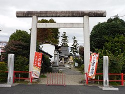
Haga Town
はがまち
Past the torii, a main hall from 1770.
Ubagai Shrine
Population
14,961
5-year change
−1.5%
to Utsunomiya
39 min
Farming townFruit growingTown of makersA river runs through祖母井神社
Click to open Haga Town.
09361 / Kennan
Mibu Town
みぶまち
A tomb doorstone sits in a castle park.
Azuma Kofun, doorstone
Population
39,474
5-year change
−1.2%
Castle townPost townA river runs throughPlains吾妻古墳
Click to open Mibu Town.
09364 / Kennan
Nogi Town
のぎまち
Fire moves through 16 sections in turn.
Nogi Brick Kiln
Population
24,913
5-year change
−1.5%
to Tokyo
71 min
Ōmiya 39 min, Shinjuku 71 min, Ueno 65 min
PlainsCommuter townFarming townA river runs through野木町煉瓦窯
Click to open Nogi Town.
09384 / Kenpoku
Shioya Town
しおやまち
Water wells up in over ten places.
Shojinzawa Spring
Population
10,354
5-year change
−9.9%
Natural springsMountainsA river runs through尚仁沢湧水名水百選
Hot springsMountainsHighlandsPost townMountain climbing
Click to open Nasu Town.
09411 / Kenpoku
Nakagawa Town
なかがわまち
The 'temple ruin' was a district office.
Nasu Kanga Site
Population
15,215
5-year change
−10.3%
to Ujiie
47 min
MountainsA river runs throughHot springs那須官衙遺跡梅曽廃寺跡
Click to open Nakagawa Town.
Lakes: National Land Numerical Information (Lake Data), MLIT. Processed by Machigatari. Prepared with the approval of the Director-General of the Geospatial Information Authority of Japan, using its Digital Map 25000 (Spatial Data Framework) and Digital Map 25000 (Place Names and Public Facilities). (承認番号 平27情使、第585号)
All municipalities
Name, pronunciation and type. A readable town links to its page.