Miyagi Prefecture has 35 municipalities (14 cities, 20 towns, 1 village). All of them have town stories to read.
Boundaries: National Land Numerical Information (Administrative Area Data), MLIT. Processed by Machigatari.Lakes: National Land Numerical Information (Lake Data), MLIT. Processed by Machigatari. Prepared with the approval of the Director-General of the Geospatial Information Authority of Japan, using its Digital Map 25000 (Spatial Data Framework) and Digital Map 25000 (Place Names and Public Facilities). (承認番号 平27情使、第585号)
Point at an interest to light up its towns on the map.
Point at a town to see it here. Click to open its page.
04100 / Sendai
Sendai City
せんだいし
Named for a legend of hunter brothers.
Banji Rock, Futakuchi Gorge
Population
1,096,704
5-year change
+1.3%
to Tokyo
90 min
MountainsA river runs throughPlains磐司岩二口峡谷
Click to open Sendai City.
04202 / Ishinomaki, Tome and Kesennuma
Ishinomaki City
いしのまきし
Split stone plates nailed on as a roof.
Sekibanbuki, Ogatsu slate
Population
140,151
5-year change
−4.8%
By the seaA river runs throughIslandsPort townTraditional crafts
Click to open Ishinomaki City.
04203 / Sendai
Shiogama City
しおがまし
A shrine on an island sung in waka.
Magakigashima, Magaki Shrine
Population
52,203
5-year change
−3.7%
By the seaIslandsPort townMany shrines and templesFamous festival
Click to open Shiogama City.
04205 / Ishinomaki, Tome and Kesennuma
Kesennuma City
けせんぬまし
Two singing-sand beaches, 2 km apart.
Kugunarihama, Kukunakihama
Population
61,147
5-year change
−5.9%
By the seaIslandsPort town十八鳴浜九九鳴き浜
Click to open Kesennuma City.
04206 / Sennan
Shiroishi City
しろいしし
A rock wall like lumber stood on end.
Obara Zaimokuiwa, lumber rock
Population
32,758
5-year change
−7.1%
to Tokyo
107 min
A castleCastle townA river runs through小原の材木岩虎岩
Click to open Shiroishi City.
04207 / Sendai
Natori City
なとりし
Three main halls; two are Kumano-zukuri.
Kumano Shrine, Kumano-zukuri
Population
78,718
5-year change
+2.7%
PlainsA river runs through熊野神社熊野造熊野新宮社本殿
Click to open Natori City.
04208 / Sennan
Kakuda City
かくだし
A thatched hall said built around 1177.
Kozoji Amida Hall
Population
27,976
5-year change
−7.3%
Many shrines and templesCastle townA river runs through高蔵寺阿弥陀堂旧佐藤家住宅
Click to open Kakuda City.
04209 / Sendai
Tagajo City
たがじょうし
A stele carves 1,500 ri to the capital.
Tagajo Stele
Population
62,827
5-year change
+1.2%
National Treasure多賀城碑多賀城跡特別史跡多賀城南門
Click to open Tagajo City.
04211 / Sendai
Iwanuma City
いわぬまし
A chapel with exposed stone masonry.
Iwanuma Church, stone chapel
Population
44,068
5-year change
−1.4%
to Tokyo
264 min
Ueno 257 min
Temple gate townPost townBy the seaA river runs throughPlains
Click to open Iwanuma City.
04212 / Ishinomaki, Tome and Kesennuma
Tome City
とめし
A school's entrance has an open balcony.
Toyoma Higher Elementary School
Population
76,037
5-year change
−7.2%
A river runs throughA lakePlainsRice countryOld streetscape
Click to open Tome City.
04213 / Osaki and Kurihara
Kurihara City
くりはらし
A gate shut since Emperor Meiji used it.
Arikabe Honjin, the closed gate
Population
64,637
5-year change
−7.5%
to Tokyo
115 min
Post townMountainsA river runs through旧有壁宿本陣御成門
Click to open Kurihara City.
04214 / Ishinomaki, Tome and Kesennuma
Higashimatsushima City
ひがしまつしまし
Pines grip a cliff eroded by waves.
Sagakei, Miyato Island cliffs
Population
39,098
5-year change
−1%
By the seaIslandsMountains嵯峨渓宮戸島
Click to open Higashimatsushima City.
04215 / Osaki and Kurihara
Osaki City
おおさきし
A school garden, islands in its pond.
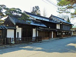
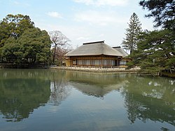
Former Yubikan, Iwadeyama school
Population
127,330
5-year change
−4.5%
to Tokyo
106 min
Hot springsFarming townPlains旧有備館岩出山
Click to open Osaki City.
04216 / Sendai
Tomiya City
とみやし
Where it crumbled, they dug into a hill.
Shitoda Tunnel, water tunnel
Population
51,651
Post townOld streetscapeAn odd landmark志戸田隧道千坂半左衛門
At a kiln the domain later ran, blue landscapes were painted.
Kirigome, Sendai Domain's kiln
Population
21,943
5-year change
−7.6%
to Furukawa
24 min
MountainsIt snowsMountain climbing切込焼薬莱山
Click to open Kami Town.
04501 / Osaki and Kurihara
Wakuya Town
わくやちょう
A shrine stands on a Buddhist hall site.
Koganeyama gold site, shrine
Population
15,388
5-year change
−7.9%
MountainsA river runs throughFarming town黄金山産金遺跡黄金山神社
Click to open Wakuya Town.
04505 / Osaki and Kurihara
Misato Town
みさとまち
Shrine moved as a post station opened.
Yamanokami Shrine, relocation
Population
23,994
5-year change
−3.5%
A river runs throughPlainsFarming townFruit growing山神社
Click to open Misato Town.
04581 / Ishinomaki, Tome and Kesennuma
Onagawa Town
おながわちょう
Islets float east of Oshika Peninsula.
Enoshima Islands
Population
6,430
5-year change
+1.5%
By the seaIslandsMountainsFishingFishing town
Click to open Onagawa Town.
04606 / Ishinomaki, Tome and Kesennuma
Minamisanriku Town
みなみさんりくちょう
An ichthyosaur bears the name Utatsu.
Utatsusaurus, Utatsu Tatesaki
Population
12,225
5-year change
−1.2%
to Sendai
99 min
By the seaIslandsMountainsウタツギョリュウ歌津館崎
Click to open Minamisanriku Town.
Lakes: National Land Numerical Information (Lake Data), MLIT. Processed by Machigatari. Prepared with the approval of the Director-General of the Geospatial Information Authority of Japan, using its Digital Map 25000 (Spatial Data Framework) and Digital Map 25000 (Place Names and Public Facilities). (承認番号 平27情使、第585号)
All municipalities
Name, pronunciation and type. A readable town links to its page.