Yamanokami Shrine, relocation, Misato Town
Article

04505 / みさとまち

Miyagi Prefecture 遠田郡

Misato Town

Shrine moved as a post station opened.

Yamanokami Shrine, relocation

Photo by Bachstelze (CC BY-SA 3.0)

01 / Historic site

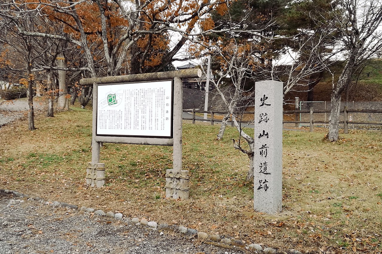
From Jomon shell midden to Kofun-period moat,traces layer up on one terrace.

Historic site in Misato Town
Photo by MChew (CC BY-SA 4.0)

The Early Jomon shell midden is small, made up of marine shells such as oysters and clams. In the early Kofun period a moat 4 to 6 m wide was dug around the terrace edge, and a settlement was built inside it.

  • National Historic Site since 1976
  • Shell layer 15 m across
  • Moat 4 to 6 m wide

02 / Registered variety

The apple-like pear Appiwas registered by Kogota Town.

The variety registration gazette of 24 October 2005 lists the pear Appi, with Kogota Town as the registrant. The town introduces it as a variety of the apple-like pear called ringo-nashi (apple pear).

  • Variety registration No. 13423
  • Gazette of 24 October 2005
  • Registrant: Kogota Town

03 / Old tree

In a park on a small hill,a tsuki tree said to be over 750 years old.

The park stands on a small hill in a district in the middle of the Nango area. A tsuki (zelkova) tree said to be over 750 years old stands there, as if watching over the townspeople.

  • Said to be over 750 years old
  • On a small hill
  • Middle of the Nango area

Misato Town from the sky

Now and 1974–78. Tap a photo to zoom in.

Wide (about 6 km across)

Close (about 1.5 km across)

Now (shot November 2023)Shot 1974–78

Source: Geospatial Information Authority of Japan (GSI) GSI Tiles(全国最新写真(シームレス)/国土画像情報(第一期:1974〜1978年撮影))

Open in GSI Maps (now)Open in GSI Maps (1974–78)

Living here

At Kogota Station, three lines cross.

  • about 20,000 people
  • Rural district town

The town calls itself a transport hub where three railway lines cross. It says Kogota Station is 45 minutes from Sendai Station, and 12 minutes by train from Furukawa Station on the Shinkansen.

People living here
23,994people
2010

−3.5% since 2015

25,190 → 23,994

Area
74.99km²

74.85km² of it habitable

2024

Households
8,565households

2.8 people per household

2020

Rent (average for rentals)
37,158yen

National average 60,630 yen

2023

Healthcare
2 hospitals / 11 clinics

5.4 per 10,000 people

2023

Almost entirely flat.Almost all of it is habitable land (99.8%)
Area and habitable land at the same scalee-Stat B1101 / B1103
Children waiting for childcare
—2 nurseries and similar
Home purchase subsidy
—
Average annual temperature
—

These 3 items are waiting on a nationwide data source. We do not fill them with estimates.

Shape

Surrounded by 5 municipalities, and almost entirely flat.

Misato Town in Japan38.544°N 141.057°E
TokyoOsakaMisato Town
Territory of Misato Town
Boundaries: National Land Numerical Information (Administrative Area Data), MLIT. Processed by Machigatari.Lakes: National Land Numerical Information (Lake Data), MLIT. Processed by Machigatari. Prepared with the approval of the Director-General of the Geospatial Information Authority of Japan, using its Digital Map 25000 (Spatial Data Framework) and Digital Map 25000 (Place Names and Public Facilities). (承認番号 平27情使、第585号)

North to south

17.2km

Travel times per leg are not published by the municipality, so they are not shown.

Misato Town isthis kind of town.

  1. 01The town's Yamanokami Shrine records in its chronology that in 1662, as the Sendai domain opened the Kogota post station, a shrine hall was built and the shrine moved to a site in Minami-Kogota Village; its move to the present grounds was in 1917
  2. 02The Yamamae site is a national historic site, where an Early Jomon shell midden and an early Kofun-period settlement with a moat lie on the same terrace
  3. 03Appi is a pear that Kogota Town registered as a variety in 2005, and a tsuki tree said to be over 750 years old stands in a park on a small hill

If something caught your eye, ask the town itself.