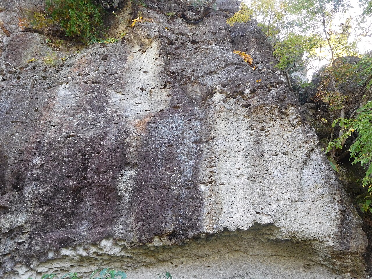
Nagaoka Hyakuana, higashi-gun-2.jpg
Article

09201 / うつのみやし

Tochigi Prefecture

Utsunomiya City

A hill of cave tombs, open to the south.

Nagaoka Hyakuana Kofun

Photo by Saigen Jiro (CC0)

01 / Iron stupa

For a mother's 13th memorial,a stupa cast in iron was dedicated.

Seiganji Tetsutoba (enlarged) 2013-11-22.JPG
Photo by Asanagi (CC0)

In 1312, Utsunomiya Sadatsuna, the eighth lord of Utsunomiya, had this iron stupa cast and dedicated it to pray for his late mother on the 13th anniversary of her death. Its surface is in relief, with Sanskrit characters, an Amida triad and inscriptions. The city's cultural-property database, Utsunomiya Gaku, says no other iron stupa like it is known in Japan.

  • Cast and dedicated, 1312
  • Sanskrit characters and Amida triad in relief
  • Important Cultural Property

02 / Koshiji Rock

Where the Sugatagawa River turns,a rock stands alone.

Oya Rare-shaped Rock, Koshiji Rock.jpg
Photo by Miyuki Meinaka (CC BY-SA 4.0)

Koshiji Rock (in Tashita) is one of the Oya Rock Formations, a nationally designated Place of Scenic Beauty. It is a freestanding rock rising on the right bank where the Sugatagawa River turns sharply from east to south, and its dotting of pine trees has earned it the name "Matsushima on land". In Oya, a monument raised by villagers in 1919 records the stone tramway.

  • National Place of Scenic Beauty, 2006
  • "Matsushima on land"
  • Tramway monument, 1919

03 / Okamoto House

Two thatched roofs side by side,and layered rice and wheat straw under the eaves.

Panorama of Okamoto's House, Utsunomiya.jpg
Photo by Miyuki Meinaka (CC BY-SA 4.0)

The Okamoto House in Shimo-Okamoto-machi is a mid-Edo-period building whose main house faces south. A charm board dated 1714 is nailed to it, so it may be older. Two thatched roofs stand side by side, and under the eaves rice straw and wheat straw of different colours are laid in stepped layers. It is privately owned and an Important Cultural Property.

  • Charm board of 1714
  • Rice and wheat straw in layers
  • Important Cultural Property

Living here

About 50 minutes to Tokyo by Shinkansen.

  • about 520,000 people
  • 60 min to a city centre
  • Shinkansen stops here

Utsunomiya Station is served by the Tohoku Shinkansen and the JR Utsunomiya and Nikko lines. Tokyo Station is about 50 minutes away by Shinkansen and Omiya about 25 minutes. Shinjuku takes about 1 hour 40 minutes on the Shonan-Shinjuku Line. The prefectural capital became a core city in 1996 and absorbed Kamikawachi and Kawachi in 2007.

People living here
518,757people
2010

0% since 2015

511,739 → 518,757

Area
416.85km²

336.5km² of it habitable

2024

Households
230,841households

2.2 people per household

2020

Rent (average for rentals)
52,878yen

National average 60,630 yen

2023

Healthcare
32 hospitals / 438 clinics

9.1 per 10,000 people

2023

Area416.85km²Habitable land336.5km² / 81%
Area and habitable land at the same scalee-Stat B1101 / B1103

Population from 2010 onward (municipal boundary changed).2007-03-31 に編入合併後は(上河内町・河内町)。2010年調査から市域が変わっている。

Children waiting for childcare
—74 nurseries and similar
Home purchase subsidy
—
Average annual temperature
—

These 3 items are waiting on a nationwide data source. We do not fill them with estimates.

ACCESS

Where you can go from here.

Utsunomiya City in Japan36.555°N 139.883°E
OsakaUtsunomiya City
Utsunomiya Station
宇都宮駅2023
  • to TokyoTohoku Shinkansen50min
  • to ŌmiyaTohoku Shinkansen25min
  • to ShinjukuJR Shonan-Shinjuku Line98min

Travel times follow JR東日本の駅時刻表(timetables.jreast.co.jp。宇都宮駅 list0248 の 2610 版)の東北新幹線〈東京方面・上り〉と宇都宮線〈大宮・上野・新宿方面・上り〉の平日・土曜休日の両方を読み、各列車の列車ページ(時刻表の個々の列車)で宇都宮駅の『発』と終点側の駅の『着』を数えた(2026-10-08 閲覧) (checked 2026-10-08). They vary by time of day.

Shape

Borders 10 municipalities.

Territory of Utsunomiya City
Boundaries: National Land Numerical Information (N03)Lakes: National Land Numerical Information (Lake Data), MLIT. Processed by Machigatari. Prepared with the approval of the Director-General of the Geospatial Information Authority of Japan, using its Digital Map 25000 (Spatial Data Framework) and Digital Map 25000 (Place Names and Public Facilities). (承認番号 平27情使、第585号)

North to south

29.5km

日光市, 鹿沼市, 芳賀町, 上三川町, さくら市, 真岡市, 壬生町, 高根沢町, 塩谷町, 下野市

Utsunomiya City isthis kind of town.

  1. 01The prefecturally designated Nagaoka Hyakuana Kofun has 52 cave tombs in a tuff hillside, open to the south and carved with later Kannon figures
  2. 02An iron stupa cast in 1312 by Utsunomiya Sadatsuna for his late mother survives at Seigan-ji as an Important Cultural Property
  3. 03Koshiji Rock, part of the nationally designated Oya Rock Formations, and the thatched Okamoto House with layered straw eaves are here

See the town as it is now.

Source: Wikidata (P2002, P2003, P2013, P2397)

If something caught your eye, ask the town itself.