Cylindrical dividers, Nishitenryu, Minamiminowa Village
Article

20385 / みなみみのわむら

Nagano Prefecture 上伊那郡

Minamiminowa Village

Field area sets the number of outlets.

Cylindrical dividers, Nishitenryu

Photo by Ozawajun (CC BY-SA 4.0)

01 / Mikoshiba Site finds

From a narrow area about 4 m across,large stone axes and points came out together.

This stone tool group from the end of the Paleolithic is centered on finds from the 1959 dig. The Agency for Cultural Affairs writes that the stone axes over 20 cm long became the standard tools called the "Mikoshiba-type stone axe." It is a nationally Important Cultural Property; the village records it as privately owned and kept on display at the Ina City Sosokan.

  • Found together in an area about 4 m across
  • Largest point 25.2 cm
  • Important Cultural Property, 1988

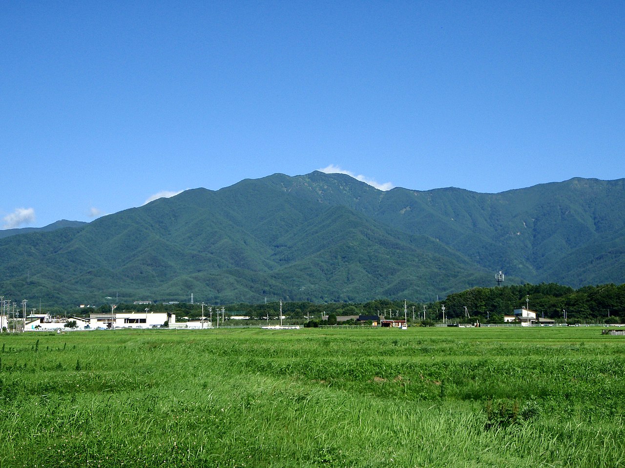
02 / Mount Kyogatake

Middle schoolers race up this exclave mountainto the eighth station.

Mount Kyogatake in Minamiminowa Village
Photo by kinoshima (CC BY 3.0)

Mount Kyogatake is an exclave of Minamiminowa Village. The village records the Kyogatake Kyoho speed hike, in which all students of Minamiminowa Junior High race up to the eighth station, as a traditional event held since 1953. A monument, "Bokyo," stands there from 1992, and the mountain is counted among Japan's 200 Famous Mountains.

  • Race held since 1953
  • Monument at the eighth station
  • One of Japan's 200 Famous Mountains

03 / Human-figure jar

A jar about 4,500 years old,with a human body shown clearly in relief.

Unearthed in a 1995 dig at the Kubo Uenotaira Site, this jar from the middle Jomon period stands 29.9 cm high. A human-body motif covers its front, and the village records that few examples show a body so clearly and in such relief. It became a village-designated cultural property in March 1998.

  • About 4,500 years old, middle Jomon
  • 29.9 cm high
  • Village-designated, March 1998

Minamiminowa Village from the sky

Now and 1974–78. Tap a photo to zoom in.

Wide (about 6 km across)

Close (about 1.5 km across)

Now (shot April 2016)Shot 1974–78

Source: Geospatial Information Authority of Japan (GSI) GSI Tiles(全国最新写真(シームレス)/国土画像情報(第一期:1974〜1978年撮影))

Open in GSI Maps (now)Open in GSI Maps (1974–78)

Living here

182 minutes by highway bus from Shinjuku, 188 from Nagoya.

  • about 20,000 people
  • Rural district town

Two JR Iida Line stations lie in the village, Kitatono and Tabata, and the gateway is Kitatono Station. Highway buses reach the village stop "Ina Interchange-mae" in 182 minutes from Shinjuku and 188 minutes from Nagoya. Reservations are the norm for both.

People living here
15,797people
19952020

+4.9% since 2015

12,133 → 15,797

Area
40.99km²

17.75km² of it habitable

2024

Households
6,445households

2.5 people per household

2020

Rent (average for rentals)
46,106yen

National average 60,630 yen

2023

Healthcare
1 hospital / 8 clinics

5.7 per 10,000 people

2023

Area40.99km²Habitable land17.75km² / 43%
Area and habitable land at the same scalee-Stat B1101 / B1103
Children waiting for childcare
—5 nurseries and similar
Home purchase subsidy
—
Average annual temperature
—

These 3 items are waiting on a nationwide data source. We do not fill them with estimates.

ACCESS

Where you can go from here.

Minamiminowa Village in Japan35.873°N 137.975°E
OsakaMinamiminowa Village
Kitatono Station
北殿駅2023
  • to ShinjukuHighway bus182min
  • to NagoyaHighway bus188min

Travel times follow 京王バス『新宿~伊那飯田線』時刻表(2025.12.24発行。運行会社=京王バス・伊那バス・信南交通ほか。『高速乗合バス(路線バス)』として運行)と、名鉄バス『名古屋⇔駒ヶ根・伊那』時刻(名鉄バス公式。2026-10-21 に読んだ。『一部便を運休』の注記あり) (checked 2026-10-21). They vary by time of day.

Shape

Borders 4 municipalities.

Territory of Minamiminowa Village
Boundaries: National Land Numerical Information (Administrative Area Data), MLIT. Processed by Machigatari.Lakes: National Land Numerical Information (Lake Data), MLIT. Processed by Machigatari. Prepared with the approval of the Director-General of the Geospatial Information Authority of Japan, using its Digital Map 25000 (Spatial Data Framework) and Digital Map 25000 (Place Names and Public Facilities). (承認番号 平27情使、第585号)

Minamiminowa Village isthis kind of town.

  1. 01The cylindrical dividers of the Nishitenryu Main Canal send water to each channel in exact proportion through a number of outlets set by the area of rice paddy, and in 2006 the Japan Society of Civil Engineers chose them as Selected Civil Engineering Heritage
  2. 02The Mikoshiba Site finds are a nationally Important Cultural Property, and on Mount Kyogatake, the village's exclave mountain, middle schoolers have raced to the eighth station since 1953
  3. 03The human-figure jar of about 4,500 years ago from the Kubo Uenotaira Site is a village-designated cultural property, shown at the British Museum's Dogu exhibition in 2009

If something caught your eye, ask the town itself.

From this town's themes