Shinmei-gu stage, 1783 tablet, Omi Village
Article

20446 / おみむら

Nagano Prefecture 東筑摩郡

Omi Village

Two taifu-za flank the six-bay stage.

Shinmei-gu stage, 1783 tablet

Photo by Qurren (CC BY-SA 4.0)

01 / The name Omi

The name Omi seems to come fromthe Omibe tied to Ise Shrine, the village says.

The village's cultural property notes say the name of Omi-go seems to come from the Omibe, who were tied to Ise Shrine. The Wamyo Ruijusho lists Omi-go in Sarashina District, and the Shinposho lists the Omi-no-mikuriya estate. The tourism site says the village name comes from karaso, a kind of hemp, once spun into thread and offered to Ise Shrine.

  • Omi-go in the Wamyo Ruijusho
  • Omi-no-mikuriya in the Shinposho
  • Karaso thread offered to Ise Shrine

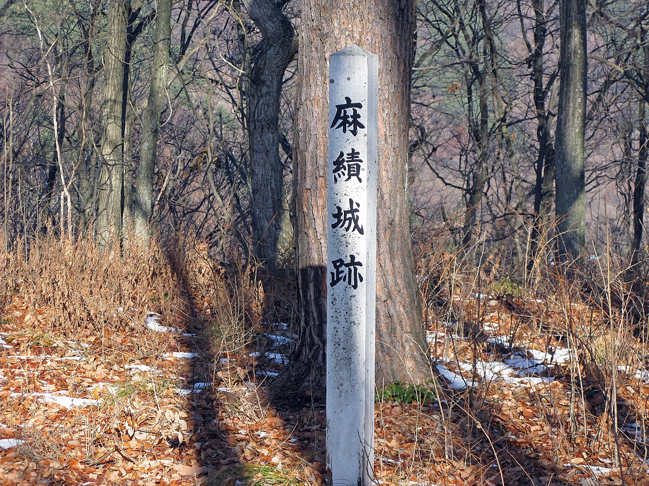
02 / Omi Castle Site

The gorinto and tahoto said to honor the lord of Omi Castlewere judged to combine Kamakura and Muromachi pieces.

Omi Castle Site in Omi Village
Photo by 前田左衛門佐 (Public domain)

Omi Castle Site is a prefectural historic site, and the village's list gives its designation as March 22, Showa 49 (1974). A gorinto and a tahoto said to have been built by Kaijunbo, younger brother of the castle lord Hattori Kiyonobu, were judged by experts to combine pieces from both the Kamakura and Muromachi periods. The village says the people involved remain for future study.

  • Prefectural historic site (village list: March 22, 1974)
  • Gorinto and tahoto
  • Pieces from the Kamakura and Muromachi periods combined

03 / Fukuman-ji

The Nikko and Gakko Bodhisattvas are known to bethe work of Myokai of Zenko-ji, in Gentoku 4.

At Fukuman-ji, the Nikko and Gakko Bodhisattvas flank the Yakushi Nyorai. The village's note says they are known to be the work of Myokai of Zenko-ji in Gentoku 4 (1332), and calls them the last of the nine statues he left in the prefecture, made at age 48. The village's list gives their Important Cultural Property designation as June 27, Heisei 8 (1996).

  • Gentoku 4 (1332)
  • Last of Myokai's nine statues
  • Important Cultural Property, 1996

Omi Village from the sky

Now and 1974–78. Tap a photo to zoom in.

Wide (about 6 km across)

Close (about 1.5 km across)

Now (shot September–October 2024)Shot 1974–78

Source: Geospatial Information Authority of Japan (GSI) GSI Tiles(全国最新写真(シームレス)/国土画像情報(第一期:1974〜1978年撮影))

Open in GSI Maps (now)Open in GSI Maps (1974–78)

Living here

On the southern foot of Mount Hijiri, in the Omi River basin.

  • about 3,000 people
  • Rural district town

The village says it lies in the Omi River basin on the southern foot of Mount Hijiri, bordering Chikuma City and Nagano City to the north and Chikuhoku Village to the east, south and west. In the Edo period it was shogunal land with Omi-juku on the Hokkoku Waki-okan road. The village's only JR Shinonoi Line station is Hijiri-Kogen Station, the gateway.

People living here
2,593people
19952020

−7% since 2015

3,499 → 2,593

Area
34.38km²

10.14km² of it habitable

2024

Households
971households

2.7 people per household

2020

Rent (average for rentals)
—
Healthcare
0 hospitals / 2 clinics

7.7 per 10,000 people

2023

Area34.38km²Habitable land10.14km² / 29%
Area and habitable land at the same scalee-Stat B1101 / B1103
Children waiting for childcare
—1 nurseries and similar
Home purchase subsidy
—
Average annual temperature
—

These 3 items are waiting on a nationwide data source. We do not fill them with estimates.

Shape

Borders 3 municipalities.

Omi Village in Japan36.456°N 138.045°E
OsakaOmi Village
Territory of Omi Village
Boundaries: National Land Numerical Information (Administrative Area Data), MLIT. Processed by Machigatari.Lakes: National Land Numerical Information (Lake Data), MLIT. Processed by Machigatari. Prepared with the approval of the Director-General of the Geospatial Information Authority of Japan, using its Digital Map 25000 (Spatial Data Framework) and Digital Map 25000 (Place Names and Public Facilities). (承認番号 平27情使、第585号)

North to south

8.3km

Travel times per leg are not published by the municipality, so they are not shown.

Omi Village isthis kind of town.

  1. 01The Shinmei-gu stage devotes its central six bays to the stage and sets a one-bay-square taifu-za at each side of the front. A ridge tablet of Tenmei 3 (1783) survives, and the state designated it an Important Cultural Property in 1993 with the main hall, temporary hall, worship hall and kagura hall
  2. 02The village says the name Omi seems to come from the Omibe tied to Ise Shrine, and Shinmei-gu is said to have been enshrined to guard the Omi-no-mikuriya estate of the Inner Shrine of Ise
  3. 03The gorinto and tahoto said to honor the lord of Omi Castle were judged to combine pieces from the Kamakura and Muromachi periods, and the Nikko and Gakko Bodhisattvas of Fukuman-ji are known to be the work of Myokai of Zenko-ji in Gentoku 4 (1332)

If something caught your eye, ask the town itself.

From this town's themes