Tarama yaeyama tomi.jpg
Article

47375 / たらまそん

Okinawa Prefecture 宮古郡

Tarama Village

No mountains, yet a ship lookout stays.

Yaeyama Lookout

Photo by Paipateroma (CC BY-SA 4.0)

01 / Tarama's forest belts

A belt of woods about 1.8 km long rings the village,shielding a flat island from the wind.

多良間島全景.jpg
Photo by Yamada udon (CC BY-SA 4.0)

The Pogu are forest belts: the village belt around the settlement and the shore belt around the island's coast. The village belt runs about 1.8 km from west to east. A prefectural Natural Monument, it became a Forestry Heritage site in fiscal 2018 and a Nationally Important Agricultural Heritage System in January 2025.
  • Village belt about 1.8 km long
  • 1974: prefectural Natural Monument
  • Jan 2025: Nationally Important Agricultural Heritage System

02 / Toburi

From the island's inland toward the sea,named paths radiate outward.

Toburi are the small paths that lead to the sea. Named ones number 47, counting Minna Island, and each is an entrance to the shore. Some are still used as ritual sites, while others are fading away.

  • 47 named Toburi
  • Radiating from inland to the sea
  • 47 listed on the guide map

03 / Tarama Harvest Festival

Nakasuji's day, Shiokawa's day, then both districts' day.Dancing goes on for three days in the eighth lunar month.

The harvest festival, also called Hachigatsu Odori, is danced in the eighth lunar month: the first day by Nakasuji district, the second by Shiokawa, the third by both. Folk dances such as the lion dance and the stick dance are joined by classical dances and kumiodori, brought from Shuri in the Meiji era.

  • Day 1 Nakasuji, day 2 Shiokawa, day 3 both
  • Lion dance, stick dance, pestle dance and more
  • 1976: national Important Intangible Folk Cultural Property

Living here

An island village, about 2 hours by ferry from Miyakojima.

  • about 1,000 people
  • Rural district town

Tarama is a village of two islands, Tarama and Minna, about 8 km apart, and has no railway. Its gateway is Tarama Port. The Tarama Kaiun ferry takes about 2 hours from Hirara Port on Miyakojima. By the village's guide, it is about 20 minutes by air from Miyakojima.

People living here
1,058people
19952020

−11.4% since 2015

1,409 → 1,058

Area
22km²

11.9km² of it habitable

2024

Households
466households

2.3 people per household

2020

Rent (average for rentals)
—
Healthcare
0 hospitals / 1 clinic

9.5 per 10,000 people

2023

Area22km²Habitable land11.9km² / 54%
Area and habitable land at the same scalee-Stat B1101 / B1103
Children waiting for childcare
—1 nurseries and similar
Home purchase subsidy
—
Average annual temperature
—

These 3 items are waiting on a nationwide data source. We do not fill them with estimates.

ACCESS

Where you can go from here.

Tarama Village in Japan24.669°N 124.702°E
TokyoOsakaTarama Village
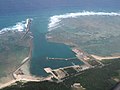
Port of Tarama
多良間港2016
  • to MiyakojimaTarama Kaiun120min

Travel times follow 事業者公式 多良間海運(合資会社多良間海運。http://www.taramakaiun.com/。2026-10-07 に読んだ。ページの『お知らせ』は 2026-10-07 付、時刻表そのものに更新日の表示なし)の『平良港 ⇔ 多良間港(距離62km)』:平良港発 09:00 ⇒ 多良間港着 11:00(約 2時間)/多良間港発 13:00 ⇒ 平良港着 15:00(約 2時間)。『日曜日は運休です』。村公式『フェリー運行情報』(更新 2022-01-20)も同じ時刻・約2時間・日曜運休 (checked 2026-10-07). They vary by time of day.

Shape

Borders 0 municipalities.

Territory of Tarama Village
Boundaries: National Land Numerical Information (N03)

North to south

13.9km

Tarama Village isthis kind of town.

  1. 01Yaeyama Lookout stands on high ground west of the settlement and is said to have been built around the 17th century as a ship lookout; it is a village-designated historic site, and the national historic site Sakishima Beacon Mounds spans five municipalities including Tarama
  2. 02The Fukugi-lined approach about 650 m long to Shiokawa Utaki is a prefectural Natural Monument, and the village also has a Monument of Gratitude, built in thanks for the warm hospitality shown to the crew of a merchant ship from Miyako City in Iwate
  3. 03The village consists of Tarama Island and Minna Island; the cave wells Amagā, Shugāgā and Fushatogā are village-designated historic sites, and the Oyasato family documents, appointment letters from the Shuri royal government, are a prefectural tangible cultural property

If something caught your eye, ask the town itself.