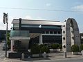
Rokutan-ji, gaikan-2.jpg
Article

27381 / たいしちょう

Osaka Prefecture 南河内郡

Taishi Town

Rock carved away, leaving a tower.

Rokutanidera, 13-tier tower

Photo by Saigen Jiro (CC0)

01 / Stone chamber

A side-opening stone chamber, foundduring work, is now shown in a town plaza.

Matsuizuka Kofun, sekkaku-1.jpg
Photo by Saigen Jiro (CC0)

Found in 1958, the chamber turned up, the town says, while a well was being dug, and the prefecture says, while a water tank was being installed. It is made of Mt. Nijozan tuff, with an opening in its end face. At the time it made the papers as possibly an attendant tomb of Empress Suiko's mausoleum; it is now displayed in the town plaza, moved from its original site.

  • Found in 1958
  • Mt. Nijozan tuff
  • Prefectural designation, 30 March 1973
  • Prefectural name: "Matsuizuka Kofun sekkan"

02 / Cave temple

Two Nara-period grottoes, large and small.The clan involved in building them is unknown.

Iwaya (Taishi, Osaka), gaikan-2.jpg
Photo by Saigen Jiro (CC0)

Iwaya is a cave-temple site near Iwaya Pass, a side route of the Takenouchi Kaido. The larger grotto is 7.6 m wide, 6.14 m high and 4.5 m deep, with a tuff stone tower at its centre. The town calls it a site of many mysteries: no document records it, and the clans involved in building it are unknown.

  • Large grotto 7.6 m wide, 6.14 m high, 4.5 m deep
  • National Historic Site, 14 January 1948
  • Stone tower of tuff

03 / Person

Kyuzo, who left Kasuga to settle in Hokkaido, took on rice-growingin a cold climate.

The town introduces Nakayama Kyuzo as a man born in 1828 who went from Kasuga (now Taishi) by way of Sendai Domain and settled in Shimamatsu (now Kitahiroshima, Hokkaido) in 1871. In 1873 he took on growing a cold-climate rice variety (literally "red hair"), and Kitahiroshima records a harvest that year of 345 kg per tan.

  • Born 1828
  • Settled in Shimamatsu, 1871
  • 345 kg per tan harvested, 1873

Living here

From Kaminotaishi Station, 6 minutes by bus.

  • about 10,000 people
  • Rural district town

There is no railway station in the town; the nearest are Kaminotaishi Station on the Kintetsu Minami-Osaka Line, in Habikino, and Kishi Station on the Nagano Line, in Tondabayashi. By the town's timetable (revised October 2025) it takes at best 6 minutes by the town's community bus from Kaminotaishi Station to the town office, and 11 minutes by Kongo Furusato Bus from Kishi Station.

People living here
13,009people
19952020

−5.4% since 2015

12,872 → 13,009

Area
14.17km²

8.99km² of it habitable

2024

Households
5,048households

2.6 people per household

2020

Rent (average for rentals)
—
Healthcare
0 hospitals / 7 clinics

5.4 per 10,000 people

2023

Area14.17km²Habitable land8.99km² / 63%
Area and habitable land at the same scalee-Stat B1101 / B1103
Children waiting for childcare
—2 nurseries and similar
Home purchase subsidy
—
Average annual temperature
—

These 3 items are waiting on a nationwide data source. We do not fill them with estimates.

ACCESS

Where you can go from here.

Taishi Town in Japan34.519°N 135.648°E
TokyoTaishi Town
Taishi Town Office
太子町役場2007
  • to KaminotaishiLocal bus6min
  • to KishiLocal bus11min

Travel times follow 太子町公式『太子町内を走るバスの時刻表』(更新日 2026-04-01・令和7年10月1日から新ダイヤ・2026年4月更新で『バスのダイヤに変更ありません』)の PDF(https://www.town.taishi.osaka.jp/material/files/group/14/260401newjikoku.pdf・保存 $SP/osaka-taishi/bustt.pdf・16頁)。【上ノ太子→役場】たいしのってこバス(太子町コミュニティバス)の『太子中央循環線』山田廻り(平日表):上ノ太子駅前 8:06 発→太子町役場 8:12 着(6分)、8:39→8:45、12:25→12:31、17:56→18:02、20:11→20:17、22:56→23:02。(土・日・祝表):7:57→8:03、17:27→17:33、18:57→19:03、20:09→20:15、22:48→22:54。平日にも土日祝にも6分の便がある(毎日運転)。ほかの便は17分(太子廻り)や7分(春日廻り)。【喜志→役場】金剛ふるさとバス(近鉄バス)『喜志循環線』(全日=平日・休日共通の1枚の表):喜志駅前 11:10→太子町役場 11:21、12:10→12:21、16:35→16:46、17:25→17:36、18:15→18:26、19:35→19:46、20:25→20:36(いずれも11分・太子廻り)。ほかの便(6:30→6:47・7:15→7:32・8:10→8:27・9:10→9:27・10:10→10:27・13:35→13:52・14:25→14:42・15:10→15:27)は葉室廻りで17分。【町公式の目安】町公式『アクセス』(更新日 2023-12-21):『上ノ太子駅よりたいしのってこバス…「太子町役場」バス停下車(所要時間約10分)』『喜志駅より近鉄バスに乗車「太子町役場」バス停下車(所要時間約15分)』 (checked 2026-10-14). They vary by time of day.

Shape

Borders 5 municipalities across 1 prefectures.

Territory of Taishi Town
Boundaries: National Land Numerical Information (N03)

North to south

4.9km

Osaka Prefecture
河南町, 羽曳野市, 富田林市
Nara Prefecture
葛城市, 香芝市

Taishi Town isthis kind of town.

  1. 01Rokutanidera is the site of a Nara-period cave temple at the foot of Mt. Nijozan, and a national Historic Site. The Agency for Cultural Affairs' commentary says the multi-tiered stone tower was made by carving away the surrounding bedrock, that 13 tiers remain and its top is damaged, and that three seated Buddhas are line-carved on the grotto's back wall; the same commentary also recognizes the place as a former stone quarry
  2. 02The town calls Mt. Nijozan to the east its symbol and writes that sanukite quarried at its foot was used for stone tools across the Kinki region from the Paleolithic onward. In the Asuka period, it writes, a great road laid out under Empress Suiko, later the Takenouchi Kaido, ran along the south foot
  3. 03In 1956 the villages of Shinaga and Yamada merged and the town was named Taishi after Prince Shotoku. The town writes that many tombs of emperors and royals were built here, and that the area came to be called the Valley of Royal Tombs

If something caught your eye, ask the town itself.