Shinbashi, a post-town bridge, Kaminoyama City
Article

06207 / かみのやまし

Yamagata Prefecture

Kaminoyama City

Tolls repaid part of a stone bridge.

Shinbashi, a post-town bridge

Photo by Mizuki Kusakawa (CC BY-SA 4.0)

01 / Sub-inn

The post-town sub-inn was also a headman'shome, an L-shaped house entered on its long side.

Sub-inn in Kaminoyama City
Photo by Mizuki Kusakawa (CC BY-SA 4.0)

The former Tanno family house is also known by its trade name. It was both the sub-inn (waki-honjin) and the village head's house of a post town on the Ushu Kaido, and is an L-shaped house entered on its long side, presumed to have been built just after 1757 (Horeki 7). It was moved and restored in 1993 (Heisei 5) and is a prefectural cultural property.

  • Prefectural designation (December 8, 1995)
  • Both sub-inn and village head's house
  • Presumed built just after 1757

02 / Samurai residences

The house of a Meishinkan domain-school teacher,and that of a man who called his garden "Yellow Flower Garden".

Samurai residences in Kaminoyama City
Photo by くろふね (CC BY 4.0)

In one district of the city, four samurai residences (the Morimoto, Miwa, Yamada and former Sogabe houses) are designated by the city. The Miwa family entered the service of the Matsudaira of the Kaminoyama domain in 1796 (Kansei 8) and, in the last years of the shogunate, taught at the domain school, the Meishinkan. The city records that the 11th head of the Morimoto family called his garden the "Yellow Flower Garden" and that traces of it remain today.

  • Four city-designated samurai residences
  • The Miwa house: teacher at the Meishinkan
  • Morimoto garden called the "Yellow Flower Garden"

03 / Stone torii

A stone torii 5.05 m high was cut from a boulderby a stonemason over two years, it is said.

The Hosoya stone great torii is said to be the first torii of Tenaga Inari Shrine and was erected in 1884 (Meiji 17). The city board of education's material gives its size as 5.05 m high and 6.09 m wide, and relays a record that the stonemason Moriya Zenshichi cut it out of a huge boulder at Nagano over two years. The memorial stone there names nineteen villages as helpers.

  • City designation (November 18, 1983)
  • 5.05 m high, 6.09 m wide (board of education material)
  • Nineteen helper villages named

Kaminoyama City from the sky

Now and 1974–78. Tap a photo to zoom in.

Wide (about 6 km across)

Close (about 1.5 km across)

Now (shot April–September 2023)Shot 1974–78

Source: Geospatial Information Authority of Japan (GSI) GSI Tiles(全国最新写真(シームレス)/国土画像情報(第一期:1974〜1978年撮影))

Open in GSI Maps (now)Open in GSI Maps (1974–78)

Living here

Tokyo in 2 h 32 min on the Yamagata Shinkansen.

  • about 30,000 people
  • Shinkansen stops here

From Tokyo Station to Kaminoyama-Onsen Station, the fastest Yamagata Shinkansen train that runs every day takes 2 hours 32 minutes. The Yamagata Shinkansen stops at Kaminoyama-Onsen Station in the city.

People living here
29,110people
19952020

−7.8% since 2015

38,047 → 29,110

Area
240.93km²

78.46km² of it habitable

2024

Households
10,537households

2.8 people per household

2020

Rent (average for rentals)
38,952yen

National average 60,630 yen

2023

Healthcare
3 hospitals / 22 clinics

8.6 per 10,000 people

2023

Area240.93km²Habitable land78.46km² / 33%
Area and habitable land at the same scalee-Stat B1101 / B1103
Children waiting for childcare
—5 nurseries and similar
Home purchase subsidy
—
Average annual temperature
—

These 3 items are waiting on a nationwide data source. We do not fill them with estimates.

ACCESS

Where you can go from here.

Kaminoyama City in Japan38.150°N 140.268°E
TokyoOsakaKaminoyama City
Kaminoyama-Onsen Station
かみのやま温泉駅2022
  • to TokyoYamagata Shinkansen152min

Travel times follow JR東日本『駅の時刻表』2026年11月号(URL に 2611)。東京駅の山形新幹線の下り(東京駅 tt04・平日と土曜休日)の列車ページ64件のうち、東京の『発』とかみのやま温泉の『着』が載る列車を、かみのやま温泉駅(コード0496)の山形新幹線の時刻表の列車とあわせて数えた。毎日運転(平日と土休日の両方に同じ分数で載り、運転日の注記が無い)の最速は、やまびこ137号(列車番号137B)併結のつばさ137号(137M)の東京12:00発→かみのやま温泉14:32着=152分(福島で分割)。列車ページの『運転日』の欄は空(臨時・特定日の注記なし)。 (checked 2026-10-28). They vary by time of day.

Shape

Borders 5 municipalities across 1 prefectures.

Territory of Kaminoyama City
Boundaries: National Land Numerical Information (Administrative Area Data), MLIT. Processed by Machigatari.

North to south

19.0km

Miyagi Prefecture
Shichikashuku Town, Zao Town

Kaminoyama City isthis kind of town.

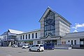
  1. 01Shinbashi, in a post town on the Ushu Kaido, is an arched stone bridge completed in August 1880; the city records that its cost was met by a prefectural subsidy and loans from residents, and that tolls collected from users after completion went toward repaying part of it
  2. 02The post town has the former Tanno family house, a prefectural designated property, and another district has four city-designated samurai residences, including the Miwa house, whose family taught at the Meishinkan domain school
  3. 03The Hosoya stone great torii is city-designated, and the city also has the former Ogata family house, an Important Cultural Property, and the city-designated Kaminoyama domain drum-and-fife music and a boulder long used as a domain boundary marker

See the town as it is now.

Source: Wikidata (P2002, P2003, P2013, P2397)

If something caught your eye, ask the town itself.