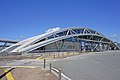
Kumano Taisha Haiden, Nanyo City
Article

06213 / なんようし

Yamagata Prefecture

Nanyo City

A hall whose front bay is all open.

Kumano Taisha Haiden

Photo by Towacoco (CC BY-SA 4.0)

01 / Kofun

The keyhole-shaped tomb, about 96 m long,has not had its burial facility excavated.

Kofun in Nanyo City
Photo by Saigen Jiro (CC0)

The Nanyo city newsletter describes the mound as about 96 m long and, seen from the air, like a hand mirror that women of the Edo period favored. By order of the national government the burial facility has not been excavated; the earth of the mound was tamped in alternating layers of clay and soil, and jars and stemmed vessels used in rites have been found.

  • National Historic Site (designated May 24, 1980)
  • About 96 m long
  • Mound tamped in alternating layers of clay and soil

02 / Stone bridge

The "Yoshida" in the bridge's name is not a place,but the surname of the stonemason Yoshida Zennosuke.

This arched stone bridge, 7 ken (12.6 m) long, was completed in December 1880 (Meiji 13). It was one of the works of the prefectural trunk road project, and the stonemason was Yoshida Zennosuke of Miyauchi. The city newsletter says the flame-shaped ornaments on the railing posts are used only on this bridge and on the Maizuru Bridge at the main enclosure of Yonezawa Castle.

  • Completed December 1880 (Meiji 13)
  • 7 ken (12.6 m) long, 4 ken (7.2 m) wide
  • City Designated Tangible Cultural Property (building)

03 / Thirty-three Kannon

The priest Kinmo carved thirty-three Kannoninto the boulders of Iwabuyama.

Thirty-three Kannon in Nanyo City
Photo by Geomr (CC BY-SA 3.0)

Kinmo, the 16th head priest of a local temple, carved thirty-three Kannon into the huge boulders of Iwabuyama. The city newsletter says that each time he visited the Saikoku thirty-three pilgrimage sites he copied the figure of the Kannon, and that he spent his own money on the stonecutters' wages. The city's other thirty-three Kannon are stone statues that were carved first and then enshrined.

  • City Designated Tangible Cultural Property (historic site)
  • Thirty-three Kannon carved into boulders
  • About 40 donors named in the register

Nanyo City from the sky

Now and 1974–78. Tap a photo to zoom in.

Wide (about 6 km across)

Close (about 1.5 km across)

Now (shot June 2016)Shot 1974–78

Source: Geospatial Information Authority of Japan (GSI) GSI Tiles(全国最新写真(シームレス)/国土画像情報(第一期:1974〜1978年撮影))

Open in GSI Maps (now)Open in GSI Maps (1974–78)

Living here

Tokyo in 2 h 18 min by Yamagata Shinkansen.

  • about 30,000 people
  • Shinkansen stops here

The fastest daily through train from Tokyo Station to Akayu Station on the Yamagata Shinkansen takes 2 hours 18 minutes with no change. The city says Tokyo is about 2 hours 30 minutes away.

People living here
30,420people
19952020

−5.8% since 2015

36,810 → 30,420

Area
160.52km²

64.35km² of it habitable

2024

Households
10,760households

2.8 people per household

2020

Rent (average for rentals)
44,523yen

National average 60,630 yen

2023

Healthcare
2 hospitals / 26 clinics

9.2 per 10,000 people

2023

Area160.52km²Habitable land64.35km² / 40%
Area and habitable land at the same scalee-Stat B1101 / B1103
Children waiting for childcare
—7 nurseries and similar
Home purchase subsidy
—
Average annual temperature
—

These 3 items are waiting on a nationwide data source. We do not fill them with estimates.

ACCESS

Where you can go from here.

Nanyo City in Japan38.055°N 140.148°E
TokyoOsakaNanyo City
Akayu Station
赤湯駅2022
  • to TokyoYamagata Shinkansen138min

Travel times follow JR東日本の駅の時刻表(版 2611=2026年11月号)。東京駅の山形新幹線の下りの列車ページから、東京の発→赤湯駅の着を `$SP/yamagata-prep/jr/jr_count.py` で数えた。平日の毎日運転の最速は つばさ129号(東京09:00発→赤湯11:15着)の135分、土休日の毎日運転の最速は やまびこ133号(東京10:00発→赤湯12:18着)の138分。遅いほうの138分を採る(運転日の欄が空の定期便だけ。9079B・6069B・8177B など運転日に日付の入る臨時は外した) (checked 2026-10-28). They vary by time of day.

Shape

Borders 7 municipalities.

Nanyo City isthis kind of town.

  1. 01The haiden of Kumano Taisha is a thatched worship hall whose front bay is entirely open, with a one-ken-square inner sanctum at the center; the city newsletter introduces it as having an interior structure not seen in other haiden in the prefecture, and it is a prefectural designated cultural property (building)
  2. 02Inarimori Kofun is a keyhole-shaped tomb and a national historic site whose burial facility has not been excavated; Yoshida Bridge, completed in 1880, is a stone bridge named for the surname of its stonemason and is a city designated cultural property; and Priest Kinmo carved thirty-three Kannon into the boulders of Iwabuyama
  3. 03On a cliff face in the Akayu area, 5 itabi (stone slab memorials) are carved in an upper row and 10 in a lower row; the upper 5 are the prefecturally designated Einin 2 cliff-carved itabi, and the city newsletter says that the man they commemorate does not appear in historical documents

If something caught your eye, ask the town itself.