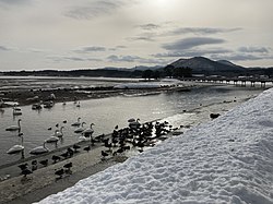
Akanezawa Red Rock, Imabetsu Town
Article

02303 / いまべつまち

Aomori Prefecture 東津軽郡

Imabetsu Town

Nearby red earth was paint for shrines.

Akanezawa Red Rock

Photo by あおもりくま,(Aomorikuma) (CC BY-SA 4.0)

01 / Bronze stupa

A bronze stupa 301.5 cm tallbears a priest's biography.

The bronze stupa is an Aomori Prefecture important cultural property (building) and stands 301.5 cm tall in total. The front bears the Namu Amida Butsu invocation in raised characters and the back a relief of Jizo, while the sides and margins record the biography of the priest. He is said to have cast it, with bronze gained through donations, by inviting a founder from Honjo in Akita.

  • Prefectural important cultural property (building)
  • 301.5 cm tall in total
  • Namu Amida Butsu invocation on the front
02 / Arauma

Sending off the god of the rice fields,three groups keep Arauma alive.

Imabetsu's Arauma (wild-horse dance) is a prefectural intangible folk cultural property kept by three preservation societies: Imabetsu, Okawadaira and Futamata. The town describes it as a rite of seeing off the god of the rice fields, held after planting in thanks to the god. A man as the horse and a woman holding the reins dance as a pair.

  • Prefectural intangible folk cultural property
  • Three preservation societies
  • A rite of seeing off the field god

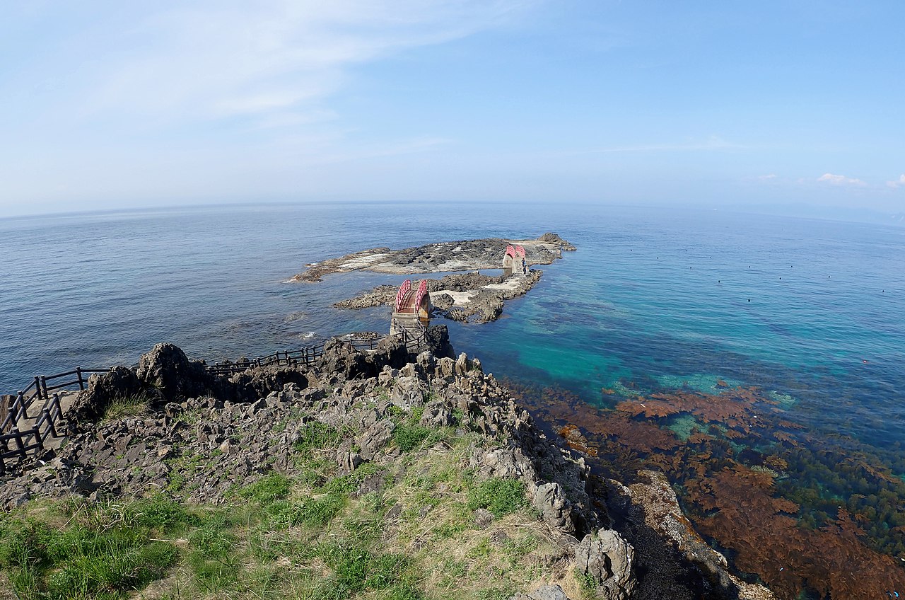
03 / Takanosaki

From a cape of strange rocks,Hokkaido shows on clear days.

Takanosaki in Imabetsu Town
Photo by あおもりくま(Aomorikuma) (CC BY-SA 3.0)

Takanosaki, on the Horozuki coast, is a scenic spot where strange and odd-shaped rocks jut out everywhere; on a clear day Cape Tappi, the Shimokita Peninsula and, far off, Hokkaido can be seen. Two bridges link the lighthouse to the rocks. The Horozuki coast is part of Tsugaru Quasi-National Park.

  • Strange rocks jut out everywhere
  • Two bridges to the rocks
  • Tsugaru Quasi-National Park

Imabetsu Town from the sky

Now and 1974–78. Tap a photo to zoom in.

Wide (about 6 km across)

Close (about 1.5 km across)

Now (shot July–October 2023)Shot 1974–78

Source: Geospatial Information Authority of Japan (GSI) GSI Tiles(全国最新写真(シームレス)/国土画像情報(第一期:1974〜1978年撮影))

Open in GSI Maps (now)Open in GSI Maps (1974–78)

Living here

Tokyo in 3 h 30 min on the Hokkaido Shinkansen.

  • about 2,000 people
  • Shinkansen stops here
  • Rural district town

From Tokyo Station to Okutsugaru-Imabetsu Station, the fastest daily Hokkaido Shinkansen train takes 3 hours 30 minutes on the JR East timetable (checked October 2026).

People living here
2,334people
19952020

−15.3% since 2015

4,737 → 2,334

Area
125.27km²

19.46km² of it habitable

2024

Households
1,127households

2.1 people per household

2020

Rent (average for rentals)
—
Healthcare
0 hospitals / 3 clinics

12.9 per 10,000 people

2023

Area125.27km²Habitable land19.46km² / 16%
Area and habitable land at the same scalee-Stat B1101 / B1103
Children waiting for childcare
—1 nurseries and similar
Home purchase subsidy
—
Average annual temperature
—

These 3 items are waiting on a nationwide data source. We do not fill them with estimates.

ACCESS

Where you can go from here.

Imabetsu Town in Japan41.182°N 140.482°E
TokyoOsakaImabetsu Town
Okutsugaru-Imabetsu Station
奥津軽いまべつ駅2023
  • to TokyoHokkaido Shinkansen210min

Travel times follow JR東日本の駅の時刻表(timetables.jreast.co.jp/2611・東京駅 下り tt1039 平日1039020・土曜休日1039021)の列車ページを aomori-prep/jr/trains-1039.json(261件)から数え直し、列車ページ(はやぶさ17号 17B の train/111101)を直接読んで確かめた。東京の発→奥津軽いまべつの着で、運転日の欄が空(臨時でない)の毎日運転の最速は210分:はやぶさ17号〈17B。東京10:45発→奥津軽いまべつ14:15着〉。平日と土曜・休日の両方に同じ5本(1号3001B 215分・17号17B 210分・25号3025B 220分・31号3031B 217分・35号3035B 218分)が載り、最速は17B。下ごしらえの本体の数え(210分)と一致 (checked 2026-10-28). They vary by time of day.

Shape

Borders 2 municipalities.

Territory of Imabetsu Town
Boundaries: National Land Numerical Information (Administrative Area Data), MLIT. Processed by Machigatari.Lakes: National Land Numerical Information (Lake Data), MLIT. Processed by Machigatari. Prepared with the approval of the Director-General of the Geospatial Information Authority of Japan, using its Digital Map 25000 (Spatial Data Framework) and Digital Map 25000 (Place Names and Public Facilities). (承認番号 平27情使、第585号)

North to south

14.1km

Imabetsu Town isthis kind of town.

  1. 01Akanezawa no Akaiwa, in Sunagamori, Imabetsu, is a prefectural natural monument; red earth (benigara) nearby was dug as pigment in the domain era and used as red paint for shrines and temples in the domain
  2. 02The bronze stupa, 301.5 cm tall, is a prefectural important cultural property, and Arauma is a prefectural intangible folk cultural property kept by the societies of Imabetsu, Okawadaira and Futamata
  3. 03Takanosaki on the Horozuki coast juts out with strange rocks, and Okutsugaru-Imabetsu Station on the Hokkaido Shinkansen is 3 h 30 min from Tokyo

If something caught your eye, ask the town itself.