Yamakura Daijin salmon festival, Katori City
Article

12236 / かとりし

Chiba Prefecture

Katori City

Upstream salmon are offered to a deity.

Yamakura Daijin salmon festival

Photo by katorisi (CC BY 3.0)

01 / Giant tree

Notified as a camphor tree,it proved to be a tabunoki.

Giant tree in Katori City
Photo by katorisi (CC BY 2.5)

The Huma Great Camphor Tree, in the grounds of Uga Shrine, was designated a national Natural Monument in 1926 and notified as a camphor tree. A 1969 survey showed it was a tabunoki (Machilus thunbergii), and the city thinks the species was notified wrongly. It stands about 16 m tall.

  • National Natural Monument, 1926
  • Identified as tabunoki in 1969
  • About 16 m tall (city)

02 / River landing

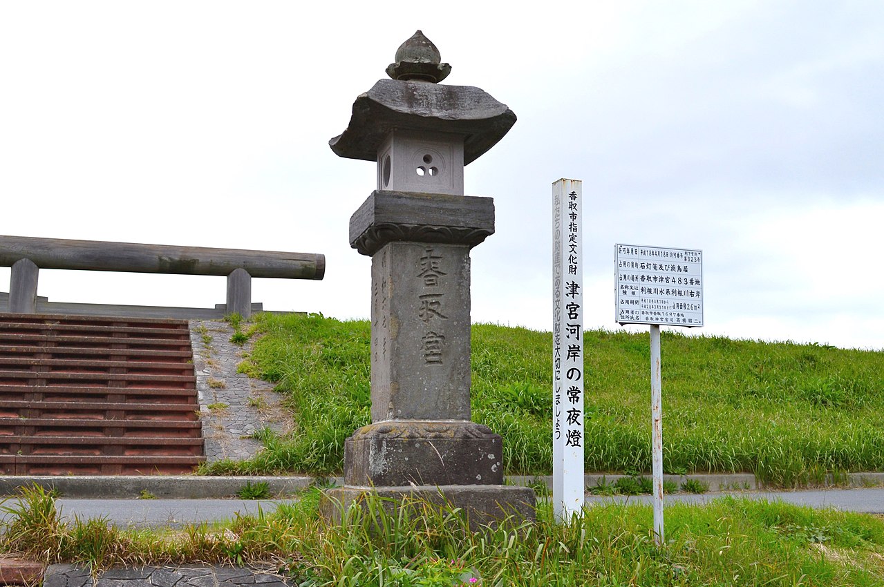
Once Katori Jingu's gateway landing,it keeps one stone lantern.

River landing in Katori City
Photo by Saigen Jiro (CC0)

The stone lantern of the Tsunomiya Torii landing stands midway up the Tone River embankment. In 1769, 36 people from nearby villages along the river formed a kō (association) and dedicated it. It is 280 cm tall now; old photographs suggest it exceeded 360 cm. The city designated it a tangible cultural property in 1977.

  • Dedicated in 1769
  • 36 people formed the association
  • City tangible cultural property, 1977

03 / Ranch

Earthen banks that penned wild horsessurvive in places among the fields.

Ranch in Katori City
Photo by katorisi (CC BY-SA 3.0)

The Aburada Ranch was one of the Sakura Seven Ranches run by the Edo shogunate, centred on the Kumigami area. The banks enclosing the wild horses were about 3–4 m high, apparently with moats on both sides. Parts survive in several districts, and the site became a national historic site in 2019.

  • Banks about 3–4 m high
  • Parts survive in several districts
  • National historic site, 2019

Katori City from the sky

Now and 1974–78. Tap a photo to zoom in.

Wide (about 6 km across)

Close (about 1.5 km across)

Now (shot September 2024)Shot 1974–78

Source: Geospatial Information Authority of Japan (GSI) GSI Tiles(全国最新写真(シームレス)/国土画像情報(第一期:1974〜1978年撮影))

Open in GSI Maps (now)Open in GSI Maps (1974–78)

Living here

83 minutes at best from Tokyo Station by express bus.

  • about 70,000 people
  • 90 min to a city centre

Sawara Station North Exit is 83 minutes at best by Keisei Bus express from Bus Terminal Tokyo Yaesu (fastest in the timetable, October 2026). City Hall is a 10-minute walk from Sawara Station on the JR Narita Line. In 2006 Sawara and three neighbouring municipalities merged into the present city.

People living here
72,356people
2010

−6.6% since 2015

82,866 → 72,356

Area
262.35km²

209.91km² of it habitable

2024

Households
27,572households

2.6 people per household

2020

Rent (average for rentals)
48,375yen

National average 60,630 yen

2023

Healthcare
6 hospitals / 46 clinics

7.2 per 10,000 people

2023

Area262.35km²Habitable land209.91km² / 80%
Area and habitable land at the same scalee-Stat B1101 / B1103
Children waiting for childcare
—20 nurseries and similar
Home purchase subsidy
—
Average annual temperature
—

These 3 items are waiting on a nationwide data source. We do not fill them with estimates.

ACCESS

Where you can go from here.

Katori City in Japan35.898°N 140.499°E
OsakaKatori City
Sawara Station
佐原駅2023
  • to TokyoHighway bus83min

Travel times follow 京成電鉄バスグループ『銚子東京線(佐原ルート・小見川ルート)』通過予定時刻表(令和8年3月20日〜。香取市公式の高速バスのページに置かれたPDF・HP20260320choshitokyojikoku.pdf) (checked 2026-10-22). They vary by time of day.

Shape

Borders 9 municipalities across 1 prefectures.

Territory of Katori City
Boundaries: National Land Numerical Information (Administrative Area Data), MLIT. Processed by Machigatari.Lakes: National Land Numerical Information (Lake Data), MLIT. Processed by Machigatari. Prepared with the approval of the Director-General of the Geospatial Information Authority of Japan, using its Digital Map 25000 (Spatial Data Framework) and Digital Map 25000 (Place Names and Public Facilities). (承認番号 平27情使、第585号)

North to south

22.8km

Katori City isthis kind of town.

  1. 01The Yamakura salmon festival, held at Yamakura Daijin's first-day-of-the-hare festival, offers salmon that have swum up a tributary of the Kuriyama River; it is a prefectural intangible folk cultural property
  2. 02The Huma Great Camphor Tree was notified as a national Natural Monument as a camphor tree but proved in a 1969 survey to be a tabunoki. The Tsunomiya landing lantern, on the Tone River embankment, is a city tangible cultural property
  3. 03The earthen horse banks of the Shimosa-Sakura Aburada Ranch site are a national historic site; the city also has Katori Jingu, the Sawara townscape and the former residence of Ino Tadataka

If something caught your eye, ask the town itself.