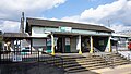
Pagoda core stone, Ryukakuji, Sakae Town
Article

12329 / さかえまち

Chiba Prefecture 印旛郡

Sakae Town

Its water never rose or fell, they say.

Pagoda core stone, Ryukakuji

Photo by Saigen Jiro (CC0)

01 / Burial mound

A stone chamber built of cut stone, in two rooms.One of three "rock houses" said to lend bowls.

Burial mound in Sakae Town
Photo by Saigen Jiro (CC0)

The burial chamber of Iwaya Kofun is of cut stone, with two rooms side by side, east and west. One of the seven wonders of the temple, the "Three Rock Houses," covers the chambers of this mound and Miso Iwaya Kofun. A spirit called the Hidden Zato lent trays and bowls, until someone forgot to return them.

  • National Historic Site
  • Cut-stone chamber, two rooms
  • Legend of the Three Rock Houses

02 / Temple legend

In a drought year, the head of the Lake Inba dragonis said to have been laid to rest here.

Temple legend in Sakae Town
Photo by Saigen Jiro (CC0)

According to the temple's chronicle, a dragon of Lake Inba brought rain in a drought year and was torn in three. The temple that received its head took the name Ryukakuji. Its belly and tail went to temples in Inzai and Sosa. The prefectural board of education tells the same legend.

  • Temple chronicle
  • Head at Ryukakuji, belly in Inzai, tail in Sosa
  • Told by the prefectural board of education

03 / Old roof tiles

From kilns said to have fired the founding tiles,tiles inscribed with place names.

Old roof tiles in Sakae Town
Photo by Saigen Jiro (Public domain)

Old roof tiles and sutra cases unearthed in the temple grounds are a prefectural tangible cultural property. The town board of education's yearbook says tiles inscribed with neighboring place names were found at two kiln sites linked to the temple's tiles.

  • Prefectural property (1965)
  • Tiles inscribed with place names
  • Town board of education yearbook

Sakae Town from the sky

Now and 1974–78. Tap a photo to zoom in.

Wide (about 6 km across)

Close (about 1.5 km across)

Now (shot May–September 2008)Shot 1974–78

Source: Geospatial Information Authority of Japan (GSI) GSI Tiles(全国最新写真(シームレス)/国土画像情報(第一期:1974〜1978年撮影))

Open in GSI Maps (now)Open in GSI Maps (1974–78)

Living here

63 minutes from Ueno, 8 minutes' walk to the town office.

  • about 20,000 people
  • 90 min to a city centre
  • Rural district town

The town's one station is Ajiki Station, an 8-minute walk from the town office (town website). In the October 2026 JR East timetable, some Joban Line rapid trains run through to the Narita Line at Abiko, and three trains leaving Ueno at 12:42, 13:42 and 15:42 take 63 minutes without a change.

People living here
20,127people
19952020

−5.2% since 2015

25,615 → 20,127

Area
32.51km²

29.14km² of it habitable

2024

Households
8,276households

2.4 people per household

2020

Rent (average for rentals)
53,022yen

National average 60,630 yen

2023

Healthcare
1 hospital / 6 clinics

3.5 per 10,000 people

2023

Area32.51km²Habitable land29.14km² / 90%
Area and habitable land at the same scalee-Stat B1101 / B1103
Children waiting for childcare
—1 nurseries and similar
Home purchase subsidy
—
Average annual temperature
—

These 3 items are waiting on a nationwide data source. We do not fill them with estimates.

ACCESS

Where you can go from here.

Sakae Town in Japan35.841°N 140.244°E
OsakaSakae Town
Ajiki Station
安食駅2021
  • to UenoJR Joban Line and Narita Line63min
  • to TokyoJR Ueno-Tokyo Line, Joban Line and Narita Line74min

Travel times follow JR東日本の駅の時刻表(デジタル時刻表)安食駅 成田線 成田方面(下り)の平日(0055010)と土曜・休日(0055011)と、その列車ページ。上野・東京の発時刻と安食駅の着時刻の差。運転日の注記が無い列車(上野発は12:42・13:42・15:42の3本)と、平日・土休日の両方に走る東京発の夕方の1往復を数えた。2610版(2026年10月ダイヤ)。2026-10-22 取得 (checked 2026-10-22). They vary by time of day.

Shape

Borders 4 municipalities across 1 prefectures.

Territory of Sakae Town
Boundaries: National Land Numerical Information (Administrative Area Data), MLIT. Processed by Machigatari.Lakes: National Land Numerical Information (Lake Data), MLIT. Processed by Machigatari. Prepared with the approval of the Director-General of the Geospatial Information Authority of Japan, using its Digital Map 25000 (Spatial Data Framework) and Digital Map 25000 (Place Names and Public Facilities). (承認番号 平27情使、第585号)

North to south

7.2km

Chiba Prefecture
Inzai City, Narita City
Ibaraki Prefecture
Kawachi Town, Tone Town

Sakae Town isthis kind of town.

  1. 01The foundation stone of the pagoda site at the temple, the stone that held the central pillar, is also called the "stone that neither grows nor shrinks," and the prefectural board of education writes that water pooled in its hole is said to have stayed the same in heavy rain or drought
  2. 02Iwaya Kofun has a cut-stone chamber in two rooms, and a legend tells of the Hidden Zato lending bowls from the Three Rock Houses. The temple's chronicle says it holds the head of the Lake Inba dragon
  3. 03Finds from the temple are prefecturally designated, and the town board of education's yearbook records tiles inscribed with neighboring place names from kiln sites

See the town as it is now.

Source: Wikidata (P2002, P2003, P2013, P2397)

If something caught your eye, ask the town itself.

From this town's themes