Fukui Prefectural Varve Museum Varve sample magnification.jpg
Article

18501 / わかさちょう

Fukui Prefecture 三方上中郡

Wakasa Town

70,000 years of mud, now a world scale.

Lake Suigetsu varves

Photo by Yasunorihayashi (CC BY-SA 4.0)

01 / Urami River

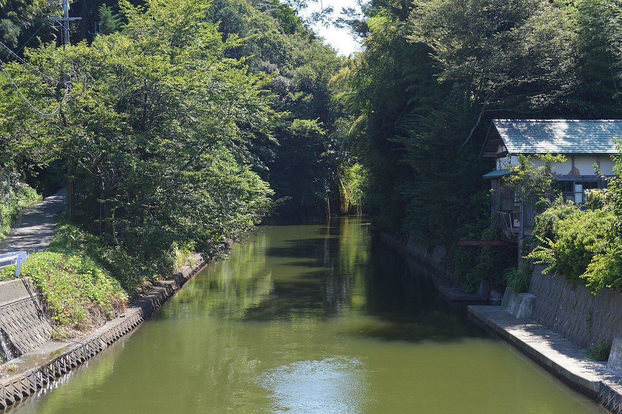
To reopen the lakes' outlet,they cut 36 m down through a hill.
Urami River ac (3).jpg
Photo by Asturio Cantabrio (CC BY-SA 4.0)

An earthquake in 1662 blocked the river that had been the outlet of the Mikata Five Lakes (三方五湖). About 20 days later the Obama domain began cutting through Urami Pass (浦見峠), and water flowed through the following year. From the top of the pass to the channel bed is about 36 m, and the channel is about 236 m long; the work took some 225,000 person-days. New rice fields appeared on the drained shores, and two new villages, Ikura (生倉) and Narude (成出), were founded.

  • Cut about 36 m deep
  • About 236 m long
  • Two new villages

02 / Boathouses and plums

Plums loaded into small boats,rowed across the lake to a song.

Funagoya Boathouse-01.jpg
Photo by Gohachiyasu1214 (CC BY-SA 4.0)

Thatched boathouses (舟小屋) still stand on the shore of Lake Mikata (三方湖). They held the boats used to reach the plum orchards on the far shore, and from the Meiji era to the mid-Shōwa era, mostly women loaded green plums into the boats and rowed out singing the Umeuri-uta (梅売り唄, plum sellers' song). Plum growing is said to have begun in Irazumi (伊良積) in the Tenpō era, and the main variety, Benisashi (紅映), was bred in Wakasa. About 80% of Fukui's plums are grown in this town.

  • Since the Tenpō era
  • Benisashi bred in Wakasa
  • About 80% of Fukui's plums

03 / Maekawa channel

A fast channel in front of the houses,with washing steps called kawato.

Kumakawa-juku Nakancho 2020-05 ac (6).jpg
Photo by Asturio Cantabrio (CC BY-SA 4.0)

Along the old road through Kumagawa-juku (熊川宿) runs a fast-flowing channel called the Maekawa (前川). In Kaminchō its water is taken from where the Kita and Amasu rivers meet; in Nakanchō it comes from the Kōchi River. Stone bridges cross it to the houses, and here and there are washing places called kawato (かわと). The town became an Important Preservation District for Groups of Traditional Buildings in 1996, and the channel's banks were lined with stone.

  • Kawato washing places
  • Stone-bridge entrances
  • Preservation district, 1996

Living here

Lakes and sea to the north, the Kumagawa valley to the south.

  • about 10,000 people
  • Rural district town

The town was formed in 2005 by the merger of Mikata and Kaminaka. To the north lie the Mikata Five Lakes, which it shares with Mihama, and the Tsunegami Peninsula (常神半島) jutting into Wakasa Bay. To the south, in Kaminaka, is Kumagawa-juku, near the old border with Ōmi. The gateway is Mikata Station on the JR Obama Line, on the side of the main Mikata town office. There are three interchanges on the Maizuru-Wakasa Expressway in the town.

People living here
14,003people
20052020

−8.2% since 2015

16,780 → 14,003

Area
178.49km²

51.11km² of it habitable

2024

Households
4,830households

2.9 people per household

2020

Rent (average for rentals)
—
Healthcare
2 hospitals / 8 clinics

7.1 per 10,000 people

2023

Area178.49km²Habitable land51.11km² / 29%
Area and habitable land at the same scalee-Stat B1101 / B1103
Children waiting for childcare
—9 nurseries and similar
Home purchase subsidy
—
Average annual temperature
—

These 3 items are waiting on a nationwide data source. We do not fill them with estimates.

Shape

Borders 3 municipalities across 1 prefectures.

Wakasa Town in Japan35.549°N 135.908°E
TokyoWakasa Town
Territory of Wakasa Town
Boundaries: National Land Numerical Information (N03)

North to south

27.7km

Fukui Prefecture
小浜市, 美浜町
Shiga Prefecture
高島市

Travel times per leg are not published by the municipality, so they are not shown.

Wakasa Town isthis kind of town.

  1. 01At the bottom of Lake Suigetsu (水月湖), 70,000 years of annual layers (varves) have built up without a break, and in 2012 they were adopted as the core of IntCal, the world standard scale for radiocarbon dating
  2. 02After an earthquake in 1662 blocked the lakes' outlet, the Obama domain cut down through a hill to dig the Urami River, and two new villages were founded on the lakeshore
  3. 03Thatched boathouses once used to carry plums remain on Lake Mikata, and in Kumagawa-juku to the south the Maekawa channel along the road has washing places called kawato

If something caught your eye, ask the town itself.