Hirai Tomb 1, decorated swords, Fujioka City
Article

10209 / ふじおかし

Gunma Prefecture

Fujioka City

Two swords found intact, side by side.

Hirai Tomb 1, decorated swords

Photo by Saigen Jiro (Public domain)

01 / Haniwa kiln

A climbing kiln about 10 m longfired haniwa until the end of the 6th century.

Haniwa kiln in Fujioka City
Photo by こやまひろ (CC BY 4.0)

Hongo Haniwa Kiln Site was discovered in 1906. It is confirmed to have operated from the late 5th century to the end of the 6th. Two kilns were excavated in 1943 and 1944, and the one in better condition is protected under a cover building. It is a large climbing kiln about 10 m long and 1.8 m wide.

  • About 10 m long, 1.8 m wide
  • Operated late 5th to end of 6th century
  • National Historic Site

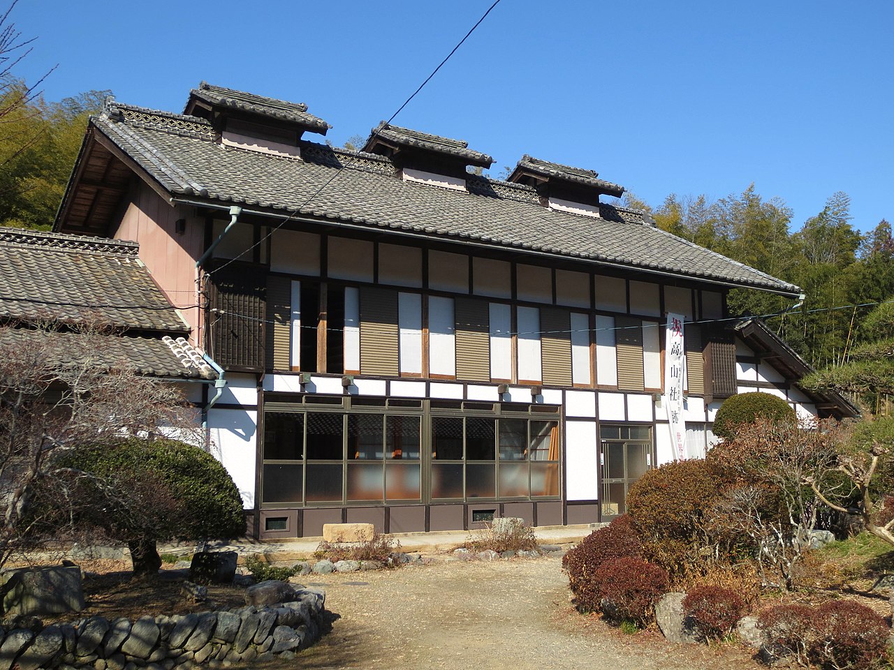
02 / Sericulture

For farmers without thermometers,room temperature meant “one lined kimono.”

Sericulture in Fujioka City
Photo by Qurren (CC BY-SA 3.0)

Takayama-sha Site is a World Heritage component and a National Historic Site. It is the birthplace of Takayama Chogoro, who researched and taught the sericulture method Seion-iku here. The target was 21 to 24 degrees and about 35 days of rearing; he put it as a room comfortable in a single lined kimono, with the rim of the silkworm basket at skin temperature. The main house and silkworm room have been under conservation work since fiscal 2021.

  • Room temperature 21–24 degrees
  • About 35 days of rearing
  • World Heritage component

03 / Pagoda

Said to be one of six treasure pagodas nationwide,a bronze tower 5.3 m high.

The sorinto tower at Johoji temple (Jodo-in) is said to be one of the six treasure pagodas nationwide built in 815 at the wish of Saicho. Of the six, only this one and a temple in Shimotsuke Province were completed in Saicho's lifetime. The present tower is a remodeling from 1672. It is bronze, and a city-designated Important Cultural Property.

  • Said to be built in 815
  • Remodeled in 1672
  • 5.3 m high, bronze

Fujioka City from the sky

Now and 1974–78. Tap a photo to zoom in.

Wide (about 6 km across)

Close (about 1.5 km across)

Now (shot December 2022 – February 2023)Shot 1974–78

Source: Geospatial Information Authority of Japan (GSI) GSI Tiles(全国最新写真(シームレス)/国土画像情報(第一期:1974〜1978年撮影))

Open in GSI Maps (now)Open in GSI Maps (1974–78)

Living here

110 minutes to Shinjuku by express bus.

  • about 60,000 people
  • 2 hours to a city centre

The city's railway stations are Gunma-Fujioka and Kita-Fujioka on the JR Hachiko Line, and for Tokyo you change at Takasaki Station. The express bus from the Fujioka Interchange stop at the express bus terminal takes 110 minutes to Shinjuku and 150 minutes to Tokyo Station (Nihon Chuo Bus, reservation required).

People living here
63,261people
2010

−3.7% since 2015

67,975 → 63,261

Area
180.29km²

75.46km² of it habitable

2024

Households
25,362households

2.5 people per household

2020

Rent (average for rentals)
43,315yen

National average 60,630 yen

2023

Healthcare
5 hospitals / 44 clinics

7.7 per 10,000 people

2023

Area180.29km²Habitable land75.46km² / 42%
Area and habitable land at the same scalee-Stat B1101 / B1103

Population from 2010 onward (municipal boundary changed).2006-01-01 に編入合併(鬼石町)。2010年調査から市域が変わっている。

Children waiting for childcare
—19 nurseries and similar
Home purchase subsidy
—
Average annual temperature
—

These 3 items are waiting on a nationwide data source. We do not fill them with estimates.

ACCESS

Where you can go from here.

Fujioka City in Japan36.259°N 139.075°E
OsakaFujioka City
Gunma-Fujioka Station
群馬藤岡駅2022
  • to ShinjukuHighway bus110min
  • to TokyoHighway bus150min

Travel times follow 日本中央バス(事業者公式)『前橋・高崎・藤岡~池袋・新宿・東京駅線』の高速バス時刻表(2026年4月1日乗車分より運賃改定の版・https://ncb.jp/emg.pdf)。『前橋~東京線』の群馬方面(下り)の表で、バスタ新宿(新宿駅南口)18:30発→池袋駅東口19:00→藤岡インター20:20(0110便)、同20:30発→池袋20:55→藤岡インター22:20(0114便)。バスターミナル東京八重洲(東京駅)19:50発→新宿20:30→池袋20:55→藤岡インター22:20(0114便)。表に運行日の注記は無い(同じ紙面の名古屋・大阪線の表には『毎日』『月~木』『金・土・日』の運行日の欄があるが、前橋~東京線の表には無い)。高速バスのバス停『藤岡インター』は道の駅ららん藤岡の高速バスターミナル(道の駅公式『高速バスターミナル』の3番のりば=池袋・新宿・東京駅線・日本中央バス)。 (checked 2026-10-21). They vary by time of day.

Shape

Borders 8 municipalities across 1 prefectures.

Territory of Fujioka City
Boundaries: National Land Numerical Information (Administrative Area Data), MLIT. Processed by Machigatari.Lakes: National Land Numerical Information (Lake Data), MLIT. Processed by Machigatari. Prepared with the approval of the Director-General of the Geospatial Information Authority of Japan, using its Digital Map 25000 (Spatial Data Framework) and Digital Map 25000 (Place Names and Public Facilities). (承認番号 平27情使、第585号)

North to south

19.5km

Fujioka City isthis kind of town.

  1. 01In the stone chamber of Hirai District Tomb No. 1, two decorated swords were unearthed side by side, intact, and the finds are designated Important Cultural Properties
  2. 02The climbing kiln at Hongo Haniwa Kiln Site, confirmed to have operated from the late 5th century to the end of the 6th, is protected under a cover building as a National Historic Site
  3. 03Takayama-sha Site, a World Heritage component, is where Seion-iku was taught, and Johoji temple has a sorinto tower said to be built at Saicho's wish

See the town as it is now.

Source: Wikidata (P2002, P2003, P2013, P2397)

If something caught your eye, ask the town itself.

From this town's themes