Sebayashi Ripple Marks, Kanna Town
Article

10367 / かんなまち

Gunma Prefecture 多野郡

Kanna Town

Dinosaur tracks, 20 years after listing

Sebayashi Ripple Marks

Photo by さかおり (CC BY-SA 4.0)

01 / Maru-Dai on Mount Nishi-Mikabo

On the mountain's south grass,a circle over 100 m wide with Dai.

Mount Nishi-Mikabo is a sacred mountain enshrining Fudo. On the grass of its south side, a circle more than 100 m across holding the character for "dai" (big) is cut out of the turf. The town records that in the Genroku era of the late 17th century an epidemic in Shori Village was cured, and in thanks villagers cut it out. Today a preservation society takes the lead, and the town records that it is held on a Sunday in September each year.

  • Over 100 m across
  • Genroku era, late 17th century
  • Town-designated Important Intangible Folk Cultural Property

02 / Kanna Nanataki

Among seven falls,Hayataki drops about 40 meters.

Kanna Nanataki in Kanna Town
Photo by Tatsuo TANABE (CC BY 3.0)

The town's tourism page lists seven falls, including Irisawa, Fudo, Hayataki and Azuki, as the Kanna Nanataki. The town records that Hayataki is rich in water with a drop of about 40 meters, and that Irisawa Falls can be viewed from behind, which is why it is also called the back falls.

  • Seven falls
  • Hayataki drop about 40 meters
  • Irisawa Falls viewed from behind

03 / Okawasesage at Nakayama Shrine

The portable shrine enters the Kanna Riverand circles to the right three times.

At the festival of Nakayama Shrine, young men carry the portable shrine bearing the deity into the Kanna River and purify it vigorously, circling to the right three times. It is placed on a seat built on the river shallows, and the town records that on the way back they stroll on, knocking down stacked pebble lanterns on both sides of the road. The prefecture designates this and two sites in Ueno Village as one item.

  • Prefecture-designated Important Intangible Folk Cultural Property (2005)
  • Three sites, one item
  • Three turns to the right

Kanna Town from the sky

Now and 1974–78. Tap a photo to zoom in.

Wide (about 6 km across)

Close (about 1.5 km across)

Now (shot December 2022 – February 2023)Shot 1974–78

Source: Geospatial Information Authority of Japan (GSI) GSI Tiles(全国最新写真(シームレス)/国土画像情報(第一期:1974〜1978年撮影))

Open in GSI Maps (now)Open in GSI Maps (1974–78)

Living here

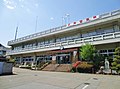
A town with no station, 70 minutes by bus from Gunma-Fujioka Station.

  • about 2,000 people
  • Rural district town

The town has no railway station. From Gunma-Fujioka Station on the JR Hachiko Line, a Nihon Chuo Bus route bus takes 70 minutes on the fastest daily service to reach Kanna Town Office. The town records an elevation of 340 meters around the office, with many terraced fields and no paddy fields at all.

People living here
1,645people
20052020

−15.8% since 2015

2,757 → 1,645

Area
114.6km²

13.32km² of it habitable

2024

Households
827households

2.0 people per household

2020

Rent (average for rentals)
—
Healthcare
0 hospitals / 3 clinics

18.2 per 10,000 people

2023

Area114.6km²Habitable land13.32km² / 12%
Area and habitable land at the same scalee-Stat B1101 / B1103
Children waiting for childcare
—1 nurseries and similar
Home purchase subsidy
—
Average annual temperature
—

These 3 items are waiting on a nationwide data source. We do not fill them with estimates.

ACCESS

Where you can go from here.

Kanna Town in Japan36.116°N 138.917°E
OsakaKanna Town
Kanna Town Office
神流町役場2014
  • to Gunma-FujiokaLocal bus70min
  • to ShinmachiLocal bus82min

Travel times follow 神流町公式『町へのアクセス』(ページID 1050・更新日 2024-06-06)からリンクされた『日本中央バス時刻表(令和6年4月)』=奥多野線 通過予定時刻表(令和6年4月1日改正・日本中央バス株式会社)の、新町駅・群馬藤岡駅発の下り(神流町役場前着)の表 (checked 2026-10-21). They vary by time of day.

Shape

Borders 6 municipalities across 1 prefectures.

Territory of Kanna Town
Boundaries: National Land Numerical Information (Administrative Area Data), MLIT. Processed by Machigatari.Lakes: National Land Numerical Information (Lake Data), MLIT. Processed by Machigatari. Prepared with the approval of the Director-General of the Geospatial Information Authority of Japan, using its Digital Map 25000 (Spatial Data Framework) and Digital Map 25000 (Place Names and Public Facilities). (承認番号 平27情使、第585号)

North to south

13.2km

Saitama Prefecture
Ogano Town, Chichibu City

Kanna Town isthis kind of town.

  1. 01The Sebayashi Ripple Marks are a Gunma Prefecture-designated Natural Monument, fossil ripple marks left on a sandy shore; in 1985 the dents on its surface were found to be dinosaur footprints, which the town designates separately as a Natural Monument
  2. 02Maru-Dai on Mount Nishi-Mikabo is cut into the grass as a circle over 100 m across holding the character Dai, in thanks for an epidemic cure in the Genroku era, the town records; the Kanna Nanataki are seven falls including Irisawa and Hayataki
  3. 03The Okawasesage at Nakayama Shrine forms one prefectural Important Intangible Folk Cultural Property with two sites in Ueno Village; the town lies in southwestern Gunma Prefecture, in Okutano, and has no railway station

If something caught your eye, ask the town itself.