Akkeshi Bridge, Akkeshi Town
Article

01662 / あっけしちょう

Hokkaido 厚岸郡

Akkeshi Town

First sea bridge in Hokkaido, town says.

Akkeshi Bridge

Photo by Highten31 (CC BY-SA 3.0)

01 / Kokutaiji Temple

For 60 years, head priestskept the temple's chronicle.
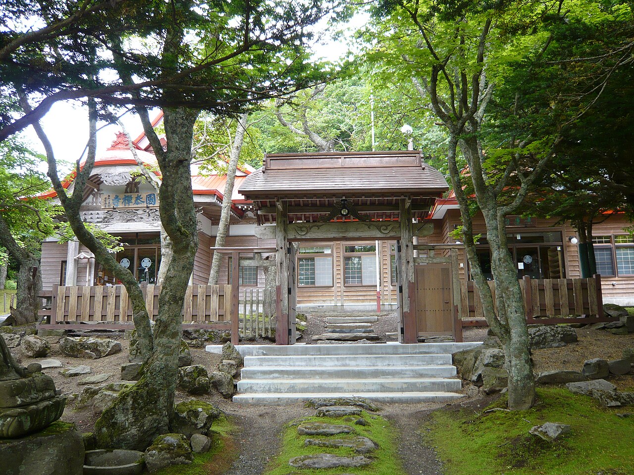
Kokutaiji Temple in Akkeshi Town
Photo by Opqr (CC BY-SA 3.0)

Kokutaiji is one of the Ezo Sankanji, three temples the shogunate built in eastern Ezo. Its head priests kept a chronicle from 1804 to 1863 that also records crops grown and wild plants gathered. The materials that include it are a national Important Cultural Property, and the grounds are a national historic site.

  • Records of 1804 to 1863
  • National Important Cultural Property
  • National historic site

02 / Akkeshiso

A plant first collected on Oyster Islandwas named for Akkeshi.

Akkeshiso in Akkeshi Town
Photo by ブルーノ・プラス (CC BY-SA 4.0)

In 1891 a plant was first collected on Oyster Island in Lake Akkeshi, and a professor at Sapporo Agricultural College (now Hokkaido University) named it Akkeshiso after the place it was collected. The island's formal name is Benten Island, and its Benten Shrine appears in a record of 1791. The town notes that the island has shrunk because the ground sank.

  • First collected in 1891
  • Shrine recorded in 1791
  • Island shrunk as ground sank

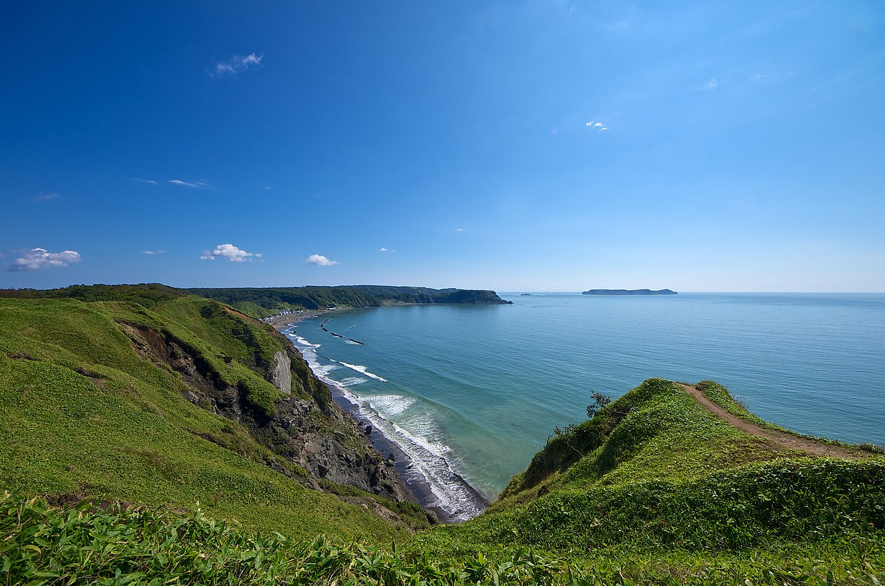
03 / Cape Aikappu

The town says the cape's original name isAinu Ai-kappu, "the thing above the arrow."

Cape Aikappu in Akkeshi Town
Photo by FoxyStranger Kawasaki (CC BY-SA 3.0)

Cape Aikappu stands on sea cliffs several tens of meters high, jutting into Akkeshi Bay. The name came from the thought of overcoming impossible hardship to win the crown of love, and the town records that the original name is the Ainu Ai-kappu, meaning "the thing above the arrow." In 1992 the Bell Arch of Love was completed.

  • Cliffs tens of meters high
  • Ai-kappu: above the arrow (town)
  • Bell Arch completed in 1992

Akkeshi Town from the sky

Now and 1974–78. Tap a photo to zoom in.

Wide (about 6 km across)

Close (about 1.5 km across)

Now (shot September 2019)Shot 1974–78

Source: Geospatial Information Authority of Japan (GSI) GSI Tiles(全国最新写真(シームレス)/国土画像情報(第一期:1974〜1978年撮影))

Open in GSI Maps (now)Open in GSI Maps (1974–78)

Living here

About 50 minutes from Kushiro on the Hanasaki Line.

  • about 9,000 people
  • Rural district town

The town's access page (checked October 2026) gives about 50 minutes from Kushiro to Akkeshi on the JR Hanasaki Line. Four active JR stations stand in town, including Akkeshi Station, and all four appear in the JR Hokkaido October 2026 timetable.

People living here
8,892people
19952020

−9.1% since 2015

13,076 → 8,892

Area
739.12km²

194.13km² of it habitable

2024

Households
4,021households

2.2 people per household

2020

Rent (average for rentals)
—
Healthcare
1 hospital / 2 clinics

3.4 per 10,000 people

2023

Area739.12km²Habitable land194.13km² / 26%
Area and habitable land at the same scalee-Stat B1101 / B1103
Children waiting for childcare
—3 nurseries and similar
Home purchase subsidy
—
Average annual temperature
—

These 3 items are waiting on a nationwide data source. We do not fill them with estimates.

Shape

Borders 4 municipalities.

Akkeshi Town in Japan43.052°N 144.847°E
TokyoOsakaAkkeshi Town
Territory of Akkeshi Town
Boundaries: National Land Numerical Information (Administrative Area Data), MLIT. Processed by Machigatari.Lakes: National Land Numerical Information (Lake Data), MLIT. Processed by Machigatari. Prepared with the approval of the Director-General of the Geospatial Information Authority of Japan, using its Digital Map 25000 (Spatial Data Framework) and Digital Map 25000 (Place Names and Public Facilities). (承認番号 平27情使、第585号)

North to south

45.1km

Travel times per leg are not published by the municipality, so they are not shown.

Akkeshi Town isthis kind of town.

  1. 01Akkeshi Bridge links the south and north shores of the lake, is 456.5 m long, opened in September 1972, and the town records it as Hokkaido's first sea bridge
  2. 02Kokutaiji is one of the Ezo Sankanji; the materials that include the chronicle its head priests kept from 1804 to 1863 are a national Important Cultural Property, and its grounds are a national historic site
  3. 03Akkeshiso, first collected on Oyster Island in 1891, took the name of Akkeshi, and the town records that the original name of Cape Aikappu is the Ainu Ai-kappu

See the town as it is now.

Source: Wikidata (P2002, P2003, P2013, P2397)

If something caught your eye, ask the town itself.