Katanagake Rock, Raiden Coast, Iwanai Town
Article

01402 / いわないちょう

Hokkaido 岩内郡

Iwanai Town

Legend says a sword hung on this rock.

Katanagake Rock, Raiden Coast

Photo by ja:GOXZ7 (CC BY-SA 3.0)

01 / Kumano Shrine plaque

A plaque from a shrine meant to guardtravelers from bears is signed by Takeshiro.

Kumano Shrine plaque in Iwanai Town
Photo by Matsuura Takeshiro 松浦武四郎 (1818-1888) (Public domain)

Cultural Heritage Online records that in 1857 the explorer Matsuura Takeshiro was asked by a woodcutter at Raiden Pass to build a shrine to protect travelers from bears, and wrote to the Hakodate magistrate. The plaque reads "Kumano" on the front and bears Takeshiro's signature on the back.

  • Town-designated tangible cultural property
  • Designated 26 Nov 2018
  • "Kumano" front, signature back

02 / Akasaka yakko

In festival streets, the town-designatedIwanai Akasaka Yakko procession walks.

The town's overview describes the 200-year-old festival of Iwanai Shrine as one where two mikoshi and the procession of the town intangible cultural property Akasaka yakko parade through the streets. Akasaka yakko was designated a town intangible folk cultural property on 5 July 1983, and the mikoshi racing up the shrine slope is a highlight.

  • Town intangible folk property
  • Designated 5 July 1983
  • Two mikoshi race up the shrine slope

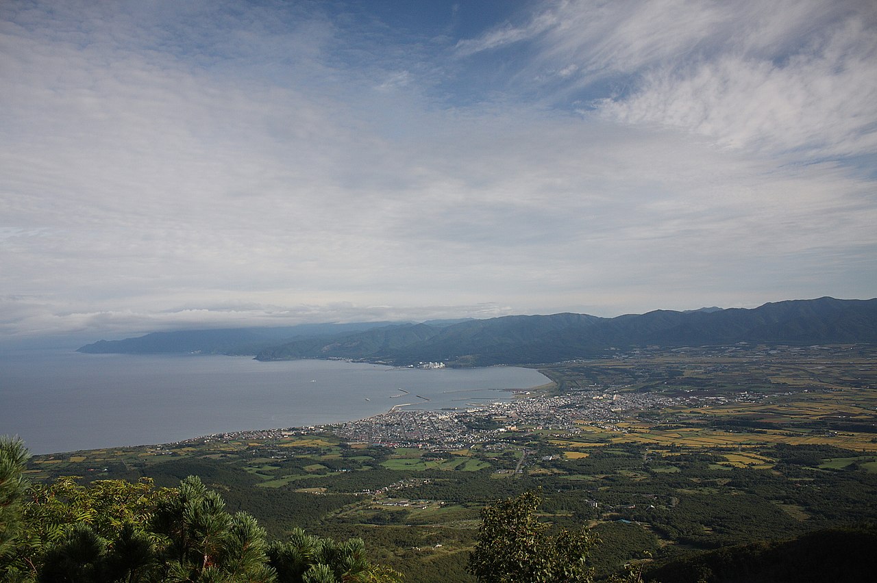
03 / Mt. Iwanai

A town with the Sea of Japan to the north,Mt. Iwanai to the south, at a peninsula's base.

Mt. Iwanai in Iwanai Town
Photo by 柴田拓 (CC BY-SA 3.0)

The town's overview places Iwanai at the western base of the Shakotan Peninsula, facing the Sea of Japan to the north with Mt. Iwanai of the Niseko range to the south, covering 70.60 km². From Maruyama Observatory the townscape and the peninsula spread out, and Iwanai's night view was certified a Japan Night View Heritage site in 2018.

  • Area 70.60 km²
  • Maruyama Observatory views the peninsula
  • Japan Night View Heritage, 2018

Iwanai Town from the sky

Now and 1974–78. Tap a photo to zoom in.

Wide (about 6 km across)

Close (about 1.5 km across)

Now (shot May–August 2025)Shot 1974–78

Source: Geospatial Information Authority of Japan (GSI) GSI Tiles(全国最新写真(シームレス)/国土画像情報(第一期:1974〜1978年撮影))

Open in GSI Maps (now)Open in GSI Maps (1974–78)

Living here

No station; 44 minutes by bus from Kutchan.

  • about 10,000 people
  • Rural district town

There is no railway station in the town, and the Japanese National Railways' Iwanai Line closed in 1985. From Kutchan Station on the JR Hakodate Main Line, the Niseko Bus Ozawa Line reaches Iwanai Terminal with no change; on the summer timetable revised on 1 April 2026, every daily service takes 44 minutes.

People living here
11,648people
19952020

−10.7% since 2015

17,895 → 11,648

Area
70.6km²

13.84km² of it habitable

2024

Households
5,750households

2.0 people per household

2020

Rent (average for rentals)
—
Healthcare
1 hospital / 10 clinics

9.4 per 10,000 people

2023

Area70.6km²Habitable land13.84km² / 20%
Area and habitable land at the same scalee-Stat B1101 / B1103
Children waiting for childcare
—3 nurseries and similar
Home purchase subsidy
—
Average annual temperature
—

These 3 items are waiting on a nationwide data source. We do not fill them with estimates.

ACCESS

Where you can go from here.

Iwanai Town in Japan42.980°N 140.515°E
TokyoOsakaIwanai Town
Iwanai Town Office
岩内町役場2018
  • to KutchanLocal bus44min

Travel times follow ニセコバス『小沢線』(令和8年4月1日改正・2026夏ダイヤ。https://www.nisekobus.co.jp/uploads/小沢線_compressed-1.pdf 。倶知安駅前⇔厚生病院前⇔小沢⇔岩内ターミナル)。倶知安駅前発→岩内ターミナル着:平日7:00→7:44・8:00→8:44・9:05→9:49・12:30→13:14・16:05→16:49・17:15→17:59・18:40→19:24、土日祝8:25→9:09・10:30→11:14・14:45→15:29・18:40→19:24=全便44分。逆向き(岩内ターミナル発→倶知安駅前着)も平日6:00→6:44ほか・土日祝7:20→8:04ほか全便44分 (checked 2026-10-29). They vary by time of day.

Shape

Borders 2 municipalities.

Territory of Iwanai Town
Boundaries: National Land Numerical Information (Administrative Area Data), MLIT. Processed by Machigatari.Lakes: National Land Numerical Information (Lake Data), MLIT. Processed by Machigatari. Prepared with the approval of the Director-General of the Geospatial Information Authority of Japan, using its Digital Map 25000 (Spatial Data Framework) and Digital Map 25000 (Place Names and Public Facilities). (承認番号 平27情使、第585号)

North to south

11.7km

Iwanai Town isthis kind of town.

  1. 01Katanagake Rock on the Raiden Coast is a rock where a sword is said to have hung, and the Iwanai Tourism Association calls it the town's symbolic rock
  2. 02The Kumano Shrine plaque reads "Kumano" on the front and bears Matsuura Takeshiro's signature on the back, and is a designated town cultural property
  3. 03The town's overview places it at the base of the Shakotan Peninsula, with no railway station, reached by bus from Kutchan Station

If something caught your eye, ask the town itself.