Oyunuma, Niseko Yumoto, Rankoshi Town
Article

01394 / らんこしちょう

Hokkaido 磯谷郡

Rankoshi Town

A pond with a geyser until mid-Taisho.

Oyunuma, Niseko Yumoto

Photo by Soica2001 (Public domain)

01 / Shell museum

Shells from towns and peopleacross Japan, 30,000 of them.

Shell museum in Rankoshi Town
Photo by shell fish museum of Rankoshi (CC BY-SA 3.0)

The town's shell museum holds 30,000 shells donated by some 500-odd municipalities and individuals nationwide, with 1,500 species and 5,000 shells always on show. The town says it was particular about its 4 km of coastline, and a giant clam shell weighing 194 kg is among the displays.

  • 30,000 shells donated
  • 1,500 species, 5,000 shells on display
  • Opening ceremony: July 29, 1991

02 / Town name

From the Ainu Ranko-ushi, it is said,a place of many katsura trees.

The town explains that Rankoshi is a corruption of the Ainu Ranko-ushi, meaning a place of many katsura trees. Minami-Shiribetsu Village split from Shiribetsu Village in 1899. When it became a town in 1954, it was renamed Rankoshi. The town emblem combines an orchid flower with four katakana ko characters.

  • 1899: split off as Minami-Shiribetsu Village
  • Dec. 1, 1954: renamed Rankoshi Town
  • Emblem: an orchid and four ko

03 / Shiribetsu River

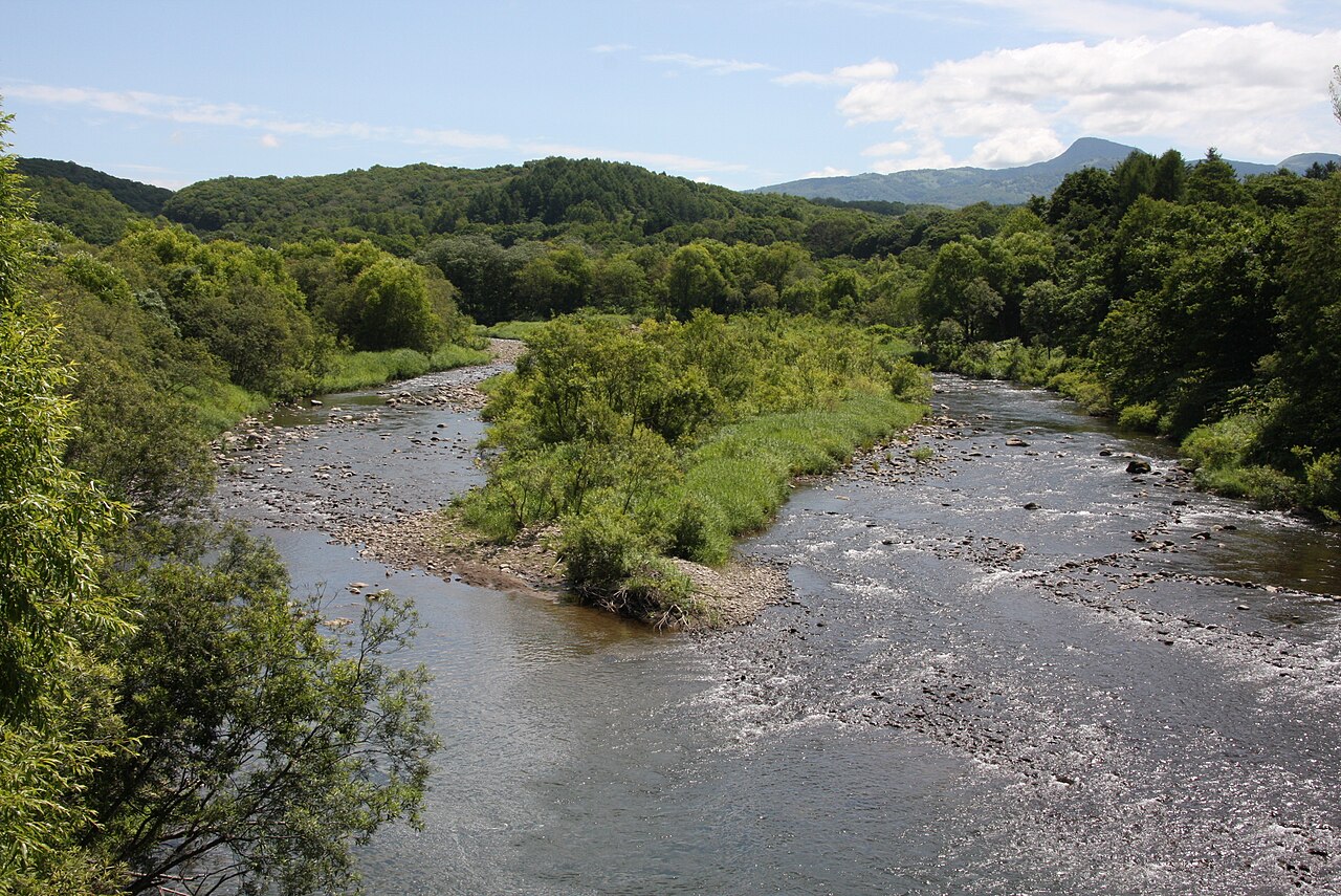
The Shiribetsu River runs 30 kmeast to west through the town.

Shiribetsu River in Rankoshi Town
Photo by Highten31 (CC BY-SA 3.0)

The town calls the Shiribetsu River the largest river in southern Hokkaido. It runs through the middle of Rankoshi for about 30 km from east to west and flows into the Sea of Japan, the town says. The flat land spread along it is fertile and suited to paddy fields.

  • About 30 km, east to west
  • Through the middle of the town
  • Town calls it southern Hokkaido's largest river

Rankoshi Town from the sky

Now and 1974–78. Tap a photo to zoom in.

Wide (about 6 km across)

Close (about 1.5 km across)

Now (shot May–September 2025)Shot 1974–78

Source: Geospatial Information Authority of Japan (GSI) GSI Tiles(全国最新写真(シームレス)/国土画像情報(第一期:1974〜1978年撮影))

Open in GSI Maps (now)Open in GSI Maps (1974–78)

Living here

3 hours by train from Sapporo or Hakodate.

  • about 5,000 people
  • Rural district town

The town's access page says it is 3 hours on the JR Hakodate Main Line from both Sapporo and Hakodate (checked October 2026). The town's stations on the line are Konbu, Mena and Rankoshi, and the gateway is Rankoshi Station.

People living here
4,568people
19952020

−5.7% since 2015

6,450 → 4,568

Area
449.78km²

94.78km² of it habitable

2024

Households
2,081households

2.2 people per household

2020

Rent (average for rentals)
—
Healthcare
1 hospital / 3 clinics

8.8 per 10,000 people

2023

Area449.78km²Habitable land94.78km² / 21%
Area and habitable land at the same scalee-Stat B1101 / B1103
Children waiting for childcare
—2 nurseries and similar
Home purchase subsidy
—
Average annual temperature
—

These 3 items are waiting on a nationwide data source. We do not fill them with estimates.

Shape

Borders 7 municipalities.

Rankoshi Town in Japan42.809°N 140.528°E
TokyoOsakaRankoshi Town
Territory of Rankoshi Town
Boundaries: National Land Numerical Information (Administrative Area Data), MLIT. Processed by Machigatari.Lakes: National Land Numerical Information (Lake Data), MLIT. Processed by Machigatari. Prepared with the approval of the Director-General of the Geospatial Information Authority of Japan, using its Digital Map 25000 (Spatial Data Framework) and Digital Map 25000 (Place Names and Public Facilities). (承認番号 平27情使、第585号)

North to south

30.9km

Travel times per leg are not published by the municipality, so they are not shown.

Rankoshi Town isthis kind of town.

  1. 01Oyunuma is a natural hot-spring pond in the Niseko Yumoto hot spring area that gives off sulfur-laden gas and steam. The town, citing its town history, says a geyser spouted there until mid-Taisho, and small yellow sulfur spheres wash up along its edge
  2. 02In a town with 4 km of Sea of Japan coast, the shell museum holds 30,000 donated shells from across Japan. The town explains its name as a corruption of the Ainu Ranko-ushi, and the Shiribetsu River runs about 30 km through its middle
  3. 03The town's stations on the Hakodate Main Line are Konbu, Mena and Rankoshi, and the town gives 3 hours from Sapporo or Hakodate

If something caught your eye, ask the town itself.

From this town's themes