Miwa Town, name changed, Kuromatsunai Town
Article

01393 / くろまつないちょう

Hokkaido 寿都郡

Kuromatsunai Town

Renamed four months after town status.

Miwa Town, name changed

Photo by アラツク (CC BY-SA 4.0)

01 / Utasai Beech Forest

Utasai Beech Forest has survivedtwo threats of logging.

The town writes that the beech forest running on from Honshu breaks off at the Kuromatsunai Lowland, which links Suttsu and Oshamambe, and names Utasai Beech Forest as its representative. Around 1944 a logging plan was halted by a scholar's appeal; in 1954 a petition from local residents kept the designation from being lifted.

  • National natural monument (designated 1928)
  • About 92 hectares
  • Beech limit: the lowland linking Suttsu and Oshamambe
02 / Beech character

The town writes beech with its own"precious" character, not "nothing".

Beech is generally written with the tree radical and the character for "nothing", but the town reads beech as the tree radical with the character for "precious", calling the tree indispensable to Kuromatsunai. The town's chronology says it began using that character around 1985.

  • Usually written with "nothing"
  • Town writes it with "precious"
  • In use from about 1985

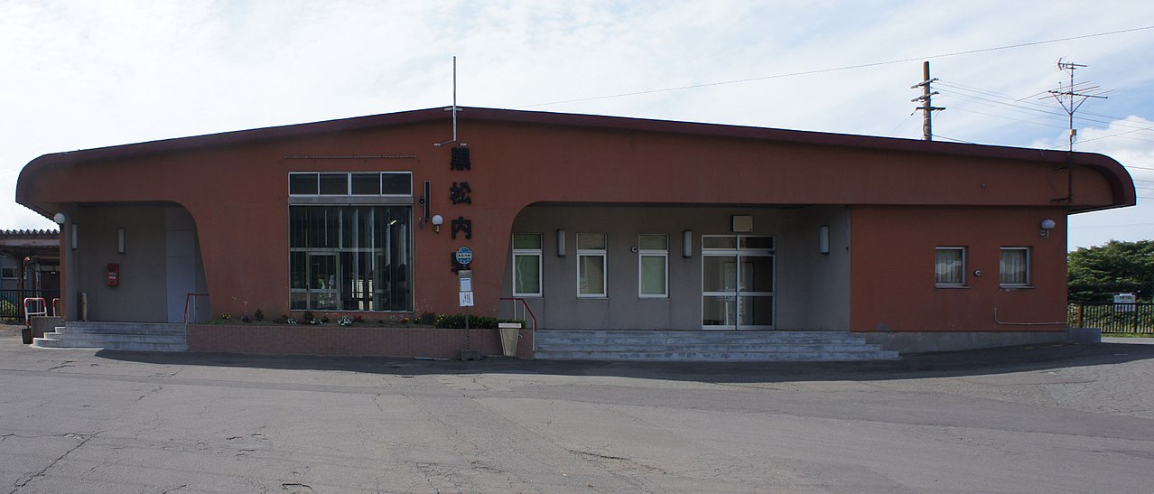
03 / Kuromatsunai Station

The station opened in 1903,and the railway town bustled.

Kuromatsunai Station in Kuromatsunai Town
Photo by Mister0124 (CC BY-SA 4.0)

The town's chronology records that in 1903 the railway from Hakodate opened, with Kuromatsunai Station and one other station in the town, and the town bustled as a railway town. When the Muroran Main Line opened in 1928, the railway hub moved to Oshamambe.

  • Station opened in 1903
  • JR Hakodate Main Line
  • Hub moved to Oshamambe in 1928

Kuromatsunai Town from the sky

Now and 1974–78. Tap a photo to zoom in.

Wide (about 6 km across)

Close (about 1.5 km across)

Now (shot August–September 2022)Shot 1974–78

Source: Geospatial Information Authority of Japan (GSI) GSI Tiles(全国最新写真(シームレス)/国土画像情報(第一期:1974〜1978年撮影))

Open in GSI Maps (now)Open in GSI Maps (1974–78)

Living here

Midway between Sapporo and Hakodate, with no coast.

  • about 3,000 people
  • Rural district town

The town says it lies about midway between Sapporo City and Hakodate City and touches neither the Sea of Japan nor the Pacific directly. Two stations on the JR Hakodate Main Line, including Kuromatsunai Station, are in town and appear in the JR Hokkaido timetable for October 2026.

People living here
2,791people
19952020

−9.4% since 2015

3,875 → 2,791

Area
345.65km²

65.75km² of it habitable

2024

Households
1,298households

2.2 people per household

2020

Rent (average for rentals)
—
Healthcare
0 hospitals / 4 clinics

14.3 per 10,000 people

2023

Area345.65km²Habitable land65.75km² / 19%
Area and habitable land at the same scalee-Stat B1101 / B1103
Children waiting for childcare
—1 nurseries and similar
Home purchase subsidy
—
Average annual temperature
—

These 3 items are waiting on a nationwide data source. We do not fill them with estimates.

Shape

Borders 5 municipalities.

Kuromatsunai Town in Japan42.668°N 140.308°E
TokyoOsakaKuromatsunai Town
Territory of Kuromatsunai Town
Boundaries: National Land Numerical Information (Administrative Area Data), MLIT. Processed by Machigatari.Lakes: National Land Numerical Information (Lake Data), MLIT. Processed by Machigatari. Prepared with the approval of the Director-General of the Geospatial Information Authority of Japan, using its Digital Map 25000 (Spatial Data Framework) and Digital Map 25000 (Place Names and Public Facilities). (承認番号 平27情使、第585号)

North to south

20.4km

Travel times per leg are not published by the municipality, so they are not shown.

Kuromatsunai Town isthis kind of town.

  1. 01Kuromatsunai Town formed in 1955 as Miwa Village by merging two villages and part of a third, became Miwa Town in January 1959 and was renamed Kuromatsunai Town that May
  2. 02Utasai Beech Forest was designated a national natural monument in 1928; the town writes that the beech forest running on from Honshu breaks off at the Kuromatsunai Lowland, and it writes beech with its own "precious" character
  3. 03Kuromatsunai Station on the JR Hakodate Main Line opened in 1903; the town lies about midway between Sapporo City and Hakodate City, and a mountain in the town looks out on both the Sea of Japan and the Pacific

If something caught your eye, ask the town itself.