Unosu Cliff, five linked cliffs, Tanohata Village
Article

03484 / たのはたむら

Iwate Prefecture 下閉伊郡

Tanohata Village

The cliff is named for cormorant nests.

Unosu Cliff, five linked cliffs

Photo by Satoh Junpei (CC BY-SA 3.0)

01 / Shian Slope

Officials reportedly wavered on this slope,now crossed by bridges 105 m and 115 m high.

Shian Slope in Tanohata Village
Photo by kosoniya (CC BY-SA 3.0)

Shianzaka in Magisawa is a slope where officials and teachers sent to the village are said to have wondered whether to turn back. Magisawa Bridge and Shianzaka Ohashi cross it, and on the next slope beyond stands Shii-no-Ohashi. Shii-no-Ohashi is named after the nearby "Shii no Mori" woods, with the villagers' hopes.

  • Magisawa Bridge 105 m above the valley floor
  • Shianzaka Ohashi 115 m
  • Shii-no-Ohashi 120 m

02 / Tsukuehama Banya

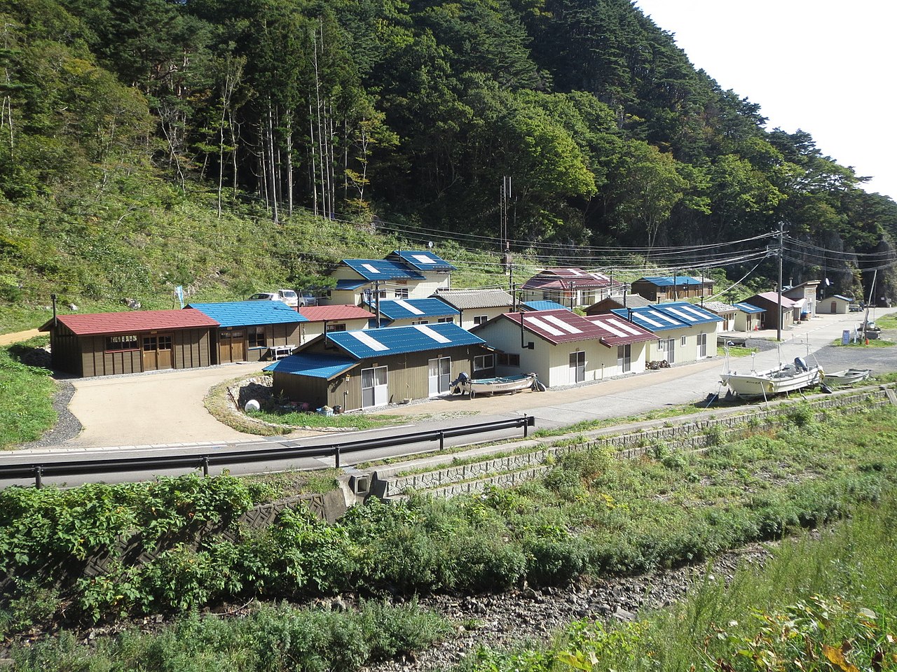
22 rebuilt huts on the shorehuddle together in a small cove.

Tsukuehama Banya in Tanohata Village
Photo by Ty19080914 (CC BY-SA 4.0)

A banya is a hut that fishermen use for storing gear and working. Fishermen of Tsukue, who lived on the hill, built huts on the shore with their own hands. The 22 standing now are reconstructions of the earlier huts, in the same places and forms. In 2006 the huts were chosen for the "100 Historical and Cultural Fishing Village Properties to Preserve for the Future".

  • 22 reconstructed huts
  • Chosen as one of the 100 properties in 2006
  • Gear sheds and workshops built by fishermen

03 / New minerals

New minerals turned up in the mine spoil;the village says six came from Tanohata.

The Tanohata Mine was developed from around 1926 and closed in 1973. The village's Geo World page says that, of 13 new minerals found in Iwate, six including tanohataite, named for its locality, came from this mine.

  • Developed from around 1926
  • Closed in 1973
  • 6 of 13 new minerals in Iwate

Tanohata Village from the sky

Now and 1974–78. Tap a photo to zoom in.

Wide (about 6 km across)

Close (about 1.5 km across)

Shot 1974–78

Source: Geospatial Information Authority of Japan (GSI) GSI Tiles(国土画像情報(第一期:1974〜1978年撮影))

Open in GSI Maps (1974–78)

Living here

From Tanohata Station, a shared taxi to the huts.

  • about 3,000 people
  • Rural district town

The village has two stations on the Sanriku Railway Rias Line: Tanohata and Shimanokoshi. From Tanohata Station the village runs a sightseeing shared taxi timed to the trains, linking the Tsukuehama huts and Kitayamazaki. It must be booked by phone at least an hour before departure (timetable revised 1 June 2026).

People living here
3,059people
19952020

−11.7% since 2015

4,806 → 3,059

Area
156.19km²

21.97km² of it habitable

2024

Households
1,233households

2.5 people per household

2020

Rent (average for rentals)
—
Healthcare
0 hospitals / 3 clinics

9.8 per 10,000 people

2023

Area156.19km²Habitable land21.97km² / 14%
Area and habitable land at the same scalee-Stat B1101 / B1103
Children waiting for childcare
—1 nurseries and similar
Home purchase subsidy
—
Average annual temperature
—

These 3 items are waiting on a nationwide data source. We do not fill them with estimates.

Shape

Borders 2 municipalities.

Tanohata Village in Japan39.931°N 141.889°E
TokyoOsakaTanohata Village
Territory of Tanohata Village
Boundaries: National Land Numerical Information (Administrative Area Data), MLIT. Processed by Machigatari.

North to south

14.8km

Travel times per leg are not published by the municipality, so they are not shown.

Tanohata Village isthis kind of town.

  1. 01Unosu Cliff is a five-part cliff 200 m high at the village's southern end, named for the Japanese cormorant nests halfway up, and Kitayamazaki has a cliff coastline running about 8 km
  2. 02Three bridges 105 to 120 m high span the Shianzaka slope and the one beyond it, and at Tsukuehama 22 reconstructed banya, fishermen's huts for gear and work, stand together
  3. 03The village records six new minerals from the Tanohata Mine, and the white-flowered rhododendron grove at Kitayamazaki and a deer dance and sword dance are prefectural designations

See the town as it is now.

Source: Wikidata (P2002, P2003, P2013, P2397)

If something caught your eye, ask the town itself.