Yagishiri Forest, Onko yew, Haboro Town
Article

01484 / はぼろちょう

Hokkaido 苫前郡

Haboro Town

Yagishiri Island's natural forest is a national natural monument.

Yagishiri Forest, Onko yew

Photo by Yobito KAYANUMA (CC BY-SA 3.0)

01 / Teuri Island

Seabirds breed on the western cliffs,and people live in the east.

Teuri Island in Haboro Town
Photo by 㭍月例祭 (CC BY-SA 4.0)

Teuri Island has a circumference of 12 km. Its west side is a sheer cliff and its east side is flat, where people live. The seabird breeding ground is a national natural monument, and the Hokkaido Regional Forest Office presents it as the only breeding site in Japan of the Common Murre, known as the Ororon bird.

  • National natural monument since 1938, per the Agency for Cultural Affairs
  • Rhinoceros auklets dig burrows underground, per its commentary
  • Island circumference: 12 km

02 / Former Ono House

A home, shop, post office and telegraph office in one,a house of 1900 with a Western-style exterior.

The former Ono House on Yagishiri Island is a Hokkaido-designated tangible cultural property, and the town says it was built in 1900. According to the town, the Ono family, from Ishikawa Prefecture, ran fishing alongside a drapery and general store, and the building included a shop and was combined with a post office and a telegraph office.

  • Built in 1900, per the town
  • Hokkaido-designated tangible cultural property (1979)
  • Open as Yagishiri Local History Museum, per the town

03 / Haboro Rose Garden

A park of about 300 kinds of roses,mainly northern types, 2,000 plants.

Haboro Rose Garden in Haboro Town
Photo by Decimator (CC BY-SA 3.0)

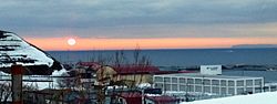
According to the town, Haboro Rose Garden is a park with about 300 kinds of roses, mainly northern types, 2,000 plants in all, at their peak from mid-July to early August. The town's overview says that from Sunset Beach you can see Teuri and Yagishiri islands and the sun setting into the Sea of Japan.

  • About 300 kinds, 2,000 plants, per the town
  • Peak: mid-July to early August
  • Sunsets seen from Haboro Sunset Beach

Haboro Town from the sky

Now and 1974–78. Tap a photo to zoom in.

Wide (about 6 km across)

Close (about 1.5 km across)

Now (shot June–July 2025)Shot 1974–78

Source: Geospatial Information Authority of Japan (GSI) GSI Tiles(全国最新写真(シームレス)/国土画像情報(第一期:1974〜1978年撮影))

Open in GSI Maps (now)Open in GSI Maps (1974–78)

Living here

No station, but two islands offshore.

  • about 7,000 people
  • Rural district town

There is no railway station in the town. According to the town, it lies near the center of the Rumoi area facing the Sea of Japan, with the two islands of Teuri and Yagishiri offshore. The average annual temperature is around 7 degrees, and the Tsushima Current is said to make it relatively mild with small temperature swings.

People living here
6,548people
19952020

−10.6% since 2015

10,102 → 6,548

Area
472.65km²

90.14km² of it habitable

2024

Households
3,143households

2.1 people per household

2020

Rent (average for rentals)
—
Healthcare
2 hospitals / 3 clinics

7.6 per 10,000 people

2023

Area472.65km²Habitable land90.14km² / 19%
Area and habitable land at the same scalee-Stat B1101 / B1103
Children waiting for childcare
—1 nurseries and similar
Home purchase subsidy
—
Average annual temperature
—

These 3 items are waiting on a nationwide data source. We do not fill them with estimates.

ACCESS

Where you can go from here.

Haboro Town in Japan44.361°N 141.697°E
TokyoOsakaHaboro Town
Haboro Town Office
羽幌町役場2010
  • to HoronobeLocal bus124min

Travel times follow 沿岸バス『時刻表 郊外線総合(令和8年10月1日改正)』(http://www.engan-bus.co.jp/10_pdf/timetable/20261001_timetable_localnetwork.pdf を 2026-10-29 に読んだ)。幌延駅→羽幌ターミナルは12系統(幌延留萌線)で7:49発→9:53着・11:59発→14:03着・15:29発→17:33着(いずれも124分。1月1日運休〈△〉または12月31日〜1月3日運休〈◇〉の注記だけの毎日運転の便)。16:29発は土日祝運休(●)、6:10発は土日祝運行(☆)で採らない。 (checked 2026-10-29). They vary by time of day.

Shape

Borders 4 municipalities.

Territory of Haboro Town
Boundaries: National Land Numerical Information (Administrative Area Data), MLIT. Processed by Machigatari.Lakes: National Land Numerical Information (Lake Data), MLIT. Processed by Machigatari. Prepared with the approval of the Director-General of the Geospatial Information Authority of Japan, using its Digital Map 25000 (Spatial Data Framework) and Digital Map 25000 (Place Names and Public Facilities). (承認番号 平27情使、第585号)

Haboro Town isthis kind of town.

  1. 01Yagishiri Island's natural forest was designated a national natural monument in 1983. The Haboro Tourism Association says a third of the island is primeval forest, with about 150,000 trees of some 50 species. The town tree is the onko (Japanese yew)
  2. 02Teuri Island has cliffs on its west side and flat land in the east where people live, and its seabird breeding ground is a national natural monument. The former Ono House on Yagishiri is a house of 1900 with a Western-style exterior, combining a shop, post office and telegraph office
  3. 03Haboro Rose Garden has about 300 kinds of roses, mainly northern types, 2,000 plants. The town has no railway station and has the two islands of Teuri and Yagishiri offshore

If something caught your eye, ask the town itself.