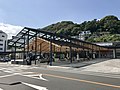
Yamagami no Juso grove, Yugawara Town
Article

14384 / ゆがわらまち

Kanagawa Prefecture 足柄下郡

Yugawara Town

About 620 m², a national monument.

Yamagami no Juso grove

Photo by さかおり (CC BY-SA 4.0)

01 / Grove

A grove enshrined as the ‘mountain god’grows yabunikkei and tabunoki trees.

Grove in Yugawara Town
Photo by さかおり (CC BY-SA 4.0)

The town says a grove stands north of Yugawara Station, enshrined as the ‘mountain god’, with a small shrine inside. Yabunikkei, tabunoki, camphor, inumaki and zelkova trees grow there. It covers about 620 m² and was designated a National Natural Monument on 7 September 1939.

  • National Natural Monument, 7 Sept 1939
  • About 620 m² (town)
  • Westernmost evergreen broadleaf forest in the prefecture (town)

02 / Giant tree

At designation: trunk girth about 6 m,the main trunk split into four branches.

Giant tree in Yugawara Town
Photo by さかおり (CC BY 4.0)

The byakushin (Chinese juniper) in the grounds of Joganji Temple was designated a National Natural Monument on 7 September 1939. The Agency for Cultural Affairs describes it as about 6 m around at eye level, its main trunk divided into four branches, and a notable giant juniper. The town gives 20 m above ground and says it is said to be the largest in Kanagawa Prefecture.

  • National Natural Monument, 7 Sept 1939
  • About 6 m trunk girth (Agency for Cultural Affairs)
  • 20 m above ground (town)

03 / Mineral

A zeolite a junior high schooler found at Fudo-taki Fallswas named the prefecture’s mineral.

According to the Hakone Geopark, Sakurai Kinichi found the zeolite at Fudo-taki Falls in 1930 as a junior high school student; the paper came out in 1952. In its 2016 ‘Prefectural Stones’, the Geological Society of Japan named Yugawaralite as Kanagawa Prefecture’s mineral. The area around the falls is a town-designated natural monument.

  • Found 1930, paper 1952 (Hakone Geopark)
  • Kanagawa’s mineral (Geological Society of Japan, 2016)
  • Source area a town natural monument

Yugawara Town from the sky

Now and 1974–78. Tap a photo to zoom in.

Wide (about 6 km across)

Close (about 1.5 km across)

Now (shot July 2019 – March 2020)Shot 1974–78

Source: Geospatial Information Authority of Japan (GSI) GSI Tiles(全国最新写真(シームレス)/国土画像情報(第一期:1974〜1978年撮影))

Open in GSI Maps (now)Open in GSI Maps (1974–78)

Living here

73 minutes to Tokyo on the Odoriko.

  • about 20,000 people
  • 90 min to a city centre
  • Rural district town

The limited express Odoriko takes 73 minutes at the fastest from Tokyo Station and 66 minutes from Shinagawa Station, with no change, to Yugawara Station. Yugawara Station is the only station in town.

People living here
23,426people
19952020

−6.4% since 2015

28,389 → 23,426

Area
40.97km²

10.4km² of it habitable

2024

Households
10,696households

2.2 people per household

2020

Rent (average for rentals)
56,943yen

National average 60,630 yen

2023

Healthcare
3 hospitals / 22 clinics

10.7 per 10,000 people

2023

Area40.97km²Habitable land10.4km² / 25%
Area and habitable land at the same scalee-Stat B1101 / B1103
Children waiting for childcare
—5 nurseries and similar
Home purchase subsidy
—
Average annual temperature
—

These 3 items are waiting on a nationwide data source. We do not fill them with estimates.

ACCESS

Where you can go from here.

Yugawara Town in Japan35.148°N 139.108°E
OsakaYugawara Town
Yugawara Station
湯河原駅2020
  • to TokyoLtd. exp. Odoriko73min
  • to ShinagawaLtd. exp. Odoriko66min

Travel times follow JR東日本の時刻表(2610 版)。湯河原駅の時刻表(東海道線)と、各列車の「停車駅一覧」の東京・品川の発時刻と湯河原の着時刻から分数を出した (checked 2026-10-21). They vary by time of day.

Shape

Borders 5 municipalities across 1 prefectures.

Territory of Yugawara Town
Boundaries: National Land Numerical Information (Administrative Area Data), MLIT. Processed by Machigatari.Lakes: National Land Numerical Information (Lake Data), MLIT. Processed by Machigatari. Prepared with the approval of the Director-General of the Geospatial Information Authority of Japan, using its Digital Map 25000 (Spatial Data Framework) and Digital Map 25000 (Place Names and Public Facilities). (承認番号 平27情使、第585号)

North to south

6.8km

Shizuoka Prefecture
Atami City, Kannami Town

Yugawara Town isthis kind of town.

  1. 01The Yamagami no Juso, about 620 m² north of Yugawara Station, was designated a National Natural Monument on 7 September 1939; the town calls it the westernmost evergreen broadleaf forest in the prefecture
  2. 02The juniper at Joganji Temple was designated a National Natural Monument the same day; the Agency for Cultural Affairs describes a trunk of about 6 m with its main trunk split into four branches
  3. 03Yugawaralite is a mineral Sakurai Kinichi found at Fudo-taki Falls. The Kashima dance of Yoshihama is a prefecture-designated intangible folk cultural property, selected by the national government

If something caught your eye, ask the town itself.

From this town's themes