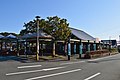
Kumai Zuido entrance.jpg
Article

39428 / くろしおちょう

Kochi Prefecture 幡多郡

Kuroshio Town

Pupils carried bricks too, it is said.

Kumai Tunnel, JSCE heritage

Photo by 利用者名42 (CC BY-SA 4.0)

01 / Irino Pine Grove

Sea and mountains in a single view,says the designation of this dune grove.

Irino no Matsubara, enkei.jpg
Photo by Saigen Jiro (CC0)

A pine grove along the dunes of Irino (入野), designated a national Place of Scenic Beauty in 1928. The designation text calls it one of Shikoku's finest pine groves: it looks west to mountains beyond a cape, faces another cape to the east, and takes in sea and mountain scenery at a glance. Tani Chūbei Tadazumi, a retainer of Chōsokabe Motochika, is said to have planted it.

  • National Place of Scenic Beauty, designated 17 Feb 1928 (Agency for Cultural Affairs)
  • The designation text calls it one of Shikoku's finest pine groves
  • Said to have been planted by Chōsokabe retainer Tani Chūbei Tadazumi (town board of education)

02 / Prince Takanaga and Ariishōji (有井庄司)

In Hata, where Prince Takanaga was exiled,stands a stone tower said to be a headman's grave.

In 1332 Prince Takanaga, the first son of Emperor Go-Daigo, was exiled to Hata in Tosa Province. The prefecture's site note says Ariishōji, the local headman, built him a residence and served him, and that the prince, once back in Kyoto, is said to have sent the family a stone tower. In Ariigawa, the "Shōjin odori" dance honoring the headman has been held on 16 August.

  • Exiled to Hata in 1332 (prefectural board of education)
  • Ariishōji's grave is a prefectural historic site, designated 29 Jan 1953
  • Ariigawa Shōji odori is a bon dance held on 16 August (town board of education)

03 / Tanokuchi Tumulus

Clearing a field,they found a horizontal-entry stone chamber.

Tanokuchi Kofun, sekishitsu-2.jpg
Photo by Saigen Jiro (CC0)

A tumulus of the late Kofun period, around the 6th century. In 1907 the landowner found it while clearing a field, and it became a prefectural historic site as the only horizontal-entry stone chamber then found in Hata District. The passage is lost and part of the chamber remains. Visitors view it from outside the restricted area.

  • Found in 1907 (prefectural board of education)
  • Prefectural historic site, designated 29 Jan 1953
  • Records show sue ware and an agate magatama bead were unearthed

Living here

Two towns, Ogata and Saga, became one.

  • about 10,000 people
  • Rural district town

Formed on 20 March 2006 by the merger of Ogata and Saga, the town covers 188.46 km². The town website says the climate is warm, with an average yearly temperature of 17 degrees and rainfall of around 2,800 mm. Ogata is strong in greenhouse horticulture, flowers and rice, Saga in Tosa pole-and-line bonito fishing. The town tree is the black pine and the ogatama.

People living here
10,262people
2010

−8.5% since 2015

12,366 → 10,262

Area
188.46km²

39.74km² of it habitable

2024

Households
4,607households

2.2 people per household

2020

Rent (average for rentals)
—
Healthcare
0 hospitals / 8 clinics

7.8 per 10,000 people

2023

Area188.46km²Habitable land39.74km² / 21%
Area and habitable land at the same scalee-Stat B1101 / B1103
Children waiting for childcare
—4 nurseries and similar
Home purchase subsidy
—
Average annual temperature
—

These 3 items are waiting on a nationwide data source. We do not fill them with estimates.

ACCESS

Where you can go from here.

Kuroshio Town in Japan33.025°N 133.004°E
TokyoOsakaKuroshio Town
Tosa-Irino Station
土佐入野駅2018
  • to OsakaOvernight bus452min
  • to SannomiyaOvernight bus398min

Travel times follow 高知西南交通『しまんとブルーライナー(京都線)』の運行時刻表ページ(kochi-seinan.co.jp/expressway/?q=kyoto)の『2026年6月1日からの時刻表』(『京都・大阪・神戸⇒宿毛・中村(夜行便)』)。同社の2026-03-30付お知らせ(expressway_info20260330.pdf)『2026年6月1日(月)出発便から運行時刻を一部変更』の新ダイヤと同じ (checked 2026-09-30). They vary by time of day.

Shape

Borders 2 municipalities.

Territory of Kuroshio Town
Boundaries: National Land Numerical Information (N03)

North to south

23.6km

四万十市, 四万十町

Kuroshio Town isthis kind of town.

  1. 01Kumai Tunnel (熊井隧道) is a brick-and-stone tunnel on the town road linking Saga and Kumai, finished in December 1905 and 95.6 m long. Its bricks are said to have been carried from Saga Port by schoolchildren and others, one or two at a time, and it was chosen as a JSCE Selected Civil Engineering Heritage in fiscal 2014.
  2. 02Irino has the Irino Pine Grove, a national Place of Scenic Beauty; Ariigawa has a stone tower said to be the grave of a headman tied to Prince Takanaga's exile; and Shimotanokuchi has Tanokuchi Tumulus, found in a field in 1907.
  3. 03The town website presents the Sunahama Museum, which treats a 4 km beach as a museum, and Saga's bonito pole-and-line fishing as the town's face. A votive tablet at Kamikawaguchi Tenmangu, showing 14 fishermen pole-fishing, is a designated town cultural property.

See the town as it is now.

Source: Wikidata (P2002, P2003, P2013, P2397)

If something caught your eye, ask the town itself.