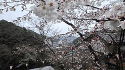
中仁淀橋―沈下橋.jpg
Article

39403 / おちちょう

Kochi Prefecture 高岡郡

Ochi Town

Railings are removed when water rises.

Nakaniyodo Bridge, with footpath

Photo by 谷本 一郎 (CC BY-SA 4.0)

01 / Emperor Antoku's mausoleum reference site

Ochi has handed down that Emperor Antoku was buriedwhere he had played kemari.

安徳天皇越智陵墓参考地(鞠ヶ奈呂陵墓).jpg
Photo by C2revenge (CC BY-SA 4.0)

According to the tradition handed down in Ochi, Emperor Antoku, having escaped peril, fled to Mt. Yokogura (横倉山) and died of illness at 23. He was buried in a place of fond memory where he had played kemari (蹴鞠), and locals know the spot by a name that recalls the game (鞠ヶ奈路陵墓参考地). The town website says it has been designated by the state as a mausoleum reference site.

  • The town website says it is designated by the state as "Emperor Antoku's mausoleum reference site"
  • Locals know it by a name that recalls kemari (tourist association)
  • Ochi's tradition says he died at 23 (tourist association)

02 / Bakadameshi

Those who ventured onto the perilous tip were deemed fools,and it came to be called "Bakadameshi."

馬鹿試し(横倉山).jpg
Photo by Koda6029 (CC BY-SA 4.0)

A sheer cliff 80 m high, made of limestone more than 400 million years old. The name is said to come from testing whether one is a fool. Below the cliff is a cave called "Heike-ana" (平家穴), said to have been a refuge for Emperor Antoku against enemy attack. Yokogura Shrine (横倉宮) stands at the top.

  • A cliff of limestone more than 400 million years old (town website)
  • 80 m high (town website)
  • The cave below the cliff is called "Heike-ana" (town website)

03 / Antoku Spring

A spring on Mt. Yokogura said to have suppliedEmperor Antoku's drinking water.

Antoku spring water area.jpg
Photo by ブルーノ・プラス (CC BY 4.0)

According to the Ministry of the Environment, the Taira no Tomomori clan, defeated at the Battle of Yashima in 1185 (Bunji 1), is said to have come to this place bearing Emperor Antoku and used the spring water as his drinking water. It is also said to have been used as purifying water by mountain ascetics. As raw spring water, it is not advised to drink it unboiled.

  • Chosen as one of Japan's 100 Famous Waters in March 1985 (Ministry of the Environment)
  • Conservation work by the local Heike association and others (Ministry of the Environment)
  • 1985 water test found coliform bacteria (Ministry of the Environment)

Living here

The town center sits where three rivers meet.

  • about 5,000 people
  • Rural district town

The town center, where the Niyodo River meets two tributaries (坂折川・柳瀬川), looked like three tails and was called Three-Tails Village (三尾村) until the early Edo period. The town crest combines three katakana "ヲ." Of the total area of 111.95 km², 9,395 hectares, about 84%, is forest and fields. The town flower is the cosmos, the tree the cedar, the bird the Japanese white-eye.

People living here
5,187people
19952020

−10.5% since 2015

7,803 → 5,187

Area
111.95km²

18.49km² of it habitable

2024

Households
2,335households

2.2 people per household

2020

Rent (average for rentals)
—
Healthcare
4 hospitals / 2 clinics

11.6 per 10,000 people

2023

Area111.95km²Habitable land18.49km² / 17%
Area and habitable land at the same scalee-Stat B1101 / B1103
Children waiting for childcare
—1 nurseries and similar
Home purchase subsidy
—
Average annual temperature
—

These 3 items are waiting on a nationwide data source. We do not fill them with estimates.

Shape

Borders 5 municipalities.

Ochi Town in Japan33.533°N 133.252°E
TokyoOsakaOchi Town
Territory of Ochi Town
Boundaries: National Land Numerical Information (N03)

North to south

16.6km

仁淀川町, 佐川町, いの町, 日高村, 津野町

Travel times per leg are not published by the municipality, so they are not shown.

Ochi Town isthis kind of town.

  1. 01Nakaniyodo Bridge in Ochi is a submersible bridge over the main stream of the Niyodo River, linking the town center with a district across the river (今成), and it was completed on December 25, 1956. The town website calls it a rare submersible bridge in the prefecture with pedestrians separated from vehicles, and the tourist association writes that it is the only submersible bridge in town with railings, which are removed when the water rises.
  2. 02Mt. Yokogura, the town's symbol, has traditions of Emperor Antoku, the cliff Bakadameshi and Antoku Spring, one of Japan's 100 Famous Waters. The town-run Mt. Yokogura Nature Forest Museum shows the origins of the mountain through fossils and rocks, Dr. Makino Tomitaro's research through plants, and the legend through dolls and film.
  3. 03Hijiri Shrine (聖神社), in a district (小日浦) at the southwest edge of town, has a hall built on posts set in a rock hollow of a chert crag, and even locals do not know its origin well. The Niyodo River also carries the Asoo (浅尾) and Kataoka submersible bridges.

If something caught your eye, ask the town itself.