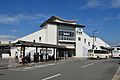
Tea and Town of Uji Historical Park 02.jpg
Article

26204 / うじし

Kyoto Prefecture

Uji City

Tea fields ring a restored stone spur.

Uji River Taiko Embankment Ruins

Photo by Indiana jo (CC BY-SA 4.0)

01 / Tumuli

After a run of round mounds,a 112 m keyhole-shaped tomb was suddenly built.

Gokasho Futagozuka Kofun, zenkei.jpg
Photo by Saigen Jiro (CC0)

A group of five tumuli on the right bank of the Uji River, designated a National Historic Site. It began with Kannonyama Tumulus, a round mound 46.5 m across, and round mounds followed, including the north mound of Futagoyama Tumulus. In the early Late Kofun period came Futagozuka Tumulus, a keyhole-shaped tomb with a double moat, the largest of its time in the southern Yamashiro region.

  • National Historic Site, 2018
  • Futagozuka Tumulus: 112 m long
  • Double moat

02 / Tea garden

Of seven tea gardens, Okunoyama remains.In April and May, the tea plants vanish from view.

Okunoyama tea plantation 02.jpg
Photo by Indiana jo (CC BY-SA 4.0)

Seven gardens said to have been planted in the Muromachi period on Ashikaga Yoshimitsu's order, by Ouchi Yoshihiro, came to be called the Seven Famous Gardens of Uji. What remains today is Okunoyama Garden, whose tea plants are among Uji City's 100 Notable Trees. In Uji, from April to May, shade covers hide the tea plants completely.

  • Seven Famous Gardens of Uji
  • One of Uji City's 100 Notable Trees
  • Tea plants out of sight, April-May

03 / Architecture

The client's square-and-circle philosophy, in squareand circular designs: a modern Japanese-style complex.

松殿山荘 04.jpg
Photo by Asset utilitist (CC0)

Shodensanso, in Uji's Kowata district, consists of tea rooms of varied styles built to spread the way of tea, and 12 of its buildings are Important Cultural Properties. The Agency for Cultural Affairs says each building is unified by an original design using squares and circles, the symbolic figures of the square-and-circle philosophy preached by the client, Takaya Tsunetaro.

  • 12 buildings, Important Cultural Properties
  • Designated 2017
  • Client: Takaya Tsunetaro

Living here

17 minutes from Kyoto by JR Rapid.

  • about 180,000 people

From Kyoto Station, the JR Rapid on the Nara Line reaches JR Uji Station in 17 minutes. City Hall is about a 10-minute walk, or a 5-minute bus ride, from JR Uji Station.

People living here
179,630people
19952020

−2.7% since 2015

184,830 → 179,630

Area
67.54km²

33.91km² of it habitable

2024

Households
73,595households

2.4 people per household

2020

Rent (average for rentals)
51,875yen

National average 60,630 yen

2023

Healthcare
10 hospitals / 134 clinics

8.0 per 10,000 people

2023

Area67.54km²Habitable land33.91km² / 50%
Area and habitable land at the same scalee-Stat B1101 / B1103
Children waiting for childcare
—23 nurseries and similar
Home purchase subsidy
—
Average annual temperature
—

These 3 items are waiting on a nationwide data source. We do not fill them with estimates.

ACCESS

Where you can go from here.

Uji City in Japan34.884°N 135.800°E
TokyoUji City
JR Uji Station
JR宇治駅2016
  • to KyotoJR Rapid17min

Travel times follow JR西日本『JRおでかけネット』区間時刻表(ページの日付 2026-10-08・木)。line-timetable/2300(奈良線 京都~奈良 下り)で、京都『発』→宇治『着』が同じ列車の列にあるものを数えた:101本。最速は17分(みやこ路快速。例 10:04→10:21・10:34→10:51 など)で、運転日注意欄に印の無い毎日運転の便が14本ある(印『平』は平日のみ。09:34→09:51 も17分だが『平』)。普通は22〜23分。逆向き line-timetable/2301(奈良~京都 上り)は宇治『発』→京都『着』の毎日運転の最速が18分(みやこ路快速。17分の便は『平』の平日のみ) (checked 2026-10-08). They vary by time of day.

Shape

Borders 5 municipalities across 1 prefectures.

Territory of Uji City
Boundaries: National Land Numerical Information (N03)Lakes: National Land Numerical Information (Lake Data), MLIT. Processed by Machigatari. Prepared with the approval of the Director-General of the Geospatial Information Authority of Japan, using its Digital Map 25000 (Spatial Data Framework) and Digital Map 25000 (Place Names and Public Facilities). (承認番号 平27情使、第585号)

North to south

11.0km

Kyoto Prefecture
京都市, 久御山町, 城陽市, 宇治田原町
Shiga Prefecture
大津市

Uji City isthis kind of town.

  1. 01The Uji River Taiko Embankment Ruins are what remains of an embankment built by Toyotomi Hideyoshi, and a National Historic Site. Ishidashi are stone spurs that regulate the flow of water; at the Historical Park of Tea and Uji Town they are restored, and according to the city, the actual ishidashi is preserved 1 m below
  2. 02The Uji Tumulus Group is a National Historic Site, Okunoyama is the garden that remains of the Seven Famous Gardens of Uji, and 12 buildings of Shodensanso are Important Cultural Properties; the broken stele of Uji Bridge, which records the bridge's origin, is also an Important Cultural Property
  3. 03Byodo-in Temple and Ujigami Shrine are World Heritage sites, and Kyoto is 17 minutes away by JR Rapid

See the town as it is now.

Source: Wikidata (P2002, P2003, P2013, P2397)

If something caught your eye, ask the town itself.