View of Mt. Myoko in late autumn (Imori Pond, Myoko City) (50595629073).jpg
Article

15217 / みょうこうし

Niigata Prefecture

Myoko City

The pond was built from wetland in 1927.

Imori Pond, Sakasa Myoko

Photo by Koichi Hayakawa (CC BY-SA 2.0)

01 / Garden

Spring water falls through a stone trough,a 5 m cascade with Mt. Myoko behind.

The Former Sekiyama Hozoin Garden is the pond garden of Hozoin, the temple that administered the Sekiyama Daigongen shrine-temple. A cascade 5 m high drops spring water called Gozen-shimizu through a stone trough, from a recess of stacked stones. Mt. Myoko can be seen beyond the artificial hill. Sogi, who visited Sekiyama in 1478, recorded a cascade in the garden of a temple lodging there.

  • Cascade 5 m high
  • National Place of Scenic Beauty, 2013
  • Recorded by Sogi, 1478

02 / Burial mounds

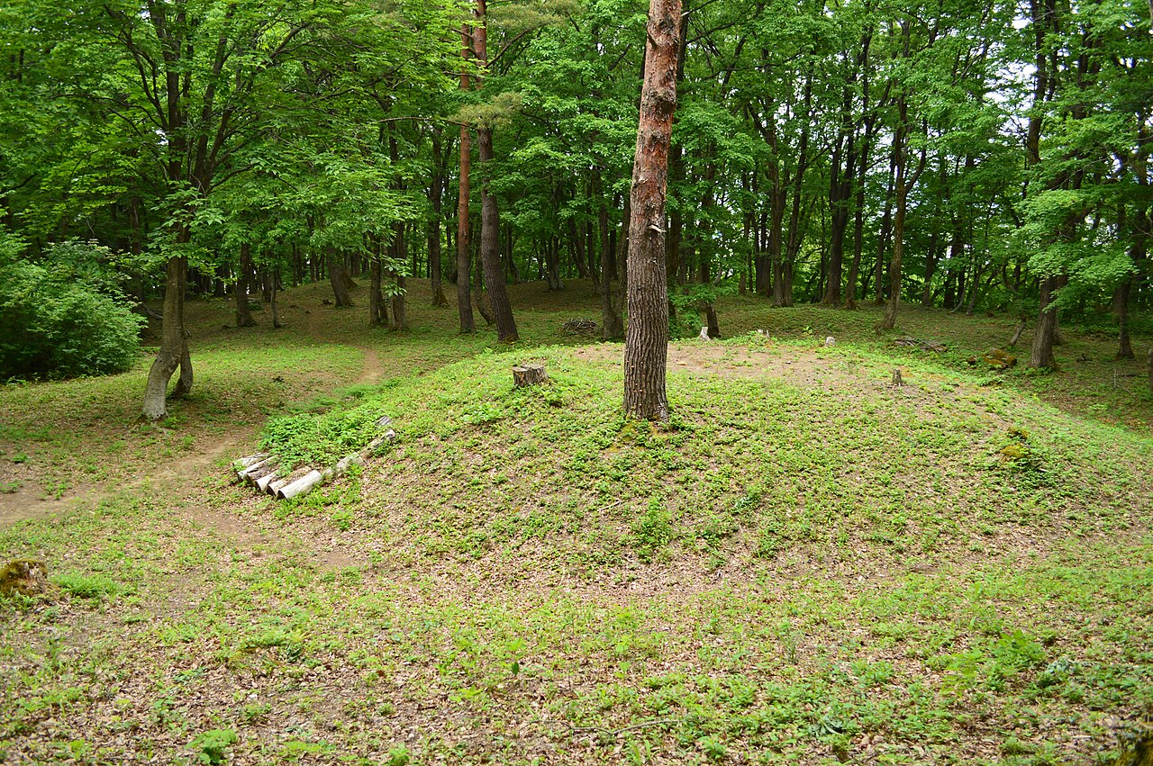
A mound group once judged mainly 5th-centuryincludes keyhole-shaped tombs that may date to the late 3rd.

Kan-nondaira Kofun Group, gaikan.jpg
Photo by Saigen Jiro (CC0)

The Kannondaira group lies on the hills north of the Hida site and the Tenjindo group to the south; when the sites were designated as a national historic site in 1978, 52 and 118 mounds were counted. The groups were then judged mainly 5th-century, but later surveys found that Tombs 1 and 4 at Kannondaira are keyhole-shaped tombs that may date back to the late 3rd century.

  • National historic site, 1978
  • 52 and 118 mounds counted at designation
  • Two keyhole-shaped tombs

03 / Irrigation canal

From earthen channel to stone walls and concrete:the Uwae Canal's history, shown at its old intake.

上江用水4.JPG
Photo by Indiana jo (CC BY-SA 4.0)

The Uwae Canal is an irrigation canal that takes water from the Seki River at Kawakami in Myoko. A prefectural document says that work is said to have begun in the Tensho era (1573-92). The site of the old intake has become a memorial park as the canal's place of origin, and a channel in its middle runs from earthen channel to stone-lined channel to three-sided concrete channel.

  • Said to have begun in 1573-92
  • Memorial park on the old intake site
  • Earthen, stone-lined, concrete channels

Living here

Three municipalities became one city in 2005.

  • about 30,000 people

Myoko was formed in April 2005 by the merger of the former Arai City, Myoko-Kogen Town and Myoko Village. Its area is 445.63 km², 3.5% of Niigata Prefecture. The city has four stations on the Echigo Tokimeki Railway: Kita-Arai, Arai, Sekiyama and Myoko-Kogen. For the Hokuriku Shinkansen, the city advises going from these stations to Joetsu-Myoko Station. The gateway is Arai Station.

People living here
30,383people
20052020

−8.5% since 2015

37,831 → 30,383

Area
445.63km²

123.83km² of it habitable

2024

Households
11,306households

2.7 people per household

2020

Rent (average for rentals)
41,051yen

National average 60,630 yen

2023

Healthcare
2 hospitals / 13 clinics

4.9 per 10,000 people

2023

Area445.63km²Habitable land123.83km² / 28%
Area and habitable land at the same scalee-Stat B1101 / B1103

Population from 2005 onward (municipal boundary changed).2005-04-01 に編入合併(妙高高原町・妙高村)。2005年調査から市域が変わっている。

Children waiting for childcare
—11 nurseries and similar
Home purchase subsidy
—
Average annual temperature
—

These 3 items are waiting on a nationwide data source. We do not fill them with estimates.

Shape

Borders 6 municipalities across 1 prefectures.

Myoko City in Japan37.025°N 138.254°E
TokyoOsakaMyoko City
Territory of Myoko City
Boundaries: National Land Numerical Information (N03)Lakes: National Land Numerical Information (Lake Data), MLIT. Processed by Machigatari. Prepared with the approval of the Director-General of the Geospatial Information Authority of Japan, using its Digital Map 25000 (Spatial Data Framework) and Digital Map 25000 (Place Names and Public Facilities). (承認番号 平27情使、第585号)

North to south

30.1km

Niigata Prefecture
上越市, 糸魚川市
Nagano Prefecture
飯山市, 信濃町, 長野市, 小谷村

Travel times per leg are not published by the municipality, so they are not shown.

Myoko City isthis kind of town.

  1. 01Imori Pond lies near Mt. Myoko and was built from wetland in 1927. It covers 12,295 square metres, and since 2014 the city has worked to remove invasive water lilies that spread across it
  2. 02The Former Sekiyama Hozoin Garden, a nationally designated Place of Scenic Beauty, pairs a 5 m cascade of spring water with Mt. Myoko as borrowed scenery. The Hida district keeps national historic sites from three eras: the Yayoi-period Hida site, burial mounds and the Sengoku-period Samegao Castle ruins
  3. 03The site of the old intake on the Seki River is now a memorial park for the Uwae Canal, with a channel showing its changes over time. The city was formed by merging the former Arai City, Myoko-Kogen Town and Myoko Village, and has four Echigo Tokimeki Railway stations

If something caught your eye, ask the town itself.