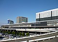
Zuiko-ji osaka 02.jpg
Article

27100 / おおさかし

Osaka Prefecture

Osaka City

Whale jawbone forms a bridge's handrail.

Sekkeikyo, Zuiko-ji Temple

Photo by Yukiyoshi yoshinaga (CC BY-SA 4.0)

01 / Civil engineering

The water entering the old Yodo Riverwas regulated by a brick lock and weir.

Kema Suimon, Osaka008.JPG
Photo by Kansai explorer (CC BY 3.0)

As part of the great Yodo River improvement works, the First Lock (completed in Meiji 40, 1907) and the weir (Meiji 43, 1910) were built at Kema. They regulated the water flowing into the old Yodo River (Okawa) and eased river traffic; the city notes both are of brick, faced with granite at the ends and key points. The weir had nine piers and ten water passages. They were designated Important Cultural Properties in 2008.

  • First Lock completed 1907
  • Weir completed 1910
  • 2008: Important Cultural Property (former Yodo River diversion facilities)

02 / Craft

An Edo-period guidebook calledFukae's sedge hats a "famous product".

Sugegasa ac (1).jpg
Photo by Asturio Cantabrio (CC BY-SA 4.0)

Fukae, in Higashinari Ward, is a sedge-hat (sugegasa) area with its own entry, "Famous Product: Fukae Sugegasa", in the Edo-period Settsu Meisho Zue. Lying along the Nara Kaido road, it is said to have made mostly hats for pilgrimages to Ise. The city writes that Fukae sedge hats and sedge shades are still supplied for the Shikinen Sengu of Ise Jingu and for the Daijosai. It is an Intangible Cultural Property of the city and a traditional craft of the prefecture.

  • Settsu Meisho Zue: "Famous Product: Fukae Sugegasa"
  • City Intangible Cultural Property (FY1999)
  • Prefectural traditional craft (2016)

03 / Architecture

Facing the pond, the Homeitei stands onstepped ground in a kakezukuri style.

Kagaya Chashitsu.jpg
Photo by Ty19080914 (CC BY-SA 4.0)

The former Kagaya Shinden Kaisho was the base of reclaimed fields that the money changer Kagaya began developing in Enkyo 2 (1745); it was completed in Horeki 4 (1754). The Homeitei faces a pond to the west and stands in a kakezukuri-like manner on stepped ground, with a tea room in its northern half. The Homeitei, the shoin and the residence are city-designated tangible cultural properties, and the kaisho site is a historic site.

  • Development began 1745
  • Kaisho completed 1754
  • City designation (FY2001): tangible cultural property and historic site

Living here

141 minutes from Tokyo, 12 from Kyoto.

  • about 2,750,000 people
  • 60 min to a city centre
  • Shinkansen stops here

Shin-Osaka Station, in the city, is a Tokaido and Sanyo Shinkansen stop. By JR West's timetable (14 October 2026), the Nozomi takes as little as 141 minutes from Tokyo, 47 from Nagoya and 12 from Kyoto. The nearest station to City Hall is Yodoyabashi Station, on the Midosuji Subway Line and the Keihan Main Line.

People living here
2,752,412people
19952020

+2.3% since 2015

2,602,421 → 2,752,412

Area
225.34km²

225.34km² of it habitable

2024

Households
1,469,718households

1.9 people per household

2020

Rent (average for rentals)
62,183yen

National average 60,630 yen

2023

Healthcare
171 hospitals / 3734 clinics

14.2 per 10,000 people

2023

Almost entirely flat.Almost all of it is habitable land (100.0%)
Area and habitable land at the same scalee-Stat B1101 / B1103
Children waiting for childcare
—418 nurseries and similar
Home purchase subsidy
—
Average annual temperature
—

These 3 items are waiting on a nationwide data source. We do not fill them with estimates.

ACCESS

Where you can go from here.

Osaka City in Japan34.694°N 135.502°E
TokyoOsaka City
Shin-Osaka Station
新大阪駅2018
  • to TokyoShinkansen Nozomi141min
  • to NagoyaShinkansen Nozomi47min
  • to KyotoShinkansen Nozomi12min

Travel times follow JR西日本『JRおでかけネット』区間時刻表『東海道・山陽・九州新幹線(東京~博多~鹿児島中央) 下り』(line-timetable/1796)と『同(鹿児島中央~博多~東京) 上り』(line-timetable/2229)。ページの日付は2026年10月14日(水)・10月17日(土)・10月18日(日)の3日。データは交通新聞社『JR時刻表』2026年10月号に基づく。『運転日注意』の欄が空の列車だけを数えた(◆・平などの印のある列車は除く)。乗り換えなしで市内の新大阪駅に着く。向きは京都市・福岡市と同じく『町の外の起点の駅の発 → 新大阪駅の着』で、東京・名古屋・京都は下りの表(1796)、新神戸は上りの表(2229) (checked 2026-10-14). They vary by time of day.

Shape

Borders 11 municipalities across 1 prefectures.

Territory of Osaka City
Boundaries: National Land Numerical Information (N03)

North to south

20.3km

Osaka Prefecture
東大阪市, 守口市, 八尾市, 松原市, 堺市, 吹田市, 豊中市, 摂津市, 門真市, 大東市
Hyogo Prefecture
尼崎市

Osaka City isthis kind of town.

  1. 01Sekkeikyo Bridge at Zuiko-ji Temple in Higashiyodogawa Ward is a city-designated tangible folk cultural property. It is a granite arch bridge whose handrails use whale jawbone, with shoulder blades set between the posts. It is said to have been built in the Horeki era
  2. 02Kema in Kita Ward has Meiji-era brick locks and a weir, Suminoe Ward has the former Kagaya Shinden Kaisho, and Fukae in Higashinari Ward has sedge-hat craft. Osaka is a city of 24 wards, here treated as a single town
  3. 03In Chuo and Nishi Wards, some 7 km of drains known as the Taiko Gesui are city-designated historic sites still in use. The Shinkansen stops at Shin-Osaka Station in the city, 141 minutes from Tokyo

If something caught your eye, ask the town itself.