Kasukabe Kite Festival 20230505e.jpg
Article

11214 / かすかべし

Saitama Prefecture

Kasukabe City

An 800 kg kite rises into the May sky.

Giant kite on the Edo River

Photo by 江戸村のとくぞう (CC BY-SA 4.0)

01 / Giant kite

An 800 kg kite,hauled into the sky by over a hundred people.

Kasukabe Kite Festival 20230505a.jpg
Photo by 江戸村のとくぞう (CC BY-SA 4.0)

The tradition is said to have begun in 1841, late in the Edo period, when a travelling monk staying at a temple in Hōshubana (宝珠花) told local people how to divine a good silk-cocoon harvest by flying kites. Today, every 3 and 5 May, well over a hundred people fly a giant kite, 15 m tall, 11 m wide and weighing 800 kg, on the bank of the Edo River. Members of the Shōwa Ōdako Bunka Hozonkai (庄和大凧文化保存会) spend three months making it from washi paper and bamboo.

  • 15 m by 11 m
  • 800 kg
  • Every 3 and 5 May

02 / Flood control

50 metres underground,a river carries away floods.

Kasukabe2006 06 07.JPG
Photo by Dddeco at Japanese Wikipedia (CC BY-SA 3.0)

The Metropolitan Area Outer Underground Discharge Channel (首都圏外郭放水路) is a national facility that, when the Naka, Ōotoshi-Furutone and other rivers threaten to overflow, sends the floodwater underground to the Edo River. It runs about 6.3 km, 50 m beneath National Route 16, and in the pressure-adjusting tank that slows the water stand 59 pillars of about 500 tonnes each. The whole channel was completed in 2006, and guided tours are held by reservation.

  • 50 m deep, about 6.3 km
  • 59 pillars
  • Fully completed in 2006

03 / Wisteria

A Special Natural Monument wisteria,and a trellis over a kilometre long.

Kasukabe Wisteria Of Ushijima 1.JPG
Photo by 京浜にけ (CC BY-SA 3.0)

The city flower is the wisteria. The Ushijima Wisteria (牛島のフジ) is said to be over 1,200 years old; in the Meiji era its flower clusters reached 3 m and it was a famous sight near Tokyo, and in 1955 it was made a national Special Natural Monument. In 1980 a wisteria trellis about 1.1 km long was built along Fuji-dōri (ふじ通り) at the west exit of Kasukabe Station, and around the Kasukabe Wisteria Festival more than 200 vines bloom.

  • Said to be over 1,200 years old
  • Special Natural Monument, 1955
  • Trellis about 1.1 km

Living here

35 minutes to Asakusa by limited express, 15 to Ōmiya by express.

  • about 230,000 people

Kasukabe Station, where the Tobu Skytree Line and Urban Park Line meet, is about 35 minutes from Asakusa Station by limited express and about 15 minutes from Ōmiya Station by express. City Hall is a 14-minute walk from the west exit. In 2005 the city merged with the town of Shōwa (庄和町), extending it to the Edo River.

People living here
229,792people
20052020

−1.3% since 2015

238,506 → 229,792

Area
66km²

65.64km² of it habitable

2024

Households
97,638households

2.4 people per household

2020

Rent (average for rentals)
55,365yen

National average 60,630 yen

2023

Healthcare
13 hospitals / 130 clinics

6.2 per 10,000 people

2023

Almost entirely flat.Almost all of it is habitable land (99.5%)
Area and habitable land at the same scalee-Stat B1101 / B1103

Population from 2005 onward (municipal boundary changed).2005-10-01 に新設合併(庄和町)。2005年調査から市域が変わっている。

Children waiting for childcare
—29 nurseries and similar
Home purchase subsidy
—
Average annual temperature
—

These 3 items are waiting on a nationwide data source. We do not fill them with estimates.

ACCESS

Where you can go from here.

Kasukabe City in Japan35.975°N 139.752°E
OsakaKasukabe City
Kasukabe Station
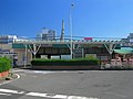
春日部駅2012
  • to AsakusaTobu Skytree Line ltd. exp.35min
  • to Kita-SenjuTobu Skytree Line ltd. exp.20min
  • to ŌmiyaTobu Urban Park Line express15min

Travel times follow 市公式「春日部市の位置と地勢」(2022-05-20 更新)と移住リーフレット「かすかべでくらそう」(令和7年度版・2025-06-26 作成のPDF)の「良好なアクセス」に載っている値。東武鉄道の2026年3月14日ダイヤ改正の発表資料(2025-12-12)で特急の所要を確かめた (checked 2026-09-24). They vary by time of day.

Shape

Borders 7 municipalities across 1 prefectures.

Territory of Kasukabe City
Boundaries: National Land Numerical Information (N03)

North to south

11.9km

Saitama Prefecture
さいたま市, 杉戸町, 越谷市, 松伏町, 宮代町, 白岡市
Chiba Prefecture
野田市

Kasukabe City isthis kind of town.

  1. 01Every May, well over a hundred people fly a 15 m, 800 kg giant kite on the bank of the Edo River
  2. 02One of the world's largest underground flood channels runs 50 m beneath National Route 16, carrying floodwater to the Edo River
  3. 03Home to the Ushijima Wisteria, a national Special Natural Monument, and the 1.1 km wisteria trellis of Fuji-dōri

If something caught your eye, ask the town itself.