Sakado Koma River Most Downstream 1.JPG
Article

11239 / さかどし

Saitama Prefecture

Sakado City

Home of the Koma, a clear Kanto river.

Photo by 京浜にけ (CC BY-SA 3.0)

01 / Folic acid

The national guideline is 240 μg.Sakado recommends 400 μg of folic acid.

In fiscal 2006 the city turned research by Japan Nutrition University (日本栄養大学, formerly Kagawa Nutrition University) into policy and launched a campaign to take 400 μg of folic acid a day. The national recommended amount is 240 μg, but about 15% of Japanese people have genes that make folic acid harder to use. With the university and local shops, the city has also made bread and eggs with added folic acid.

  • Since fiscal 2006
  • 400 μg a day
  • Run with Japan Nutrition University

02 / Taoist temple

Taiwanese temple carpentersspent 15 years building a Taoist temple.

Sakado Xientengong Tenmon 20110203 1.jpg
Photo by 京浜にけ at Japanese Wikipedia (CC BY-SA 3.0)

Seitenkyū (聖天宮) is a Taoist temple built by Kō Kokuten (康國典), a master priest born in Taiwan. After recovering from a grave illness, he looked for a place to build a temple in thanks, and is said to have been guided by a divine message to a woodland in Sakado rather than his native Taiwan. Work began in 1981, and with carpenters brought from Taiwan it took 15 years to open in 1995.

  • Construction began in 1981
  • 15 years in the making
  • Opened in 1995

03 / Koma River

About 10 km along a clear riverto the only hill in the city.

Sakado Koma River Wakamiya Bridge 2.JPG
Photo by 京浜にけ (CC BY-SA 3.0)

The Komagawa Furusato Promenade (高麗川ふるさと遊歩道) is a path of about 10 km along the Koma River. From Kita-Sakado it heads upstream with the river on the right, past the Wakamiya and Mannen bridges, to Shiroyama, the only hill in the city. At the Asaba Biotope (浅羽ビオトープ) on the riverbank you can see wild birds such as kingfishers, buzzards and kestrels.

  • A promenade of about 10 km
  • Asaba Biotope
  • Ends at Shiroyama

Living here

About 40 minutes to Ikebukuro.

  • about 100,000 people

According to the prefecture's relocation site, Sakado Station is about 40 minutes from Ikebukuro on the Tobu Tojo Line. The city has three Tojo Line stations, Wakaba, Sakado and Kita-Sakado, and the Tobu Ogose Line branches off at Sakado. City Hall is about a 17-minute walk from the east exit of Wakaba Station. Since fiscal 2023, school lunches at city elementary and junior high schools have been completely free.

People living here
100,275people
19952020

−1.4% since 2015

98,221 → 100,275

Area
41.02km²

40.35km² of it habitable

2024

Households
44,555households

2.3 people per household

2020

Rent (average for rentals)
49,432yen

National average 60,630 yen

2023

Healthcare
5 hospitals / 64 clinics

6.9 per 10,000 people

2023

Almost entirely flat.Almost all of it is habitable land (98.4%)
Area and habitable land at the same scalee-Stat B1101 / B1103
Children waiting for childcare
—10 nurseries and similar
Home purchase subsidy
—
Average annual temperature
—

These 3 items are waiting on a nationwide data source. We do not fill them with estimates.

ACCESS

Where you can go from here.

Sakado City in Japan35.957°N 139.403°E
OsakaSakado City
Wakaba Station
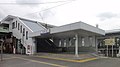
若葉駅2011
  • to IkebukuroTobu Tojo Line40min

Travel times follow 埼玉県の移住サイト「住むなら、埼玉。」の坂戸市のページ(移住の問い合わせ先は坂戸市政策企画課)に載っている値 (checked 2026-09-24). They vary by time of day.

Shape

Borders 7 municipalities.

Territory of Sakado City
Boundaries: National Land Numerical Information (N03)

North to south

8.7km

毛呂山町, 鶴ヶ島市, 川越市, 川島町, 東松山市, 鳩山町, 日高市

Sakado City isthis kind of town.

  1. 01A promenade of about 10 km runs beside the Koma River, one of the clearest rivers in Kanto, to Shiroyama
  2. 02Building on research by Japan Nutrition University, the whole city has been encouraging people to take 400 μg of folic acid a day since fiscal 2006
  3. 03Seitenkyū, a Taoist temple that Taiwanese carpenters spent 15 years building, opened in 1995

If something caught your eye, ask the town itself.